Complete tour of Ouessant

Walking around the island of Ouessant in a single day is sometimes like experiencing all four seasons at once.
Get ready to discover a magnificent island with an authentic character, whatever the weather.
It’s certainly a challenging hike in terms of distance (around 38 km) and the changes in elevation, but what a pleasure it is to complete the circular hike with the satisfaction of having overcome a small challenge. The perfect way to round it all off is to enjoy a hearty ‘ragoût dans les mottes’, a traditional dish from Ouessant.

Details

n°4058523
Creation:
Last update:
Last review:
  • Walking
    Activity: Walking
  • ↔
    Distance: 23.51 mi
  • ◔
    Duration according to the author: 12 hrs 
  • ▲
    Difficulty: Very difficult

  • ⚐
    Back to start: Yes
  • ↗
    Ascent: + 646 ft
  • ↘
    Descent: - 673 ft

  • ▲
    Highest point: 203 ft
  • ▼
    Lowest point: 10 ft
  • ⚐ Country: France
  • ⚐ City: Ouessant (29242)
  • ⚑
    Start/End: N 48.462813° / W 5.088195°
  • ❏
    IGN map(s): Ref. 0317OT
  • Hour-by-hour weather

Photos

Description of the walk

Preliminary note: For the start of this walk, I recommend setting off early in the morning, before sunrise, from Lann Vihan near the water tower in the centre of the island.

(S/E) Follow the road up towards the island’s north coast, facing Keller Island. You’ll arrive at the start of the Penn Ar Rumeur headland.

(1) From there, it’s very straightforward: simply take the coastal path on the right and follow it, keeping the sea on your left at all times. You can’t go wrong this way. To make the most of your walk, always take the path furthest to the left, closest to the coast, but remain vigilant at all times, especially if you have children or a dog. Obey the signs instructing you to keep away from the edge where necessary.
You’ll arrive next to Kernic Fort, built in 1862

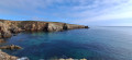
(2) Carry on straight ahead to reach Pointe de Cadoran in the north-east of the island, where the rocks and coastline are very steep and the sea is often rough. This is the wildest part of Ouessant.

(3) Keep following the coastal path, taking care as you go, to reach the Stiff Lighthouse, one of the oldest lighthouses in France, built by Vauban and commissioned in 1700, and listed as a Historic Monument since 2011.

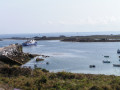
(4) Head down the road towards Stiff harbour further down; when you see the road leading down to the harbour on your left, carry on straight ahead, staying on the road, and as soon as you see the coastal path on your left, take it to explore the Penn Ar Lann headland.

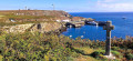
(5) Walk up a short path to discover the cromlech, a megalithic site probably dating from the Neolithic period. It is a Celtic place of worship. Continuing along the coastal path, you’ll reach La Croix de Saint-Pol, dating from 1702.

(6) Next, head down towards Arlan harbour. Once the harbour is on your left, follow the dirt track uphill until you come to the coastal path on your left, which climbs steeply. You’ll enjoy walking along a lovely path shaded by vegetation. Carry on. You’ll reach the Baie des Voleurs; it’s said that raiders used to land here in days gone by.

(7) Carry on along this path by the sea, zigzagging past the successive headlands leading to Penn Ar Roc’h cove.

(8) Keep following this yellow-marked path, pass Porz an Éjen and, further on, reach the Runiou Pyramid. This is a navigation mark used by seafarers.

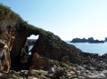
(9) Carry on due west to reach the headland of Porz Doun where, at low tide, if you climb down the rocks, you can discover a hole in the rock. (see photos).

(10) Change direction and head due east, go round Porz Goret and then walk on to Prat Beach, where you’ll find the Saint-Guénolé du Prat wash house.

(11) Now walk round Corz Beach to reach the Cross of Saint Nicolas, facing Lampaul Bay. You’ll arrive at the village of Lampaul.

(12) Head back towards the coastal path and set off westwards again. Pass the hamlet of Parluc’hen, then Poull Guéguen and Loqueltas. You will then reach Loqueltas Fort, built in 1862.

(13) Continuing westwards, head for the island’s westernmost point at Pointe de Pern.

(14) Make the most of the walk to Pointe du Créac’h to admire the magnificent rock formations and let your imagination bring them to life – can you spot the one that looks like a rabbit? You’ll then reach Créac’h Lighthouse, built in 1863 with a light range of 60 km. You can visit the lighthouse and beacon museum whilst you’re there.

(15) Now continue eastwards again, heading for Beg Biniglou and then on to Yusin Cove.

(16) Follow part of the north coast to reach the Penn Ar Rumeur headland, the northernmost point of Ouessant. You are now closest to the mysterious island of Keller with its one and only house. Enjoy the view and the surroundings.

(17) Head down the headland towards the coastal path to return to the original crossroads.

(1) Follow the same route as on the way out to return to the starting point at the Lann Vihan Water Tower (S/E).

Waypoints

  1. S/E : mi 0 - alt. 102 ft - Lann Vihan Water Tower
  2. 1 : mi 0.93 - alt. 43 ft - Start of the coastal path
  3. 2 : mi 1.29 - alt. 59 ft - Kernic Fort
  4. 3 : mi 2.96 - alt. 105 ft - Pointe de Cadoran
  5. 4 : mi 4.14 - alt. 203 ft - Stiff Lighthouse
  6. 5 : mi 6.69 - alt. 92 ft - Cromlech
  7. 6 : mi 7.22 - alt. 98 ft - Croix de Saint-Pol
  8. 7 : mi 8.42 - alt. 30 ft - Baie des Voleurs
  9. 8 : mi 11.16 - alt. 95 ft - Penn Ar Roc’h Cove
  10. 9 : mi 12.25 - alt. 82 ft - Runiou Pyramid
  11. 10 : mi 12.83 - alt. 33 ft - Pointe de Porz Doun
  12. 11 : mi 14.36 - alt. 33 ft - Saint-Guénolé wash house
  13. 12 : mi 15.54 - alt. 49 ft - The village of Lampaul
  14. 13 : mi 17.34 - alt. 56 ft - Locqueltas Fort
  15. 14 : mi 18.06 - alt. 36 ft - Pointe de Pern
  16. 15 : mi 19.36 - alt. 72 ft - Créac’h Lighthouse
  17. 16 : mi 21.35 - alt. 39 ft - Cale de Yusin
  18. 17 : mi 22.39 - alt. 43 ft - Penn Ar Rumeur
  19. S/E : mi 23.51 - alt. 98 ft - Lann Vihan Water Tower

Notes

For this walk, I strongly recommend bringing plenty of water, sandwiches and cereal bars. This is because, outside the village of Lampaul, you won’t find any water sources or places to buy food.
Also remember to take a change of clothes (socks) and suitable footwear (waterproof).
It may be well worth picking up some information from the Tourist Office.
Note: this complete tour of the island may well seem too challenging to complete in a single day. The suggested route can be completed over two days, staying overnight at the Youth Hostel. You’ll simply need to travel from Lampaul to Porsguen to complete these two circular routes. And for those with more time, doing this tour over four days will allow you to make the most of the island. You can then adapt the route to suit your preferences.

Worth a visit

(4) Stiff Lighthouse: You can visit it and, if you’re lucky (in summer), you can buy the famous and highly prized honey from the black bees of Ouessant, on sale at the foot of the lighthouse.
(8) Penn ar Toc’h Cove: in the past, many shipwrecked sailors and vessels found refuge here to escape the storms and the treacherous Fromveur current. One notable story is that of the survivors of the cargo ship Vesper in 1903, who were rescued by a local woman from Ouessant, Rose Héré.
(10) Porz Doun: this spot on the island is a lovely place to enjoy a picnic after the long walk you’ve already undertaken. In the distance, you can see the Jument Lighthouse.
(14) Pointe de Pern: this is probably the most beautiful spot on the island. You’ll spot the ruins of buildings that were once used for maritime navigation – foghorns, trumpets and so on – and ahead of you lies the Nividic Lighthouse, built between 1912 and 1936. It is a listed historic monument.
On Ouessant, everything is beautiful; the coastal landscape is breathtaking, and you’ll constantly find yourself wanting to stop and take photos. That said, be prepared, as this walk is quite long (a full day). And above all, take great care on the coastal paths, as the cliffs are magnificent but also dangerous if you don’t stay focused.

Reviews and comments

5 / 5
Based on 1 review

Reliability of the description
5 / 5
Ease of following the route
5 / 5
Route interest
5 / 5
oponcin
oponcin

Overall rating : 5 / 5

Date of your route : Jan 22, 2024
Reliability of the description : ★★★★★ Very good
Ease of following the route : ★★★★★ Very good
Route interest : ★★★★★ Very good
Very busy route : No

The northern section of the WINTER TRAIL
https://youtu.be/dFxLU2n2btM?si=H97RnAsf...

Machine-translated

Other walks in the area

For more walks, use our search engine .

The GPS track and description are the property of this route's author. Please do not copy them without permission.