Country:
 City:


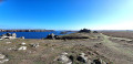
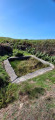
Set off from the church square in Lampaul.
(S/E) Take the D81, walk north past the church towards Port du Stiff. Pass the campsite and then the fire station. Take the road on the left after the fire station.
(1) Follow this track. Pass by the foot of a water tower and immediately turn onto a track on the right. Ignore a turn-off on the left; you’ll come out onto another track and follow it to the right. Continue along the road, pass the hamlet of Kerc’héré, keep to the right and carry on straight ahead at the next junction. Continue to the hamlet of Kernic.
(2) Carry on to the right without entering the hamlet. After about 350 metres, turn left and take the path opposite. Follow it straight on for about 950 metres until you reach a road. Turn right for about 40 metres and take the path on the left. Pass the houses to reach the Route du Stiff.
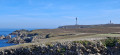
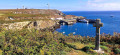
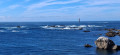
(3) Turn left towards the lighthouse. Carry on and walk round the 72-metre-high semaphore ; below it lies Villa Bac’haol on the headland of the same name, and continue along the path that runs alongside the cliff. Carry on, passing Pointe de Bouyou Glaz, and continue to Pointe de Kadoran.
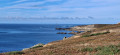
(4) The path narrows. Carry on along the path that runs the length of Bénimou Bay between the headland of Penn ar Ru Meur to the north and that of Penn ar Ru Meur to the west, passing the old fort.
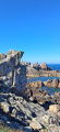
(5) Continue along the path to Penn ar Ru Meur Headland, opposite Keller Island. Turn left and walk carefully along the edge of the cliff. As you leave the headland, the path veers sharply to the right. Follow it for a further 150 metres.
(6) Then turn left onto a path heading due south, pass the hamlet of Kerdraon and continue along the road towards Keranchas.
(7) Keep to the left-hand side of the road, pass the fountain on your left and continue along the road, keeping to the right. Pass through the hamlet of Kerlann.
(8) At the next crossroads, leave the youth hostel on your left and carry straight on downhill, then take the steps on the left to reach Lampaul Church (S/E).
 Association / Club / Walk leader

 Visorando Member
 Easy

 Very difficult