Country:
 City:
City:


The route starts from the town hall car park.
Blue signposts
(S/E) With your back to the town hall, take Rue du Clos d’Ivry, which slopes down to your left, and continue to the hairpin bend.
(1) At this bend, take the path on your right, ignoring the one that veers off diagonally to the right. You are now on the Chemin Rural de Saint-Colombe to Haut Houlbec. Continue straight on, carefully crossing a tarmac road (Allée des Bois). Walk alongside meadows with horses until you reach a crossroads in the Bois d’Houlbec.
(2) Turn left, then take the first path on the right. A few dozen metres further on, turn right again and carry on straight ahead until you reach the edge of the woods.
(3) As you leave the woods, at the crossroads, turn left and then left again to return to the woods. After 200 metres, carry on straight ahead until you reach the exit (elevation 128).
(4) At the junction, turn right and continue along the path known as Chemin Charriot, which goes round the Ferme des Bois and takes you back towards the village.
(5) Just before you reach the tarmac road again, turn right and follow the path all the way down.
(6) Turn right onto a small path that runs between the houses and then past a house to reach the church. Take a moment to admire the remarkable ash tree just before the cemetery. When you come out onto Rue de la Motte, turn right and carry on straight ahead until you reach the junction with Rue du Lavoir.
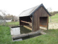
(7) Turn left to follow this street and don’t miss the wash house or the superb, very old farmhouse along the way. Walk up the hill to the first street on the left
(8) Turn left onto Côte de la Chênaie, walk up it until you reach the main road (D65) and turn left.
(9) Once you reach Place Jean-Louis Frelicot, head left to follow Rue des Écoles and return directly to the town hall and its car park (S/E).
 Visorando Member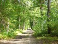
 Moderate
 Tourist office