Country:
 City:
City:


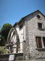
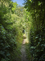
Start: Place Jacques Chirac, car park opposite the town hall, 55 Route de Chambray.
(S/E) Opposite the town hall, turn left then cross Route de Chambray at the pedestrian crossing. Turn right, go round the town hall on the right to reach a new car park. Cross the car park and, at the far end, turn right, cross a street and walk up the Rampe de l’église opposite until you reach Place de l’Église.
(1) Take Rue Saint-Martin on your right, then head down the Sente de la Ruellette on your right at number 10. At the next Fork in the road, turn left onto the Sente du Rouy until you reach a road. Turn left and walk a few metres, ignoring a road on your right.
(2) Turn right onto the Sentier des Gorets, which runs alongside a fence on your right. A little further on, at a small gate, continue to the left. At a T-junction, head up to the left onto the Sente Jurée. Cross a road and continue along the Chemin de la Grâce until you reach a Fork in the road, where you turn left. Then turn left onto the Rue de la Fosse Rouge.
(3) Just past No. 7, turn right onto Sente des Guimbets. Walk alongside the cemetery and, at a T-junction, head downhill to the left, then take Rue du Gavouet on the right until you reach a junction.
(4) Take the sharp left-hand bend onto Rue Georges Hermand. Just past No. 19, go down a few steps on the right to come out onto Rue Bourdon. Then turn right onto Rue Roger Poullain. Cross a road and continue along Rue du Canet until you reach the edge of the forest (marked by a gate).
(5) Turn left onto Sente au Guian. At the T-junction, take the road on the right for a few metres. Carry on straight ahead along a path in the bend (there is a barrier). You’ll come to a road; follow it to the right with care for about 250 m. At a barrier, turn left onto a hairpin bend along a path through the woods for about 100 m.
(6) Take a path on the right. Further on, at a crossroads, ignore a path leading down to the left and continue straight ahead to a further crossroads.
(7) Head down to the left, then follow the Sente des Vielles to the right. Continue straight on past the Résidence d’Herbaudière. At a bend, leave the tarmac and head up to the right onto the Sente des Fangeux. Pass a turn-off to the right, then one to the left. At a T-junction, continue to the left, then cross a junction.
(8) Then take the sharp left-hand bend onto Rue de la Bataille de Cocherel. Pass Rue de la Fontaine on your right and immediately turn left onto Sente de l’Ormétaie. You’ll come to a dead end. At number 7, take Sente des Moreaux immediately on your left, which will soon bend to the left.
(9) At a fork in the road, continue to the right and then right again onto Rue des Vignes. At the T-junction, turn left and take Sente de la Fosse Diard. Ignore two streets on your right before reaching another T-junction. First turn right then left to take Sente des Sérants.
(10) Turn right onto the tarmac Sente des Morats, which narrows at number 12. At the T-junction, turn left onto Rue de l’Abbé Théroude. Cross a road and take the Sente de Gosnay.
(11) Cross a road and continue slightly to the right along the same path. At the T-junction, head up to the left along the Chemin de Parisis. Then turn right onto Rue de la Croisette. At the next Fork in the road, turn right onto Rue Bonvalet for a few metres.
(12) Turn right onto a small tarmac path which will very quickly lead into Rue Jean Moulin. At a bend, just after No. 20bis, turn left onto the Sentier des Oucques. Then turn left into a street, then quickly right to arrive immediately at Place du 11 Novembre on your left (there is a bus stop here).
(13) Cross the car park and continue left along Rue du Général Leclerc. Pass Rue Grégoire on your right. Just before a T-junction, turn left to go up through two car parks and arrive back at your starting point. (S/E)


 Visorando Member
 Easy
Easy 
 Tourist office