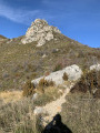
Mont Ventoux via the north face

Complete ascent of Mont Ventoux via the north face from the Chapelle Saint-Basile in the commune of Saint-Léger du Ventoux.

Details

69447
Creation:
Last update:
Last review:
  • Walking
    Activity: Walking
  • ↔
    Distance: 15.83 mi
  • ◔
    Average duration: 11h 35 
  • ▲
    Difficulty: Difficult

  • ⚐
    Back to start: Yes
  • ↗
    Ascent: + 4,951 ft
  • ↘
    Descent: - 4,951 ft

  • ▲
    Highest point: 6,263 ft
  • ▼
    Lowest point: 1,381 ft

Photos

Description of the walk

Park in the car park of an old mill, on the edge of the D40 about 2.5 km after Saint Léger-du-Ventoux towards Brantes.

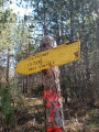
(S/E) From the car park, you will see the Saint-Basile sign indicating the direction of Brantes and Les Bernards. Take the small tarmac road on the left that climbs uphill (yellow signposting), which quickly turns into a track. In a bend, 900m higher up, the signposting leaves the track and turns left onto a path. This leads to a track at the Les Vaisses sign.

(1) Turn right towards Mont-Serein and Combe Rolland, then a few metres further on, turn left onto the red and white marked path (GR®). Continue climbing, following the markings and ignoring all the paths that branch off to the right and left. The path joins a track at the Combe Rolland sign, turn right towards Mont-Serein and Les Rouyères. 100m further on, you will reach the Les Rouyères sign.

(2) Leave the track and turn left towards Mont-Serein and Abris du Contrat.
The climb continues for 4.3 km, with beautiful forest passages and a few sections with small scree slopes. In a hairpin bend, look for a cairn on the right indicating a path to the right (this will be the path for the return journey). Leave it for now and continue onthe GR® for 150m to reach the Abri du Contrat, a small hut that serves as a shelter for hikers.

(4) Turn left onto theGR® towards Mont-Ventoux and Le Contrat. 200m further on, the sign for Le Contrat points towards Mont-Ventoux and Combe de la Mine. Follow these directions to the left.

(5) When you reach the Combe de la Mine sign, turn right towards Mont Ventoux and Les Mélèzes on a beautiful path, then 100 metres further on at the Les Mélèzes sign, continue straight ahead towards Mont Ventoux.
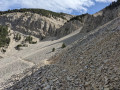
The path climbs into the forest, through increasingly tight hairpin bends and then over scree, skimming the D974 in a bend.

(6) Start climbing again on the stones. The trail eventually comes out higher up on the D974 at the foot of the summit.

(7) Cross the road and head opposite onto the small unmarked path that climbs towards the buildings at the summit

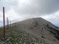
(8) You can take a quick tour of the facilities to enjoy 360° views of the surroundings before starting your descent.
Take the D974, which descends to the left towards Malaucène, pass two car parks and a viewpoint, and continue downhill to the left on the road until you reach a road sign warning of rockfall.

(7) At this point, the trail branches off to the right to begin the descent via the same route as the ascent.

(6) Skirt the road again and continue along the winding trail to the Mélèzes signpost, then continue straight ahead towards Mont Serein and Combe de la Mine.

(5) 100m further on, at the Combe de la Mine sign, turn left towards Mont Serein and Le Contrat.

(4) When you reach the Abri du Contrat, take theGR®9 trailto the right of the hut towards Brantes and Les Rouyères to reach the hairpin bend and the cairn you spotted on the way up.

(3) In the bend at the large cairn, leave theGR® which branches off to the right and take the small, barely visible path on the left. This path is abandoned but continues for 500 metres until it joins a track in a bend (yellow signposting).

(9) Take the path on the right that descends in wide hairpin bends for about 2 km and comes out at the three-way junction.

(10) Take the first track on the right towards Brantes and Les Rouyères, marked in yellow. The track continues flat for about 4 km.

(2) When you reach the Les Rouyères sign, continue straight ahead on the track towards Brantes and Combe Rolland, then 100 m further on, leave the track and turn left towards Brantes and Les Vaisses (red and white signposting).
2 km further down, when the path becomes flat, turn right at the crossroads and continue for 50 m until you see the sign for Les Vaisses.

(1) Leave the path and theGR® trail and turn left onto the yellow-marked trail towards Saint-Basile.
The path leads to a track on a bend. Continue downhill to the right to arrive at the car park a good kilometre further down (S/E).

Waypoints

  1. S/E : mi 0 - alt. 1,381 ft - Old mill car park (D40). Near - Toulourenc (rivière) - Affluent de l'Ouvèze
  2. 1 : mi 0.76 - alt. 1,703 ft - Sign for Mont Serein
  3. 2 : mi 2.19 - alt. 2,651 ft - Les Rouyères
  4. 3 : mi 4.91 - alt. 4,475 ft - Large cairn at the junction of the loop
  5. 4 : mi 5.02 - alt. 4,544 ft - Contrat shelter
  6. 5 : mi 5.43 - alt. 4,701 ft - Combe de la Mine sign
  7. 6 : mi 6.99 - alt. 5,738 ft - D974
  8. 7 : mi 7.41 - alt. 6,142 ft - D974
  9. 8 : mi 7.52 - alt. 6,263 ft - Mont Ventoux
  10. 9 : mi 10.62 - alt. 4,281 ft - PR crossroads (yellow signposting)
  11. 10 : mi 11.9 - alt. 3,202 ft - Col du Comte forest road
  12. S/E : mi 15.83 - alt. 1,381 ft - Old mill car park (D40)

Always be cautious and plan ahead when you're outdoors. Visorando and the author of this route cannot be held responsible for any accidents occurring on this route.

The GR® and PR® markings are the intellectual property of the Fédération Française de Randonnée Pédestre.

Reviews and comments

4.9 / 5
Based on 25 reviews

Reliability of the description
4.8 / 5
Ease of following the route
4.9 / 5
Route interest
4.8 / 5
cedriclapalombara@gmail.com

Overall rating : 4.7 / 5

Date of your route : Jul 13, 2024
Reliability of the description : ★★★★★ Very good
Ease of following the route : ★★★★★ Very good
Route interest : ★★★★☆ Good
Very busy route : Yes

A very beautiful hike, starting early in the morning at 6:30 a.m., it took me 4.5 hours to climb up and 4 hours to descend (not including breaks). The difficulty lies mainly in the elevation gain over time, as the slope starts very quickly with steep inclines. Be sure to save some energy for the descent, which is quite tiring on the feet and knees. I recommend wearing good shoes and not underestimating the effort required to get down. The trail is very wild until you reach the contract and Mont Serein, but from there it's like a motorway during the holidays, with lots of people doing the route from Mont Serein. The route is mostly shaded, which is pleasant in summer, but be careful on certain sections in the sun, especially on the descent.
I personally had a great time, with beautiful scenery. I even saw a chamois. It's less wild from Mont Serein onwards, but the view from the summit is well worth this small concession! I recommend it

Machine-translated

Thibaut Bourguignon
Thibaut Bourguignon

Overall rating : 5 / 5

Date of your route : Jul 02, 2024
Reliability of the description : ★★★★★ Very good
Ease of following the route : ★★★★★ Very good
Route interest : ★★★★★ Very good
Very busy route : No

Really nice hike! Lots of forest and beautiful trails.
It took us 6 hours in total to complete the entire hike at a good pace.
Bring a jumper for the top, even in June/July, as it's very windy and the temperature drops by at least 10 degrees between the bottom and the top of the hike!

Machine-translated

quito84
quito84

Overall rating : 4.7 / 5

Date of your route : Oct 08, 2023
Reliability of the description : ★★★★★ Very good
Ease of following the route : ★★★★★ Very good
Route interest : ★★★★☆ Good
Very busy route : No

I had done this climb several years ago... and so I did it again today. The sections between the start and No. 2 on the way up and between No. 9 and the finish are average because they are on trails: either rocky or monotonous and long... Otherwise, it was a beautiful hike (I didn't see anyone except between Le Contrat and the summit, who were doing the round trip from Mt Serein).
Personally, I find the climb on the west side more varied and enjoyable. It took about 8 hours there and back with short breaks. Thanks for the suggestion!

Machine-translated

Snooptrot
Snooptrot

Overall rating : 5 / 5

Date of your route : Jul 12, 2023
Reliability of the description : ★★★★★ Very good
Ease of following the route : ★★★★★ Very good
Route interest : ★★★★★ Very good
Very busy route : No

A challenging hike, slightly shorter than advertised, but requiring a good level of fitness as the climb, although never particularly difficult except for the last kilometre over rocky ground, is quite tiring as it is long, long, long...
But at the end of the climb, you get the satisfaction of having "conquered" the Ventoux!

Machine-translated

Maclecach
Maclecach

Hello,
i completely agree with RPodor. It's a magnificent hike, but the time estimate is overestimated, which may discourage some people. Even at a leisurely pace, seven hours is enough.

Machine-translated

RPodor
RPodor

Overall rating : 5 / 5

Date of your route : Apr 28, 2023
Reliability of the description : ★★★★★ Very good
Ease of following the route : ★★★★★ Very good
Route interest : ★★★★★ Very good
Very busy route : No

A superb hike whose difficulty lies in the elevation gain and length. Total time overestimated (if I hurry a bit, 2 hours 45 minutes for the ascent and 1 hour 20 minutes for the descent - in trail mode, the terrain is well suited to this). The route offers superb views of Mont Ventoux, its scree slopes, etc., and on the other side, all the peaks of the Drôme. The clear weather at the start of the day allowed us to see the Vercors and the Alps: magnificent! If you still have time (and energy after this effort), you should visit the beautiful village of Brantes and have a drink at Suzette's!

Machine-translated

Maclecach
Maclecach

Hello,
i'm going on this hike on 28 April and I'll keep you posted.
Best regards,
J. Lecacheux

Machine-translated

tblachere30
tblachere30

Overall rating : 5 / 5

Date of your route : Aug 27, 2022
Reliability of the description : ★★★★★ Very good
Ease of following the route : ★★★★★ Very good
Route interest : ★★★★★ Very good
Very busy route : No

A superb hike almost entirely through woodland, with magnificent views from the top of the legendary Mont Ventoux.
The estimated 6 hours for the climb seems exaggerated to me (4 hours 15 minutes + breaks) at an average speed of 3.1 km/h for us.
With the detailed description, there's no room for error. The route is very quiet, which is great for us!

Machine-translated

bernardgemenos
bernardgemenos

Overall rating : 5 / 5

Date of your route : May 09, 2021
Reliability of the description : ★★★★★ Very good
Ease of following the route : ★★★★★ Very good
Route interest : ★★★★★ Very good
Very busy route : Yes

Beautiful weather with no wind. The mountain doesn't deserve its name on the day of our hike! A very beautiful climb with no difficulty except for the length and elevation gain, which require you to be in good physical shape. There were hikers and a few runners on this public holiday. The path is even and well marked. We had a picnic at the summit (luckily there were no cars!) in front of a spectacular view, with the Drôme mountains in the foreground, the Alps behind them and, on the other side in the distance, Sainte-Victoire, Sainte-Baume and other mountain ranges.

Machine-translated

Ludo cqlt
Ludo cqlt

Overall rating : 5 / 5

Date of your route : May 03, 2021
Reliability of the description : ★★★★★ Very good
Ease of following the route : ★★★★★ Very good
Route interest : ★★★★★ Very good
Very busy route : No

Hike completed on 3 May 2021. The hike to the summit was really great. The round trip took a little over 7 hours with a one-hour break at the summit.

While the walk there and the climb are quite long and difficult, the return trip and descent are very easy. A really great hike!

Machine-translated

Coralie W
Coralie W

Overall rating : 5 / 5

Date of your route : Aug 10, 2019
Reliability of the description : Not used / Not applicable
Ease of following the route : ★★★★★ Very good
Route interest : ★★★★★ Very good

Round trip hike following the route described for the ascent. Departure at sunrise to avoid the heat (even though it was already 22 degrees at the bottom at night).
Having already climbed the south face, I expected more difficulties on the north face (terrain, elevation gain).
In the end, the terrain was pleasant (except for a few short rocky sections and scree), and the elevation gain was very steady except for the steepness of the Combe Rolland and the scree at the summit. The route was well shaded, which was very welcome at this time of year.
Walking at a good pace, we reached the summit in 3 hours, before 10 a.m. and before the crowds. We took a break at the bar, where we were warmly welcomed (even with dogs). We descended at the end of the morning in 2½ hours. Don't hesitate to stop off at the Toulourenc for a refreshing dip!
The difficulty lies mainly in the combination of distance and elevation gain (don't underestimate the fatigue of the descent) in good conditions. This route can be much more difficult (even dangerous) in mistral winds, fog or snow (to be avoided!).
On this round trip, the GPS track shows 25 km and 1,535 m of elevation gain.

Machine-translated

alain30300
alain30300

Overall rating : 5 / 5

Date of your route : Aug 03, 2019
Reliability of the description : ★★★★★ Very good
Ease of following the route : ★★★★★ Very good
Route interest : ★★★★★ Very good

The only disappointment was the descent to the cairn, which wasn't very pretty and was quite rocky, but overall it was a beautiful hike with the added bonus of seeing chamois near the summit. 😁

Machine-translated

Sylvictor
Sylvictor

Overall rating : 5 / 5

Date of your route : Jun 22, 2019
Reliability of the description : ★★★★★ Very good
Ease of following the route : ★★★★★ Very good
Route interest : ★★★★★ Very good

A fantastic hike, Mont Ventoux and its landscapes!
I set off with my two boys, aged 9 and 10, and we camped at Le Contrat on Saturday evening after reaching the summit, then took our time coming back down the next day. We did the whole thing in 12 hours of walking.

Machine-translated

bernardgemenos
bernardgemenos

Overall rating : 5 / 5

Date of your route : Jun 07, 2019
Reliability of the description : ★★★★★ Very good
Ease of following the route : ★★★★★ Very good
Route interest : ★★★★★ Very good

A superb hike that requires good physical condition as it is long with a significant elevation gain. The GR trail is well marked, making it easy to follow and leaving plenty of time to admire the magnificent landscape of the Drôme mountains with views stretching as far as the Ecrins... Exceptional!

Machine-translated

La Grave For Ever
La Grave For Ever

Overall rating : 5 / 5

Date of your route : May 11, 2019
Reliability of the description : ★★★★★ Very good
Ease of following the route : ★★★★★ Very good
Route interest : ★★★★★ Very good

As beautiful and stimulating as the southern slope, but with a very different, pre-Alpine atmosphere. Excellent trail. Steady, gradual climb. The descent is therefore not at all difficult.
In my opinion, the time estimate is a little overestimated, as for the south side.
Many thanks!

Machine-translated

Other walks in the area

For more walks, use our search engine .

The GPS track and description are the property of this route's author. Please do not copy them without permission.