Country:

 City:
City:


The start and finish point is at the Kattenbachy car park in Thann.
(S/E) Walk back down the road to reach the junction where there is a wooden signpost indicating a number of directions. Facing this signpost, take the path on the right and follow the Yellow Cross markings towards the Col de Grumbach.
(1) At the pass, head up the path opposite and join theGR®5, marked with a Red Rectangle, towards Camp des Canaris.
(2) At Camp des Canaris, carry on straight ahead, still following the same markings, towards Molkenrain. Follow these markings and this direction until you reach Molkenrain. TheGR®5first takes you to a junction with a wide forest track near Camp des Pyramides.
(3) Take the forest track branching off to the left, heading towards the Chalet du Becherkopf, which is visible on the hilltop to the right of the forest track.
(4) Continue along the forest track to the left of the chalet. After a wide bend to the right and then to the left, at the Fork in the road, take the track on the right and you will reach the large crossroads at Camp Turenne.
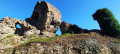
(5) A few metres before the clearing, take the path leading down to the left towards the Rocher d’Olstein, marked with a Yellow Ring. Enjoy the view. From the rock, retrace your steps to return to the Camp Turenne crossroads.
(5) Take the path leading uphill to the left (north-east), continuing along theGR®5towards Molkenrain. Along the way, on the right, there is a viewpoint overlooking Cernay and a picnic table. You’ll come to a fork in the road.
(6) Follow the path climbing up to the left towards the Molkenrain refuge run by the “Amis de la Nature”, heading north-east to the refuge
(7) Turn onto the path leading off to the left to cross the hill, heading towards the Molkenrain farm.
(8) At the Molkenrain farm, leave theGR®5and head right towards the small cowshed; take the path branching off to the left of it, heading downhill towards Cernay, marked with a Red Rectangle crossed by a White Rectangle (a variant ofthe GR®5). During the descent, the path runs alongside the road on the opposite side of the hill, then, after a series of hairpin bends, reaches the Herrenfluh Pass
(9). At the pass car park, turn onto the path leading off to the right towards Steinbach, signposted with a Blue Cross. After crossing the mountain bike trails, continue along the forest track. At the various junctions, always follow the Blue Cross markings. After a left-hand bend and a four-way junction, keep left to reach another junction about 200 m further on.
(10) At the Schmittenweg junction, continue to follow the same signposting for about 1.5 km, taking the path leading down to the right. After a wide right-hand bend, you’ll join a path coming from the left, followed by another junction.
(11) Between Chemin Ingold and Chemin du Noyer, carry on straight south following the same signposting
About 100 m further on, at the edge of the forest where the path splits in two, leave the Blue Cross markings and take the middle path towards Steinbach, marked with a Red Disc. Further on, a path signposted ‘Schelzenburg’ is marked on the left; ignore this and carry straight on along the track until the next fork. This is at the end of the straight stretch, where the track branches off to the left, heading downhill.
(12) This junction is difficult to spot as the path you need to follow, which branches off to the right, is not very clear. At this point, you should no longer follow the ‘Red Disc’ markings as the path you need to take is unmarked. After a few metres, the descent is steep until you reach the Erzenbach River.
(13) Cross the bridge over the river and follow the road to the left, away from the mine. When you reach the first houses in the village, take the path leading uphill to the right towards the Hirnlestein, marked with a Yellow Cross.
(14) At the junction with the Hirnlesteinweg, turn onto the path on the left towards the Hirnlestein Rock, marked with a Blue Cross and then a Blue Ring. Once at the rock, turn back and return to the junction with the Hirnlesteinweg.
(14) At this junction, take the path climbing up to the left towards the Amselkopf, marked with a Yellow Cross.
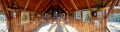
(15) At the Amselkopf Pass, leave the Yellow Cross markings and follow the path on the left towards the Waldkapelle, marked with a Yellow Triangle.
(16) At the Waldkapelle, leave the Yellow Triangle markings and take the path descending to the left towards Thann via Ihlersthal, marked with a Red Rectangle with a White Rectangle (GR®5variant). At the first junction with a forest track, continue to the left, still following the same markings. At the bottom of the descent, where you rejoin the forest track, at a clearing, turn left and follow the path downhill. Continue straight on until you reach the car park (S/E).


 Visorando Member
 Moderate