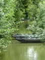
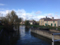
The Marais Sauvage between Damvix and the River

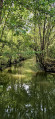
A very beautiful route in the Marais Sauvage, where peace and serenity await you.

Details

1108266
Creation:
Last update:
Last review:
  • Walking
    Activity: Walking
  • ↔
    Distance: 8.04 mi
  • ◔
    Average duration: 3h 40 
  • ▲
    Difficulty: Moderate

  • ⚐
    Back to start: Yes
  • ↗
    Ascent: + 13 ft
  • ↘
    Descent: - 13 ft

  • ▲
    Highest point: 30 ft
  • ▼
    Lowest point: 7 ft

Photos

Description of the walk

Parking: Place André Audouin next to the Damvix village hall.

(S/E) From the car park, with your back to La Sève Niortaise, walk up towards the road. Turn left in front of the pharmacy, cross the bridge and turn left towards the campsite.

(1) 150 metres further on, turn right onto Route du Grand Port. Pass the campsite and the holiday village, staying on the tarmac road. Leave a path on your right, cross the bridge over the Ribaudelle and the tarmac ends. At the next crossroads, keep left, cross the Grande Rigole and you will come to a crossroads (bench).

(2) Turn right towards Saint-Hilaire-la-Palud (the path on the left will be the return route). Keep left at the next two crossroads, then the path begins a long stretch of straight lines through the Marais Sauvage.

(3) After more than two kilometres, you will arrive at a picnic area. Continue straight ahead (ignore the path on the right towards Monfaucon). You will rejoin the tarmac road, cross a bridge and arrive at the river.

(4) At the crossroads, turn left onto Rue du Marais Sauvage, which crosses the village towards La Devise. At La Devise, continue straight ahead for about 300 metres.

(5) Turn left, cross the Broue d'Arçais and continue along the unpaved path.

(6) At the next crossroads, continue straight ahead for one kilometre.

(7) At the bridge, continue straight ahead (ignore the marked path on the right).

(8) About 700 metres further on, stay on the main path which turns left and crosses a bridge. Shortly afterwards, turn right to return to the crossroads you passed on the way there, 400 metres further on.

(2) Turn right and follow the path back to the car park (S/E).

Waypoints

  1. S/E : mi 0 - alt. 16 ft - Parking Place André Audouin - Sèvre Niortaise (fleuve)
  2. 1 : mi 0.19 - alt. 13 ft - On the right: Route du Grand Pont
  3. 2 : mi 1.27 - alt. 7 ft - Crossroads of the circular loop
  4. 3 : mi 3.69 - alt. 10 ft - Picnic area
  5. 4 : mi 4.06 - alt. 16 ft - Towards La Devise
  6. 5 : mi 4.82 - alt. 30 ft - Turn left onto the PR
  7. 6 : mi 5.14 - alt. 7 ft - Straight ahead
  8. 7 : mi 5.96 - alt. 7 ft - Straight ahead at the bridge
  9. 8 : mi 6.4 - alt. 10 ft - Turn left onto the main path.
  10. S/E : mi 8.04 - alt. 16 ft - Parking Place André Audouin

Notes

Can be done by bike to avoid the monotony of long straight stretches.
Don't forget your mosquito repellent.

Worth a visit

Boat trips from the car park.

Reviews and comments

4.5 / 5
Based on 7 reviews

Reliability of the description
4.7 / 5
Ease of following the route
4.7 / 5
Route interest
4 / 5
larochenet
larochenet

Overall rating : 4.7 / 5

Date of your route : Sep 28, 2025
Reliability of the description : ★★★★★ Very good
Ease of following the route : ★★★★★ Very good
Route interest : ★★★★☆ Good
Very busy route : No

A lovely walk on the last Sunday in September. Perfect weather. Peace and quiet, green surroundings and wonderful smells. What more could you ask for?

Machine-translated

Ceameline85
Ceameline85

Overall rating : 4.7 / 5

Date of your route : Aug 17, 2025
Reliability of the description : ★★★★★ Very good
Ease of following the route : ★★★★★ Very good
Route interest : ★★★★☆ Good
Very busy route : No

Pleasant route, mostly shaded except at the beginning and end.
No difficulties.

Machine-translated

Kaj
Kaj

Overall rating : 4 / 5

Date of your route : Oct 20, 2022
Reliability of the description : ★★★★☆ Good
Ease of following the route : ★★★★☆ Good
Route interest : ★★★★☆ Good
Very busy route : No

Easy and pleasant route.

Machine-translated

Gitedebaude
Gitedebaude

Overall rating : 5 / 5

Date of your route : Dec 06, 2020
Reliability of the description : ★★★★★ Very good
Ease of following the route : ★★★★★ Very good
Route interest : ★★★★★ Very good
Very busy route : No

A very easy hike that allows you to discover the landscape of the wet marshes and the villages of the marshlands.
A pleasant walk in any season.

Machine-translated

Blazefire
Blazefire

Overall rating : 3.7 / 5

Date of your route : Aug 03, 2020
Reliability of the description : ★★★★★ Very good
Ease of following the route : ★★★★★ Very good
Route interest : ★☆☆☆☆ Very disappointing
Very busy route : Yes

This hiking trail in the Green Venice is anything but wild; it really is misnamed. The trail is paved and tarmaced all the way; it is even used by cars and motocross bikes as it is a road/path. This route also offers few views of the hidden side of the marsh. However, it is worth noting that the group really enjoyed crossing the picturesque hamlet.

Machine-translated

unpetittour
unpetittour

Overall rating : 4.3 / 5

Date of your route : Jul 19, 2020
Reliability of the description : ★★★★☆ Good
Ease of following the route : ★★★★☆ Good
Route interest : ★★★★★ Very good
Very busy route : No

A very pleasant, shaded route.
It is best to start from Rivière Saint-Hilaire, where there are good parking and picnic facilities.
You may wish to skip the Damvix antenna, which is not particularly interesting when the weather is hot! This shortens the route by approximately 3.5 km.

Machine-translated

slinky
slinky ★

Hello gegeandco,
Thank you for reporting this error. I have just corrected it.
Have a nice day.

Machine-translated

gegeandco
gegeandco

Overall rating : 5 / 5

Date of your route : Jul 14, 2020
Reliability of the description : ★★★★★ Very good
Ease of following the route : ★★★★★ Very good
Route interest : ★★★★★ Very good
Very busy route : Yes

Hello,
There is a small error in the description of point 1.
It is the road to the large port instead of the large bridge.
Kind regards
Gérard Reuzé

Machine-translated

Other walks in the area

For more walks, use our search engine .

The GPS track and description are the property of this route's author. Please do not copy them without permission.