The Bossenot Marsh

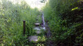
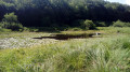
The Bossenot Marsh is situated within a Natura 2000 site. The short nature trail takes you around the marsh, allowing you to observe its unique flora as well as tuff concretions. Several information boards line this route, which is ideal for nature lovers of all ages.

Details

2274992
Creation:
Last update:
Last review:
  • Walking
    Activity: Walking
  • ↔
    Distance: 0.66 mi
  • ◔
    Average duration: 0h 25 
  • ▲
    Difficulty: Easy

  • ⚐
    Back to start: Yes
  • ↗
    Ascent: + 112 ft
  • ↘
    Descent: - 112 ft

  • ▲
    Highest point: 1,991 ft
  • ▼
    Lowest point: 1,880 ft

Photos

Description of the walk

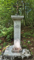
The walk starts from the car park provided for the nature trail, near the Pierre du Diable, an impressive boulder by the side of the small road linking the hamlets of Lassy and Sorcy.

Signposts are located at the very start of the walk and at both junctions (signposted in the direction of this description). The circular marsh trail, between (1) and (2), is lined with wooden posts, some of which have a fence wire attached.

(S/E) Take the path that starts to the right of the information board with the map, heading towards the start of the trail. Descend slightly.

(1) At the junction, turn right towards the nature trail, cross a meadow briefly and enter the woodland.

Take a footbridge and follow a wide circular path around the marsh, anti-clockwise, alternating between different surfaces: dirt track; wooden blocks to cross a wet area; boardwalk; grassy, damp path; dirt track; wooden beams; boardwalk; grassy path; boardwalk.

Take a footbridge and cross the lower part of the meadow.

(2) At the T-junction, head up the wide path to the left.

(1) At the junction you passed on the way there, carry straight on to reach the car park (S/E).

Waypoints

  1. S/E : mi 0 - alt. 1,991 ft - Marsh car park - Pierre du Diable
  2. 1 : mi 0.09 - alt. 1,936 ft - Start of the nature trail
  3. 2 : mi 0.52 - alt. 1,900 ft - End of the nature trail
  4. S/E : mi 0.66 - alt. 1,991 ft - Marsh car park - Pierre du Diable

Notes

Unless it is the height of summer, wear shoes suitable for wet conditions, or even wellies.

The time given is the actual walking time. Feel free to spend more time observing, listening to the birds, etc.

The Bossenot Marsh is a sensitive natural area: please respect the site, do not leave any rubbish behind, and do not pick anything.

The route is relatively straightforward, but a detailed map is always useful (at the very least, the one accompanying this description).

Walk undertaken by the author on 14 July 2019.

Worth a visit

The marsh, with its distinctive flora – including a vast reed bed – and tuff concretions in the lower reaches, is the highlight of this walk. There are several information boards.

The Pierre du Diable, near the starting car park, is a natural geological formation. It is a very large boulder left behind after the retreat of the Rhône Glacier some 10,000 years ago.

Reviews and comments

4.7 / 5
Based on 2 reviews

Reliability of the description
4.5 / 5
Ease of following the route
4.5 / 5
Route interest
5 / 5
Fringolette 74
Fringolette 74

Overall rating : 4.3 / 5

Date of your route : Nov 18, 2024
Reliability of the description : ★★★★☆ Good
Ease of following the route : ★★★★☆ Good
Route interest : ★★★★★ Very good
Very busy route : Yes

Very simple signposting – not to be attempted if there’s much more of it. You cross a marsh, which is to be expected; at the start, however, you have to go under a wire strung around a field, which, fortunately, isn’t electrified
Great for children – you walk along footbridges and boardwalks...😉👍

Machine-translated

aelig777
aelig777

Overall rating : 5 / 5

Date of your route : Aug 15, 2020
Reliability of the description : ★★★★★ Very good
Ease of following the route : ★★★★★ Very good
Route interest : ★★★★★ Very good
Very busy route : No

A really lovely walk – interesting and great for children, as there are lots of little bridges which they find great fun. The path is shaded for 90 per cent of the way, which was very welcome on such a hot day.
The route is short and has very little elevation gain, so it’s suitable for all ages.
We missed the first turn-off because the sign at the start of the walk had gone missing, but everything is clearly marked on the map so we found our way back on track quickly.

Machine-translated

Other walks in the area

For more walks, use our search engine .

The GPS track and description are the property of this route's author. Please do not copy them without permission.