La Chapelle des Pas

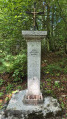
A very short walk leading to a wayside shrine in the forest, dating from 1793, known as the Chapelle des Pas. There are some lovely views along the route.

Details

3910050
Creation:
Last update:
Last review:
  • Walking
    Activity: Walking
  • ↔
    Distance: 2.80 mi
  • ◔
    Average duration: 1h 40 
  • ▲
    Difficulty: Easy

  • ⚐
    Back to start: Yes
  • ↗
    Ascent: + 453 ft
  • ↘
    Descent: - 423 ft

  • ▲
    Highest point: 2,575 ft
  • ▼
    Lowest point: 2,178 ft

Photos

Description of the walk

Start from Place du Champ Dunant in Lyaud. There are two large car parks around the square, one tarmac and one gravel.

No signposting

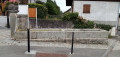
(S/E) Head north-north-east and follow the road between the two car parks (bus stop), Rue du Sommetant. At the roundabout, continue straight on along Route des Devants. It is recommended that you use the designated footpaths: on the right-hand side before the roundabout, and on the left-hand side after it. Then take thefirst right, Chemin des Chevrys, and head uphill. After the last house, the tarmac gives way to a stony track.

Red and white markings (sparse)

(1) You’ll come out onto a small road; follow it to the right uphill (you’re now on the “Thonon” variant ofthe GR®5). At a place called Les Jossières (oratory), turn left towards the Chapelle des Pas. When the road bends to the left, carry on straight ahead along a stony track (the Chemin des Pas). Climb gently until you reach a junction (signpost; a rubble dump opposite on the left).

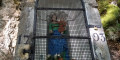
(2) Carry on straight ahead uphill. The path is lined with vegetation before entering the forest. After a very slight descent, you’ll reach the Chapelle des Pas, which is in fact an oratory.

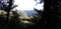
(3) Retrace your steps back to the junction with the rubble. On the way, note the beautiful views of Lake Geneva and the Dranse Gorges on the right.

Blue arrows on a white background

(2) Leave theGR® and take the path on the left, which climbs into the forest (this path is not shown on the IGN map but is marked on the OSM map). Pass at the foot of a medium-voltage pylon. Then ignore a path branching off to the left and cross a recently felled area. Enter the forest again and head downhill. At a fork in the road at the end of a gentle bend to the right, take either of the two branches; both lead to a crossroads just before the edge of the forest.

(4) Then turn left and walk along level ground through a stand of spruce trees. The path veers left and climbs slightly.

No signposting

(5) At the T-junction, follow a stony path to the right which descends steeply (Red Cross on a white background). Pass the base of another electricity pylon, then head down through meadows, hedgerows and copses. You’ll come out onto a road; follow it to the right (with a view of Lyaud church and, in the background, the two castles of Allinges). At the ‘give way’ sign, turn left onto Rue du Sanjhon. Walk gently down into the village, ignoring the side paths, and note two fountains and some beautiful old houses as you pass. This will take you to Place du Champ Dunant (S/E).

Waypoints

  1. S/E : mi 0 - alt. 2,178 ft - Place du Champ Dunant
  2. 1 : mi 0.59 - alt. 2,300 ft - Crossroads – View of the - Lac Léman
  3. 2 : mi 1.06 - alt. 2,474 ft - Junction
  4. 3 : mi 1.41 - alt. 2,566 ft - La Chapelle des Pas (Lyaud)
  5. 4 : mi 2 - alt. 2,507 ft - Crossroads
  6. 5 : mi 2.21 - alt. 2,549 ft - T-junction
  7. S/E : mi 2.8 - alt. 2,178 ft - Place du Champ Dunant

Notes

A good pair of trainers is sufficient for this short walk, which follows well-maintained paths or quiet country lanes.

No information is available regarding the potability of the water from the fountains in Lyaud on the return journey.

A detailed map is useful (at the very least, the one accompanying this description).

Hike undertaken by the author on 25 August 2020.

Worth a visit

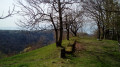
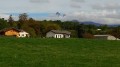
- Between (1) and (3), there are beautiful views of Lake Geneva, the Allinges castles, the Dranse Gorges and the peaks around Bernex (Mémises, Borée, Oche).
- Oratory at a place known as Les Jossières.
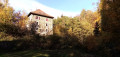
- Chapelle des Pas (2): a wayside shrine dating from 1793.
- Fountains and old houses in Lyaud, before returning to the starting point.

Always be cautious and plan ahead when you're outdoors. Visorando and the author of this route cannot be held responsible for any accidents occurring on this route.

The GR® and PR® markings are the intellectual property of the Fédération Française de Randonnée Pédestre.

Reviews and comments

4.2 / 5
Based on 3 reviews

Reliability of the description
4 / 5
Ease of following the route
4.3 / 5
Route interest
4.3 / 5
mamaumamar
mamaumamar

Overall rating : 3.3 / 5

Date of your route : Aug 21, 2022
Reliability of the description : ★★★☆☆ Average
Ease of following the route : ★★★☆☆ Average
Route interest : ★★★★☆ Good
Very busy route : No

The start of the walk is very easy to follow, very well explained and signposted.

But we missed number 5: at the T-junction, which we didn’t spot!

So we ended up further up the road leading to Le Lyaud.

Please could you provide clearer directions for the point where we need to head down a steep, stony path?

Machine-translated

Béatrice.J
Béatrice.J

Overall rating : 5 / 5

Date of your route : May 26, 2021
Reliability of the description : ★★★★★ Very good
Ease of following the route : ★★★★★ Very good
Route interest : ★★★★★ Very good
Very busy route : No

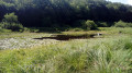
A lovely walk with magnificent views of Lake Geneva and the River Dranse, with some very pleasant stretches through the woods

Machine-translated

picetgil
picetgil

Overall rating : 4.3 / 5

Date of your route : May 08, 2021
Reliability of the description : ★★★★☆ Good
Ease of following the route : ★★★★★ Very good
Route interest : ★★★★☆ Good
Very busy route : No

A lovely walk to do with the family (not suitable for pushchairs); it can get muddy after heavy rain; part of the route takes you through the shade of the woods; the urban section is less interesting.

Machine-translated

Other walks in the area

For more walks, use our search engine .

The GPS track and description are the property of this route's author. Please do not copy them without permission.