


Refine your search for walks in Le Malinvern
Le Malinvern walks


 Mount Malinvern via the Terre Rouge Lakes.
 Visorando Member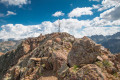
 6.77 mi
 +2,762 ft
 -2,746 ft
 5h 30
5h 30
 Difficult
 Departure from Isola (Alpes-Maritimes)
A technical hike starting from Isola 2000 that will take you to the highest point in the area, with breathtaking views of the resort and the Italian Alps. Up to the beautiful Terre Rouge Lakes and Baisse du Druos, this route is accessible to all; things get a little more challenging once you reach Italy.
Walks near Le Malinvern
Isola 2000 – Rifugio Questa
7.19 mi
+4,163 ft
-3,159 ft
6h 55
Difficult
Departure from Isola (Alpes-Maritimes)
The first stage of a circular walk around Isola. The route starts at the top of the resort and finishes at Rifugio Questa, on the Italian side, passing by the Terre Rouge Lakes and Lake Tavels.
Sant’Anna Valdieri – Livio Bianco Mountain Hut
 4.46 mi
+2,943 ft
-0 ft
4h 35
4.46 mi
+2,943 ft
-0 ft
4h 35
 Moderate
Departure from Valdieri (Cuneo)
Moderate
Departure from Valdieri (Cuneo)
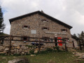
A picturesque climb through a deciduous forest leading out into an alpine valley. Nestled at the far end of this valley, in the hollow of an imposing mountain cirque, lies the refuge. What a delight it is, in the evening, to sit on the terrace and gaze at the reflection of the peaks in the mirror-like surface of the lake.
Le Boreon - Refuge de Nice
 10.85 mi
+5,971 ft
-3,678 ft
12 hrs
10.85 mi
+5,971 ft
-3,678 ft
12 hrs
 Very difficult
Departure from Saint-Martin-Vésubie (Alpes-Maritimes)
Very difficult
Departure from Saint-Martin-Vésubie (Alpes-Maritimes)
The most difficult stage of thisGR®, but the most beautiful for its landscapes, flora and fauna: chamois, marmots, ibex.
After the Pas des Ladres, we chose to take theGR®52via the alternative route that passes close to the Col de Fenestre, then descends to Lac de Fenestre before reaching La Madone de Fenestre.
Three sections are particularly difficult: between Lac de Trecolpas and the Pas des Ladres, the ascent of the Pas du Colomb, and the descent from the Pas du Colomb.
Boréon – Cougourde Mountain Hut
 5.37 mi
+2,559 ft
-472 ft
4h 40
Moderate
Departure from Saint-Martin-Vésubie (Alpes-Maritimes)
5.37 mi
+2,559 ft
-472 ft
4h 40
Moderate
Departure from Saint-Martin-Vésubie (Alpes-Maritimes)
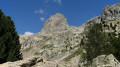
This first stage largely follows theGR®52. It takes you through wooded countryside and offers a relaxing break by the peaceful Lac de Trécolpas. From the Cougourde Mountain Hut, you’ll enjoy superb views of this majestic, pumpkin-shaped peak.
Editor’s note added on 26/07/2021: A section is closed due to bad weather. See the notices for an alternative route
From the Longon Refuge to Saint-Dalmas
 15.05 mi
+3,540 ft
-5,518 ft
10h 00
Difficult
Departure from Alpes-Maritimes
15.05 mi
+3,540 ft
-5,518 ft
10h 00
Difficult
Departure from Alpes-Maritimes
This nineteenth stage continues the long traverse of the Mercantour. From the Refuge de Longon, the path descends the Vallon du Longon diagonally across the slope to the hamlet of Rougios, before following the Fracha forest road and then taking a shortcut to the pretty Provençal village of Roure. Via a stony descent, it cuts across the hairpin bends of the M130 and M30 roads and reaches Saint-Sauveur-sur-Tinée, which it passes through before climbing up to the Chapelle Saint-Roch. Running along the hillside, it crosses the Vallon du Romarinier, passes through the hamlet of Roubinastre, crosses the Ravin de l’Esclosé and arrives at Rimplas. The GR®5 descends gently towards the small pass of Ragias and crosses the Vallon Gros, before climbing back up to the ridge on that side of the slope and then skirting the hamlet of La Bolline. From there, it climbs to the hamlet of La Roche and then ascends the ridge of the Vallon de Bramafam to reach Saint-Dalmas Valdeblore.
Roure - Saint Dalmas Valdeblore
9.54 mi
+3,261 ft
-2,657 ft
7h 15
Difficult
Departure from Alpes-Maritimes
Étape de la traversée des Alpes avec un départ de Roure jusqu'à Saint Dalmas de Valdeblore.
Randonnée allant de la vallée de la Tinée à l'arrière pays niçois.
Saint-Dalmas de Valdeblore – Le Boréon
 12.91 mi
+4,491 ft
-3,720 ft
10 hrs
Very difficult
Departure from Valdeblore (Alpes-Maritimes)
12.91 mi
+4,491 ft
-3,720 ft
10 hrs
Very difficult
Departure from Valdeblore (Alpes-Maritimes)
Second stage of the route and first stage on theGR®52. A long 21km stage taking in the Col de Veillos, numerous lakes, the Col du Barn, the Vacherie du Collet and the Col de Salèse, ending at a place called Le Boréon.
A spectacular stage thanks to its landscapes and views, but very difficult.
From Saint-Dalmas to Utelle
 15.80 mi
+4,124 ft
-5,745 ft
10h 50
Difficult
Departure from Valdeblore (Alpes-Maritimes)
15.80 mi
+4,124 ft
-5,745 ft
10h 50
Difficult
Departure from Valdeblore (Alpes-Maritimes)
This twentieth stage marks the end of the crossing of the Mercantour Massif. From Saint-Dalmas, the GR®5 heads south to climb the steep slope towards the Cime de Colmiane, which it bypasses by heading for the Col du Varaire. It crosses the Bois Noir and reaches the Col des Deux Caïres, then the Caïre Gros. The route follows its ridge and, hugging the hillside, passes beneath Mont Chalancha, La Partissuola and the Cime de la Combe before descending to the small pass of Trous. Before the Col du Fort, the path descends to the Granges de la Brasque, crosses the upper part of the Riou du Figaret valley and arrives at the Col d’Andrion. Cutting across the hairpin bends of the M33, the GR®5 reaches the Col des Fournès and the Col de Gratteloup. Through rocky gaps, it runs alongside the Petit Brec d’Utelle and then the Brec d’Utelle. From there, the path descends towards the Crête de l’Albaréa and reaches the Col du Castel Ginesté. It crosses the slope below the ridges of the Têtes du Sac de Bécasse, Parabosquet and Les Pennes to reach the Utelle community lodge.
Saint-Dalmas de Valdeblore - Utelle
15.74 mi
+4,354 ft
-5,919 ft
11h 00
Difficult
Departure from Valdeblore (Alpes-Maritimes)
Étape de la traversée des Alpes de Saint-Dalmas de Valdeblore jusqu'à Utelle. Randonnée sur une ligne de crête offrant des panoramas extraordinaires sur l'arrière pays niçois.
Mercantour route via the GR®52
 65.54 mi
+21,585 ft
-24,639 ft
7 days
Very difficult
Departure from Saint-Martin-Vésubie (Alpes-Maritimes)
65.54 mi
+21,585 ft
-24,639 ft
7 days
Very difficult
Departure from Saint-Martin-Vésubie (Alpes-Maritimes)
TheGR® 52 is a route that crosses the Mercantour National Park, through the Alpes-Maritimes from Saint-Dalmas-de-Valdeblore to Menton.
ThisGR® route is very challenging due to the varied terrain and significant elevation changes.
You’ll reach altitudes of up to 2,700m, where you can admire the high-mountain landscapes, flora and fauna. Then, in the second half of the route, you’ll encounter panoramas that are more southern in character but just as extraordinary.