Country:

 City:
City:


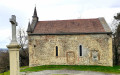
Between Cessieu and Saint-Jean-de-Soudain, take the D92 towards Rochetoirin. Head for the small car park opposite the hamlet of Le Cornu.
(S/E) Take the Route du Cornu on the other side of the D92. At the first left-hand bend, take the path straight ahead. This climbs steeply through the trees. You’ll soon reach a hunter’s observation post. You’ll then emerge from the forest where the gradient levels off, before arriving on the plateau. Carry on until you reach a road (Chemin du Puits).
(1) Turn right, towards Vernavant. Already, to the east, you’ll catch your first glimpses of the Alps. Carry on along this road until the next junction.
(2) Turn left and, 20 metres further on, take the path on the right. Follow it. Ignore the path that branches off to the right towards higher ground. 30 metres further on, at the next Fork in the road, turn left along the fence. Walk for about 500 metres until you reach a house and, immediately after, a road.
(3) Follow it to your right for 350 m. Here, you’ll cross the Ruisseau de l’Enfer for the first time.
(4) Turn onto the Chemin de la Grande Chaussée. Walk 300 m to a house. Go just behind it. Follow the path down to the stream. This is the first ford. Cross it and continue to the road.
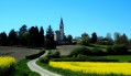
(5) Then turn right. Soon, you’ll have a lovely view of Montceau Castle and the church ahead of you. Walk down to the farm. Take the wide, stony path on your left. You’ll pass the signpost marked ‘les Guerres’. Carry on straight ahead towards Montceau. Walk to a new bridge over the Ruisseau de l’Enfer.
(6) Just before the bridge, take the path on the left (despite the Yellow Cross). Ignore the path branching off to your left (signpost 2).
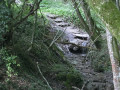
You’ll come to a fork in the road. Here, turn right. The path narrows and begins to descend. Soon, the path drops more steeply to the right. Pass between two holly bushes. Before long, you’ll be walking alongside the stream. Ignore another signposted path that climbs to the left. Carry on until you reach another ford.
(7) Cross the stream, then turn left into a small valley. The path continues on level ground to the D54b.
(8) Take the road to the left for 250 m. Take care on this stretch, as there is heavy traffic and there is little room on the hard shoulder. When you reach the recycling centre, take the wide path that climbs to the left. Climb up to a barn. You’ll reach the signpost for “l’Enfer”.
(9) Turn right towards Brezet. You’ll soon come to a road. Follow the yellow-marked path on the other side of the road. Walk for 500 m, then you’ll come to another road.
Carry on straight ahead, and very soon the road turns into a track. You’ll soon come across some houses and a tarmac road.
(10) At the junction, turn right. Walk 100 m along the pavement, then take the path that runs to the left of the house.
At the sign for “Champ Robert”, head towards the iron cross. Join the road at Saint-Joseph.
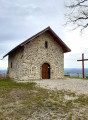
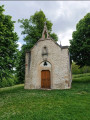
(11) Do not take the road, but head down the path on your right. This will take you to the Notre-Dame de Salette Chapel.
(12) Now head towards the Saint-Joseph Chapel. Walk past the vineyard shed. Carry on a little further, and, at the bend, leave the road (Chemin des vignes). Head up the path on the left towards the chapel and the orientation board.
(15) Head into the forest towards the road leading to the hamlet of Saint-Joseph and carry on until you reach the iron cross.
(15) Turn right onto the road towards Saint-Jean-de-Soudain. Walk past the school and carry on straight ahead until you reach the junction with the Chemin du Mauvais Pas.
(15) At the junction, turn right onto the Chemin du Mauvais Pas. Walk for 50 metres and take the path on your left. It descends quite steeply at first, then more gently.
(16) At the junction, turn left. You’ll come to some houses. Follow the Chemin des Rives. Then, at the next junction, go straight on along the Chemin de Pévrin. At the hamlet of Le Cornu, which you passed on the way out, turn right and carry on to the car park (S/E).


 Visorando Member

 Very difficult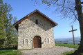
 Easy
Easy