Country:

 City:
City:


Park in the car park in the village of Les Mosses, along Route 11, before the pass when coming from Aigle.
(S/E) Follow Route 11 towards the pass and, after about a hundred metres, at a left-hand bend, turn right onto the Chemin du Lioson.
(1) At the junction, continue left onto the Chemin du Lioson.
(2) At the junction with Chemin des Preissettes (which you’ll take on the way back), turn right onto Chemin du Lioson towards the lake of the same name and Pic Chaussy. Pass the hamlet of Lioson d’en Bas and you’ll come to a small car park.
(3) Turn left onto a very steep tarmac track heading towards Lac Lioson.
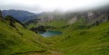
(4) When you reach an electricity pylon, turn right onto a path which takes you round a section of the track. Join the track further on and follow it uphill. You’ll arrive at Lac Lioson and its mountain hut, situated on the right.
(5) Two options here:
- Walk round the lake anti-clockwise and rejoin the main route at point (6).
- As shown on the map, turn left and walk along the lake on your right-hand side.
(6) After about 250 m – if you have chosen not to walk round the lake – turn left onto the Chemin de Pra Cornet. The path winds along the mountainside and then across a mountain pasture.
(7) At a fork in the road, take the left-hand farm track towards Pra Cornet. You’ll reach the Pra Cornet farm; pass it on your right.
(8) Follow a descending concrete track to the left (due west).
(9) Take a path on the right towards Les Communs de l’Hongrin. Descend along a series of bends.
(10) You’ll come out onto another track; follow it to the left.
(11) Take a path to the right (west).
(2) At a junction you passed on the way there, continue straight ahead.
(1) Turn right to reach the village of Les Mosses (S/E).
 Visorando Member


 Very difficult
 Difficult