


 Country:

 City:


Lac Retaud car park is right nearby. Around fifty spaces.
(S/E) Climb the hill where you’ll see the orange hiking signs: first view of the lake. With your back to the car park, follow the signposts to the right. Follow this route until you reach the Col de Voré. The markings are white-red-white and very clearly signposted. Watch out for cows – they’re on their own land and can be wild! Remember to close any gates or barriers if you come across them.
(1) Then head off to the left towards the Col des Andérets. The route is very well signposted here too. You’ll enter a private property with a restaurant (watch out for the dog). Go round the building to the left. The path continues to the right (it eventually joins up).
(2) Make sure you turn left at the turnstile on the embankment (there was no gate or wire when I was there) and climb up the embankment , which offers a magnificent panoramic view from the top.
(3) Carry on following the signposts (you might spot some marmots). You’ll reach the Col des Andérets.
(4) Here, take the path heading left towards La Palette and you’ll find the signposts a little further on, amongst the rocks. You’ll reach a viewpoint.
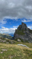
(5) Carry on a little further and you’ll reach the very summit of La Palette (360° panorama; be careful, as you may feel dizzy).
(6) Take the steep path downwards. The path is less well-maintained at this point but clearly marked.
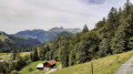
(7) At the bottom of the descent, you’ll reach the first ski lift. Go round it on the left, then follow the fence for about 50 m. When you see the second ski lift further on, veer right towards the farm below. You’ll come across the signposts again.
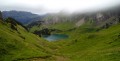
(8) Just before reaching the farm-restaurant, turn left (hiking signpost indicating the lake is 20 minutes away). The path alternates between gravel and woodland. Follow the signposts carefully. You must turn left into the pine trees; follow the GPS route if necessary. You’ll reach the lake (swimming possible depending on conditions).
(9) Return to the car park (S/E).

 Visorando Member

 Very difficult
 Difficult

