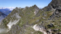
Lac de la Patinoire via Lac des Vaches and Col Rosset

The suggested route is one of my favourites in the area: you climb from the Fontanettes car park up to the iconic Lac des Vaches. You then head up to Lac de la Patinoire, before traversing via the Col Rosset to descend via Pralognan. There are plenty of possible alternatives; the suggested route is circular. This very demanding hike has few exposed sections (slightly so at Col Rosset). It offers magnificent views of a glacial lake and the Grande Casse. The Fontanettes car park is a pay-and-display facility, and you can use the council’s free shuttle buses to get there from the village.

Details

n°112103042
Creation:
Last update:
–
Last review:
–
  • Walking
    Activity: Walking
  • ↔
    Distance: 7.45 mi
  • ◔
    Average duration: 6h 25 
  • ▲
    Difficulty: Difficult

  • ⚐
    Back to start: Yes
  • ↗
    Ascent: + 3,399 ft
  • ↘
    Descent: - 3,383 ft

  • ▲
    Highest point: 8,435 ft
  • ▼
    Lowest point: 5,430 ft

Description of the walk

The start and finish are at the pay-and-display car park at Les Fontanettes.

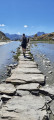
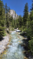
(S/E) From the car park, head towards the Refuge des Barmettes: the route (GR®55) follows a path through the forest, providing some shade when it’s hot. Cross one path and come out onto another.

(1) Follow it to the right, leaving the GR®, and ignore any side paths, until you reach the Refuge des Barmettes.

(2) At the Barmettes car park, continue along the GR®55 towards the Refuge du Col de la Vanoise. There are several possible routes; this section is often busy.

(3) Just before reaching Lac des Vaches, you can head up to the left directly towards the Chalet des Gardes; this is a shortcut for this walk. Otherwise, carry on straight ahead to cross Lac des Vaches.

(4) Once you have crossed the lake, take the circular route to the left to gain height towards the Chalet des Gardes.

(5) At the Chalet des Gardes, continue to the right.

(6) After crossing the stream, turn right for a return trip to Lac de la Patinoire. You can sometimes spot chamois there. The path is quite steep and stony, so take care. At Lac de la Patinoire, there are stunning views over the lake and the Grande Casse.

(7) Head back down the same path to the stream.

(6) Do not cross it, but head right towards Col Rosset.

(8) At Col Rosset, head straight down the path.

(9) Once you have descended from the pass, continue straight on, ignoring any side paths, until you reach the Pralognan ski area, and carry on to the foot of Mont Bochor.

(10) Head down to the left onto the road, then turn onto a path on the right as soon as possible, keeping to the descent all the way to the car park (S/E).
It is possible to continue along the road without taking the paths; you will then rejoin the path taken on the way there between the car park and the Refuge des Barmettes, which you should follow in the opposite direction.

Waypoints

  1. S/E : mi 0 - alt. 5,433 ft - Fontanettes car park
  2. 1 : mi 0.6 - alt. 6,030 ft - Junction
  3. 2 : mi 1.11 - alt. 6,621 ft - Refuge des Barmettes (2012m)
  4. 3 : mi 2.31 - alt. 7,546 ft - Junction
  5. 4 : mi 2.71 - alt. 7,684 ft - Junction - Lac des Vaches
  6. 5 : mi 3.17 - alt. 7,946 ft - Chalet des Gardes
  7. 6 : mi 3.26 - alt. 7,913 ft - Junction. Return trip to the lake
  8. 7 : mi 3.56 - alt. 8,248 ft - Lac de la patinoire
  9. 8 : mi 4.38 - alt. 8,406 ft - Col Rosset
  10. 9 : mi 5.19 - alt. 7,654 ft - Junction
  11. 10 : mi 6.43 - alt. 6,512 ft - Mont Bochor
  12. S/E : mi 7.45 - alt. 5,430 ft - Fontanettes car park

Notes

Paid car park; free local shuttle buses are available.

You can use the Genepy chairlift to shorten the climb.

Worth a visit

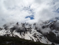
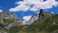
Stunning panoramic views of the Grande Casse and the Vanoise glaciers. Lac de la Patinoire is a glacial lake that’s an absolute must-see if you’re in the area!

Always be cautious and plan ahead when you're outdoors. Visorando and the author of this route cannot be held responsible for any accidents occurring on this route.

The GR® and PR® markings are the intellectual property of the Fédération Française de Randonnée Pédestre.

Other walks in the area

For more walks, use our search engine .

The GPS track and description are the property of this route's author. Please do not copy them without permission.