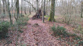
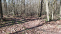
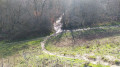
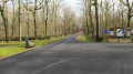
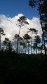
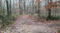
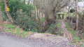
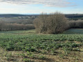
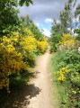
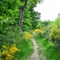
Lac de la Bordette in the Bouconne Forest

A walk for everyone in the Bouconne Forest, starting from the car park at the Saint-Louis forest house in Pujaudran and heading towards the pretty Lac de la Bordette

Details

4405028
Creation:
Last update:
Last review:
  • Walking
    Activity: Walking
  • ↔
    Distance: 9.19 mi
  • ◔
    Average duration: 4h 25 
  • ▲
    Difficulty: Moderate

  • ⚐
    Back to start: Yes
  • ↗
    Ascent: + 200 ft
  • ↘
    Descent: - 213 ft

  • ▲
    Highest point: 797 ft
  • ▼
    Lowest point: 669 ft
  • ⚐ Country: France
  • ⚐ City: Pujaudran (32600)
  • ⚑
    Start/End: N 43.59849° / E 1.186487°
  • ❏
    IGN map(s): Ref. 2043ET, 2043O
  • Hour-by-hour weather

Photos

Description of the walk

Park in the car park after the Saint-Louis forest house located on Impasse Saint-Louis in Pujaudran.

(S/E) Leave the car park behind you and take the central path on the right. Continue until you reach the first path on the right.

(1) Leave the central path and turn right onto the clearly marked track. Walk downhill until you can see the houses. Take a left-hand bend along the track that follows the edge of the forest. The path passes close to the Étang de Lutché and crosses the stream that feeds the pond.

(2) At the fork (not shown on the IGN map), turn right onto a path that follows the edge of the forest. Cross a stream, turn right with the path and then left. As you begin to see the road coming from Léguevin, the path passes in front of a pond and then follows the Rieu Tord.

(3) At the fork, take the footbridge over the Rieu Tord on the right. Cross the D42 with care and continue along the edge of the forest. At each junction, go straight on until you reach a T-junction.

(4) Then turn right into a wide lane. Take thefirst path on the left and follow the railway line on your right. Keep following it until you reach a wide lane.

(5) Follow this lane to the right and cross the railway line at the level crossing. Continue straight on until you reach the D24. Cross the road carefully and arrive at the car park for the forest area on the Lévignac side.

(6) Turn right and walk along the western edge of the car park. At the end, take a path that heads diagonally (east) through the undergrowth. At the T-junction, head down to the right and reach Lac de la Bordette.

(7) Walk round the lake either clockwise (as shown on the map) or anti-clockwise. Stay as close to the water as possible and return to the starting point.

(7) Follow the same path you took on the way out and return to the car park at the forest area.

(6) Cross the D24 again with care. Go straight on (south-west) along the wide path. Cross the railway line again at the level crossing.

(5) Continue straight ahead along the wide path, ignoring all side paths. Cross the D42 and continue for a further 150 m or so (crossing the Rieu Tord as you go).

(8) Then turn right and cross the car park. At the far end, cross thesecond section of the car park and take the path that climbs through the undergrowth. At the junction, first turn right then left.

(9) At the next junction, take thefirst path on the right, at an acute angle. Follow this path until you reach the next side lane.

(10) Turn left into this lane and then turn right along it.

(11) At the junction, turn left. At the end of the path, rejoin the central lane and follow it to the right. Continue straight ahead (south-west).

(1) Continue straight ahead to the starting car park, located on the left-hand side of the path (S/E).


Waypoints

  1. S/E : mi 0 - alt. 794 ft - Car park at the Saint-Louis forest house
  2. 1 : mi 0.12 - alt. 791 ft - Junction of the main circular loop
  3. 2 : mi 0.58 - alt. 725 ft - Fork
  4. 3 : mi 1.68 - alt. 679 ft - Footbridge over the Rieu Tord
  5. 4 : mi 2.76 - alt. 689 ft - T-junction
  6. 5 : mi 3.69 - alt. 741 ft - Wide path - Level crossing
  7. 6 : mi 4.37 - alt. 686 ft - Lévignac entrance car park
  8. 7 : mi 4.65 - alt. 669 ft - Lac de la Bordette
  9. 8 : mi 7.71 - alt. 712 ft - Léguevin / Mérenvielle entrance car park
  10. 9 : mi 8.01 - alt. 758 ft - Path on the right
  11. 10 : mi 8.12 - alt. 778 ft - Side path
  12. 11 : mi 8.35 - alt. 791 ft - Crossroads
  13. S/E : mi 9.19 - alt. 794 ft - Car park at the Saint-Louis forest house

Notes

No water points along the route
After heavy rain, to avoid mud and flooded areas, you can walk there and back via the central path without turning off at (1) and (8)
The Bouconne Forest is criss-crossed by a network of side paths that intersect the central path, which runs through the entire forest.

Worth a visit

A stop at the memorial to François Verdier, a local man and Resistance leader who was tortured and killed by the Nazis, is a must.
The walk around Lac de la Bordette is particularly pleasant; during the week you can see ducks and coypu there; they avoid the crowds at weekends.
You can have a picnic in the Saint-Louis car park, where tables and benches are available.
During the hunting season, the forest is closed to the public one Thursday a month; the closure dates are displayed at the car park.

Reviews and comments

4.5 / 5
Based on 6 reviews

Reliability of the description
4.7 / 5
Ease of following the route
4.7 / 5
Route interest
4.2 / 5
Nad31300
Nad31300

Overall rating : 4.3 / 5

Date of your route : May 05, 2026
Reliability of the description : ★★★★☆ Good
Ease of following the route : ★★★★★ Very good
Route interest : ★★★★☆ Good
Very busy route : No

We did this route in late April, just as the warm weather was setting in... So, with the shade of the trees and a breeze, the route was brilliant—except... towards the end, where we found the main path through this beautiful forest rather monotonous (and the sun beating down on us).
The lake is small; it’s quite busy as there’s a car park right next to it.
The two crossings of the main road can be a bit daunting, but visibility is good at those points.
Thanks for this route! A very beautiful forest 😊

Machine-translated

User 28641633

Overall rating : 5 / 5

Date of your route : Apr 05, 2026
Reliability of the description : ★★★★★ Very good
Ease of following the route : ★★★★★ Very good
Route interest : ★★★★★ Very good
Very busy route : Yes

A lovely walk, with plenty of alternative routes to choose from. Everything is very well signposted.

Machine-translated

Katuf
Katuf

Overall rating : 4.7 / 5

Date of your route : Apr 04, 2025
Reliability of the description : ★★★★★ Very good
Ease of following the route : ★★★★★ Very good
Route interest : ★★★★☆ Good
Very busy route : No

A lovely, very peaceful forest. We’re keen walkers and completed the circuit in 3 hours (not including our picnic break) instead of the 4½ hours indicated.
In April there were few walkers and no mosquitoes – a great time of year 🤗
A quick picnic by the lake halfway through

Machine-translated

mvaban
mvaban
• Edited:

The first part of the route is very wooded. Make sure you wear long trousers and a long-sleeved top, and bring mosquito repellent, as there are plenty of midges that can make the walk unpleasant.
A lovely lake with a picnic area.
This spot is likely to be very busy at weekends.
The second part is a straight stretch with gentle gradients
It is recommended that you read the Visorando description (no signposting)

Machine-translated

JMZAHN
JMZAHN

Overall rating : 3.7 / 5

Date of your route : Oct 04, 2023
Reliability of the description : ★★★★☆ Good
Ease of following the route : ★★★★☆ Good
Route interest : ★★★☆☆ Average
Very busy route : Yes

I completed this route (or at least followed it for the most part) on Sunday 1 October 2023.
Unrelated to the author of this route: temperatures up to 32 degrees, so another ‘sweat-fest’, ‘harassment’ by swarms of midges – almost non-stop, very unpleasant – and lots of people (that’ll teach me to choose a Sunday when the weather’s fine), especially around the lake, so lots of noise, ...
On the other hand, it’s a shame there are so many “main straight stretches” on this route.
There is so much to do in this forest, if you stray from its main route, a “motorway” (straight and long, not my favourite sort of hike).
If I were to return to this forest, it would surely be for a “trail run” or on a mountain bike, avoiding the long straight through-route as much as possible, and during a “cooler” period, hoping I won’t have to battle with the insects again.
Jean-Marie.

Machine-translated

chris5732
chris5732

Overall rating : 5 / 5

Date of your route : May 03, 2021
Reliability of the description : ★★★★★ Very good
Ease of following the route : ★★★★★ Very good
Route interest : ★★★★★ Very good
Very busy route : Yes

A lovely walk, with some lovely shaded paths – one to do again on a hot day so you can enjoy the shade...

Machine-translated

AJT-31
AJT-31

Hello,
Thank you for taking the time to leave a comment – a positive one, in my view
You can visit our Facebook page, “Marche à Fontenilles”, to find out more about us and perhaps come and walk with us

Machine-translated

Claude Sauviac
Claude Sauviac

Overall rating : 4.3 / 5

Date of your route : Feb 08, 2021
Reliability of the description : ★★★★★ Very good
Ease of following the route : ★★★★☆ Good
Route interest : ★★★★☆ Good
Very busy route : Yes

My son introduced me to your website
Spot on

Machine-translated

Other walks in the area

For more walks, use our search engine .

The GPS track and description are the property of this route's author. Please do not copy them without permission.