The ‘Route du Chien’ in the Bouconne State Forest

With a bit of imagination, the route’s layout might remind you of a ‘sitting dog’.
The route starts and ends at the car park of the Maison Forestière Saint-Louis in Pujaudran.
An easy route that does not follow any roads – and is therefore car-free – running through the southern part of the forest.

Details

4458654
Creation:
Last update:
Last review:
  • Walking
    Activity: Walking
  • ↔
    Distance: 4.93 mi
  • ◔
    Average duration: 2h 25 
  • ▲
    Difficulty: Easy

  • ⚐
    Back to start: Yes
  • ↗
    Ascent: + 207 ft
  • ↘
    Descent: - 226 ft

  • ▲
    Highest point: 909 ft
  • ▼
    Lowest point: 712 ft
  • ⚐ Country: France
  • ⚐ City: Pujaudran (32600)
  • ⚑
    Start/End: N 43.59824° / E 1.18673°
  • ❏
    IGN map(s): Ref. 2043ET, 2043O
  • Hour-by-hour weather

Photos

Description of the walk

Park in the car park at the Maison Forestière Saint-Louis in Pujaudran, accessed via Chemin des Moulins and Impasse Saint-Louis.
Path names: see Practical Information.

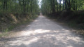
(S/E) With your back to the car park, cross the central path, which runs south-west to north-east, and take Side Path No. 38 opposite, which runs perpendicular to it. Continue until you reach thethird path, which runs parallel to the central path.

(1) Take the path that branches off diagonally to the left and follow it to the junction with thesecond path you come to, marked No. 42.
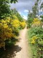
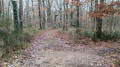
Turn left onto it and follow it to the end. It crosses Side Path No. 39, then theGR®653towards Santiago de Compostela, and passes close to a high point.
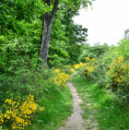
After theGR®, the track becomes a path that winds through the undergrowth to the southern edge of the forest, then heads back inland, eventually rejoining the GR®. Follow it to the left until you reach the junction with Track No. 43.

(2) Turn right and continue along Path No. 43 heading north-east. About 200 metres further on, it meets Side Path No. 3 and becomes a footpath that bends to the right and joins Path No. 42.

(3) Turn left onto Path No. 42. Less than 100 metres further on, it becomes a footpath after the junction with Path No. 38. The footpath gradually curves to the right and reaches Side Path No. 37.

(4) Turn right onto Side Path No. 37, ignore the turn-offs to the right and continue straight on until you reach thefirst path on the left.

(5) Turn left into this unnumbered lane and follow it north-eastwards until you reach the Central Path just before the Léguevin entrance car park. Continue in the same direction for a few dozen metres.

(6) Turn right into the side lane and head downhill until you reach a perpendicular lane markedGR®653.
Turn right at a 90° angle and follow theGR® until you reach a side path where the Way of St James from Léguevin joins. Turn right at a 90° angle towards the central path for about 150 m.

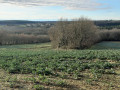
(7) Leave theGR® and take thefirst path branching off to the left towards the south-west, which descends towards the southern edge of the forest. Follow it until you see a group of houses on the left: the hamlet of Mayras.

(8) At the lowest point of the path, turn right and head back up towards the central avenue.
When you reach the central avenue, turn left and head back to the car park where you started (S/E).


Waypoints

  1. S/E : mi 0 - alt. 791 ft - Car park at the Saint-Louis forest lodge
  2. 1 : mi 0.36 - alt. 787 ft - Path veering off to the left
  3. 2 : mi 1.53 - alt. 902 ft - Chemin de Saint Jacques
  4. 3 : mi 1.97 - alt. 902 ft - Path No. 42
  5. 4 : mi 2.34 - alt. 892 ft - Side path No. 37
  6. 5 : mi 2.65 - alt. 801 ft - Path towards the central track
  7. 6 : mi 3.37 - alt. 768 ft - Central track on the Léguevin side
  8. 7 : mi 4.04 - alt. 791 ft - Path towards the southern edge
  9. 8 : mi 4.59 - alt. 735 ft - The hamlet of Mayras
  10. S/E : mi 4.93 - alt. 791 ft - Car park at the Saint-Louis forest lodge

Notes

Avenue designations:
The Bouconne Forest is criss-crossed by a network of side paths that run perpendicular to the central path, which is roughly oriented south-west to north-east and runs through the entire forest.
The so-called side paths run perpendicular to the central path.
The main side and peripheral paths are numbered in ascending order from the north to the south of the forest.
At the junction of the paths with the central path, a post displays the path number on a red background.

There are no water points along the route.

Worth a visit

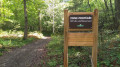
At the car park, there is a map of the forest showing the numbering of the paths. It is advisable to take a photo of it.

You can have a picnic in the Saint-Louis car park; there are tables and benches available.

During the hunting season, the forest is closed to the public one Thursday a month; the closure dates are displayed at the entrance car parks.

Always be cautious and plan ahead when you're outdoors. Visorando and the author of this route cannot be held responsible for any accidents occurring on this route.

The GR® and PR® markings are the intellectual property of the Fédération Française de Randonnée Pédestre.

Reviews and comments

4.8 / 5
Based on 2 reviews

Reliability of the description
5 / 5
Ease of following the route
4.5 / 5
Route interest
5 / 5
naddiouche
naddiouche

Overall rating : 5 / 5

Date of your route : May 09, 2026
Reliability of the description : ★★★★★ Very good
Ease of following the route : ★★★★★ Very good
Route interest : ★★★★★ Very good
Very busy route : Yes

We really enjoyed this hike. There were just the four of us, and we met a few other people along the way. We did it in the opposite direction – there were some lovely spots and it wasn’t too difficult.

Machine-translated

AJT-31
AJT-31

Hello,
Thank you for your kind comment.

Machine-translated

User 24453239

Overall rating : 4.7 / 5

Date of your route : Nov 16, 2025
Reliability of the description : ★★★★★ Very good
Ease of following the route : ★★★★☆ Good
Route interest : ★★★★★ Very good
Very busy route : No

Very pleasant, between main avenues and small paths.

Machine-translated

Other walks in the area

For more walks, use our search engine .

The GPS track and description are the property of this route's author. Please do not copy them without permission.