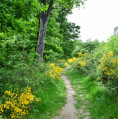
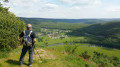
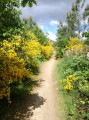
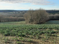
The Wolf Route in the Bouconne Forest

With a little imagination, the route of the circuit might resemble a wolf.
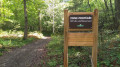
The route starts and ends at the car park of the Maison Forestière Saint-Louis in Pujaudran.
A easy route that does not follow any roads and is therefore car-free, running through the southern part of the forest.

Details

4458626
Creation:
Last update:
Last review:
  • Walking
    Activity: Walking
  • ↔
    Distance: 4.14 mi
  • ◔
    Average duration: 2h 05 
  • ▲
    Difficulty: Easy

  • ⚐
    Back to start: Yes
  • ↗
    Ascent: + 207 ft
  • ↘
    Descent: - 210 ft

  • ▲
    Highest point: 902 ft
  • ▼
    Lowest point: 712 ft
  • ⚐ Country: France
  • ⚐ City: Pujaudran (32600)
  • ⚑
    Start/End: N 43.598203° / E 1.186667°
  • ❏
    IGN map(s): Ref. 2043ET, 2043O
  • Hour-by-hour weather

Photos

Description of the walk

Park in the car park at the Maison Forestière Saint-Louis in Pujaudran

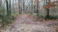
(S/E) With your back to the car park, cross the central path and take side path No. 38 opposite, heading north-west, until you reach the end of the path. After an intersection with a horizontal path (i.e. one running parallel to the central path), the path turns into a track which ends when it meets another horizontal path.

(1) Turn left at the junction and head towards the crossroads with Side Path No. 39

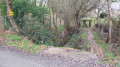
(2) Turn right into the side lane and head down until you reach the canyon. The canyon was formed by the Rieu Tord, which carved out the earth to create its bed; the canyon therefore follows the course of the Rieu Tord. Follow the canyon until you see a path coming from the right and descending from the Chaume ponds.

(3) Leave the canyon and take the path on the right which heads off at an acute angle. At the next junction, take the path which turns 90° to the left, and after a straight section, heads diagonally to the left alongside a pidgeon hunting hut. The track is wide and stony and comes from the car park at the Mérenvielle entrance.

(4) Whilst the path continues straight ahead, turn into the side path on the right and continue to the next junction.

(5) At the junction, follow the path that heads diagonally left until you reach thefirst horizontal path running parallel to the main track. Turn left onto the horizontal path until you reach the next side path.

(6) Turn right into the side path until you reach the central path. Continue left along the central path towards the Léguevin entrance car park, then turn right immediately at thefirst side path you come to, which forms part of theGR®653.

(7) Leave theGR® and take the path on the right which passes by the Lutché pond and then runs along the edge of the forest to reach the hamlet of Mayras. Turn right onto the path which climbs back up to the main track and continue left along the main track to reach the car park at the start (S/E).

Waypoints

  1. S/E : mi 0 - alt. 794 ft - Saint-Louis Forest House in Pujaudran
  2. 1 : mi 0.91 - alt. 892 ft - Turn left at the junction
  3. 2 : mi 1.2 - alt. 899 ft - Towards the canyon
  4. 3 : mi 1.65 - alt. 830 ft - Steep path
  5. 4 : mi 2.14 - alt. 889 ft - Pidgeon hunting hut
  6. 5 : mi 2.46 - alt. 886 ft - 90° path
  7. 6 : mi 2.97 - alt. 791 ft - Towards the central path
  8. 7 : mi 3.26 - alt. 791 ft - Leave the GR 653
  9. S/E : mi 4.14 - alt. 794 ft - Saint-Louis Forest House in Pujaudran

Notes

No water points along the route
Walking poles may be useful on ascents and descents, especially on muddy ground.
The Bouconne Forest is criss-crossed by a network of side paths that intersect the central path, which runs through the entire forest. The main side and perimeter paths are numbered in ascending order from north to south. At the junction of the paths with the central path, a post displays the path number on a red background.

Worth a visit

During the hunting season, the forest is closed to the public one Thursday a month; the schedule is available in the car park.
At the car park, there is a map of the forest showing the numbering of the paths. It is advisable to take a photo of it.
Picnicking is permitted in the Saint-Louis car park; tables and benches are available.

Always be cautious and plan ahead when you're outdoors. Visorando and the author of this route cannot be held responsible for any accidents occurring on this route.

The GR® and PR® markings are the intellectual property of the Fédération Française de Randonnée Pédestre.

Reviews and comments

4.2 / 5
Based on 6 reviews

Reliability of the description
4.4 / 5
Ease of following the route
4.3 / 5
Route interest
4 / 5
TonyChicken
TonyChicken

Overall rating : 3.7 / 5

Date of your route : Apr 06, 2026
Reliability of the description : ★★★★☆ Good
Ease of following the route : ★★★☆☆ Average
Route interest : ★★★★☆ Good
Very busy route : No

A lovely, enjoyable route, though made tricky by numerous obstacles (trees felled by a storm). Some of the obstacles may prove challenging for those who aren’t particularly agile

Machine-translated

renee.orel@orange.fr

Overall rating : 4 / 5

Date of your route : Aug 18, 2025
Reliability of the description : ★★★★☆ Good
Ease of following the route : ★★★★☆ Good
Route interest : ★★★★☆ Good
Very busy route : No

i can't know if it's very busy.

Machine-translated

Rémy Poncelet
Rémy Poncelet

Overall rating : 4.3 / 5

Date of your route : Sep 15, 2023
Reliability of the description : ★★★★★ Very good
Ease of following the route : ★★★★★ Very good
Route interest : ★★★☆☆ Average
Very busy route : No

A pleasant walk on a very hot day, as the route runs almost entirely under the trees. On the other hand, it is a bit monotonous. The GPS track is reliable.

Machine-translated

AJT-31
AJT-31

Thank you to everyone who left a kind comment
The Bouconne Forest is a lovely place to walk through.

Machine-translated

laurenceka
laurenceka

Overall rating : 4.3 / 5

Date of your route : Apr 18, 2022
Reliability of the description : ★★★★☆ Good
Ease of following the route : ★★★★☆ Good
Route interest : ★★★★★ Very good
Very busy route : No

We followed the directions, using the map to make sure we didn’t get lost.
As the forest is laid out in a grid pattern, all the paths look the same!
We didn’t quite follow the route to the end, on the other side of the central path, as we couldn’t recognise the paths relative to the route. So we returned to the central path to head back to the car park.
Walking poles aren’t necessary, as there are no technical difficulties. Still, best avoided after rainy days to avoid too much water on the path.
It was lovely not to see any cars and barely two or three people!

Machine-translated

bozierbruno
bozierbruno

Overall rating : 4.5 / 5

Date of your route : May 10, 2021
Reliability of the description : Not used / Not applicable
Ease of following the route : ★★★★★ Very good
Route interest : ★★★★☆ Good
Very busy route : No

A lovely, easily accessible forest route.
Thank you for sharing this.
Bozierbruno

Machine-translated

AJT-31
AJT-31

Thank you for taking the time to leave a comment, which I find very positive

Machine-translated

mipa
mipa

Overall rating : 4.7 / 5

Date of your route : Oct 17, 2020
Reliability of the description : ★★★★★ Very good
Ease of following the route : ★★★★★ Very good
Route interest : ★★★★☆ Good
Very busy route : No

The trails in Bouconne have remained just as accessible as ever during the 45 years I’ve been cycling them
A lovely route.
Thank you

Machine-translated

Other walks in the area

For more walks, use our search engine .

The GPS track and description are the property of this route's author. Please do not copy them without permission.