Around Pujaudran on the Grand Tour de Pujaudran

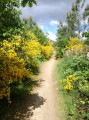
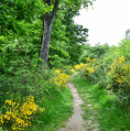
This route is based on the Grand Tour de Pujaudra (GTP), a circular walk starting from the car park at the Maison Forestière de Saint-Louis, featuring a mix of footpaths and roads and offering beautiful views.
The start follows part of the Way of St James via the Arles route.

Details

4447714
Creation:
Last update:
Last review:
  • Walking
    Activity: Walking
  • ↔
    Distance: 7.60 mi
  • ◔
    Average duration: 3h 50 
  • ▲
    Difficulty: Moderate

  • ⚐
    Back to start: Yes
  • ↗
    Ascent: + 397 ft
  • ↘
    Descent: - 420 ft

  • ▲
    Highest point: 991 ft
  • ▼
    Lowest point: 682 ft
  • ⚐ Country: France
  • ⚐ City: Pujaudran (32600)
  • ⚑
    Start/End: N 43.59836° / E 1.186777°
  • ❏
    IGN map(s): Ref. 2043ET, 2043O
  • Hour-by-hour weather

Photos

Description of the walk

Park in the car park at the Maison Forestière Saint-Louis, Impasse Saint-Louis in Pujaudran.

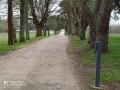
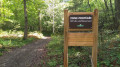
(S/E) With your back to the car park, head towards the central path and turn left. This section forms part of the GR®653, signposted in red and white, and the Way of St James, signposted with scallop shells. After a bend to the right, you’ll soon reach a Y-junction. There’s a sign to the right for the historic path and, opposite, for the Way of St James and the GTP, marked in black on a blue background.

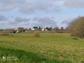
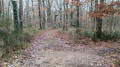
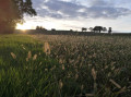
(1) Head straight ahead and follow the signs forthe GR®, the GTP and the scallop shells. Stay on this wide track, ignoring the paths branching off to the right and left. As you emerge from the forest, there is a clearing with an unobstructed view of Pujaudran; this marks the start of a track suitable for vehicles but not tarmacked. Continue along this track until you come to a path branching off to the left.

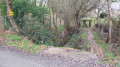
(2) Leave theGR® and the Way of St James and turn left to follow the GTP. The path winds through the woods, descends and then climbs to reach a slight incline after a left-hand bend. The path then runs alongside the Route de Mérenvielle before joining the Chemin de l’Autan. Turn left onto the tarmac road and continue until you reach the dirt track shortly afterwards on the right.

(3) Turn right onto the dirt track marked with both GTP and Chemin de Saint-Jacques signs, as you have now joined the historic route, which mainly follows the road. At the end of the dirt track, turn right onto the Allée des Mûriers and continue to the church car park.
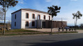
Cross the car park and walk round the church to reach Avenue Victor Capitoul.

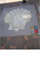
(4) Ignore the Chemin de Saint-Jacques, which branches off to the right, and the GTP, which heads straight ahead, and turn left onto the cobbled road. Walk past the church and admire the magnificent mosaic scallop shell on the pavement, then continue towards Léguevin. Walk past the new town hall and the cemetery until you reach a road on the right.

(5) Turn right onto Chemin de Lartus, head down to the RN124, follow it along, then pass under the main road and head back up towards Lartus Castle. Walk past the castle and carry on to the next junction.

(6) At the junction, rejoin the GTP by turning left onto Chemin de Secouris. Continue along this track, ignoring a path on the left, cross the Lartus Forest and head downhill to the junction with a road on the left.

(7) Still following the GTP, turn left onto Chemin des Bordes. The road climbs gently and bends to the right before crossing over the RN124. Continue along this road until you reach the next road on the right.

(8) Turn right onto Impasse de la Carrelasse; after a bend to the left, continue to the end of the cul-de-sac. Take the footpath on the right, accessible through a gate which you must open and then close behind you. Pedestrians are permitted to use this footpath. After a few metres, turn left onto the path which leads down to the road. Turn right onto the D532 Route de la Plaine until you reach the next path on the left.

(9) Just before thefirst house on the left, take the path running perpendicular to the D532. The path descends gently to the bed of the Ruisseau de Saint-Blaise and then climbs gently back up to the old RN124 (now the RN2124). Cross the main road with care and take the road opposite, which climbs more steeply. Cross the Chemin des Moulins and take the dirt track opposite which climbs towards the forest to reach the junction you passed on the way out.

(1) Then turn right at the “Y” junction to rejoin the road taken on the way out. We follow theGR® in the opposite direction but leave the GTP and the Camino behind via the Arles route. After a left-hand bend, we rejoin the central path which takes us back to the car park (S/E).

Waypoints

  1. S/E : mi 0 - alt. 794 ft - Car park at the Saint-Louis forest house
  2. 1 : mi 0.2 - alt. 791 ft - Common A/R junction. Historic path
  3. 2 : mi 1.56 - alt. 948 ft - Entrance to the Bois de Pujaudran
  4. 3 : mi 2.44 - alt. 974 ft - Chemin de L’Autan
  5. 4 : mi 2.79 - alt. 991 ft - Église Saint-Brice (Pujaudran)
  6. 5 : mi 3.08 - alt. 965 ft - Lartus Path
  7. 6 : mi 4 - alt. 961 ft - Chemin de Secouris
  8. 7 : mi 5.68 - alt. 682 ft - Chemin des Bordes
  9. 8 : mi 6.4 - alt. 715 ft - Impasse de la Carrelasse
  10. 9 : mi 6.72 - alt. 689 ft - Route de la Plaine
  11. S/E : mi 7.6 - alt. 794 ft - Car park at the Saint-Louis forest lodge

Notes

GDP = Grand Tour de Pujaudran, signposted in black on a blue background
GR®653, signposted in red and white
Way of St James, signposted with scallop shells

Water point and public toilets at the Pujaudran community hall.
Walking poles may be useful on uphill and downhill sections.
The Bouconne Forest is criss-crossed by a network of side paths that intersect the central track, which runs through the entire forest. The main side and peripheral paths are numbered in ascending order from the north to the south of the forest. At the junction of the paths with the central track, a post displays the path number on a red background.

Worth a visit

During the hunting season, the forest is closed to the public one Thursday a month; the schedule is available in the car park.

Lartus Castle is private property

The route passes close to the Moulin de la Chaü, which has been restored by the owner. Take a short detour to the point (6) to admire it.

Always be cautious and plan ahead when you're outdoors. Visorando and the author of this route cannot be held responsible for any accidents occurring on this route.

The GR® and PR® markings are the intellectual property of the Fédération Française de Randonnée Pédestre.

Reviews and comments

4.1 / 5
Based on 3 reviews

Reliability of the description
4.3 / 5
Ease of following the route
4.7 / 5
Route interest
3.3 / 5
chris5732
chris5732

Overall rating : 4 / 5

Date of your route : May 02, 2021
Reliability of the description : ★★★★☆ Good
Ease of following the route : ★★★★☆ Good
Route interest : ★★★★☆ Good
Very busy route : No

a lovely walk

Machine-translated

Le Doudou31
Le Doudou31

Overall rating : 4 / 5

Date of your route : Apr 23, 2021
Reliability of the description : ★★★★☆ Good
Ease of following the route : ★★★★★ Very good
Route interest : ★★★☆☆ Average
Very busy route : No

The first part went very well in the forest
From Pujaudran, it’s just the road for 7 km – very...

Machine-translated

bellenature
bellenature

Overall rating : 4.3 / 5

Date of your route : Jan 24, 2021
Reliability of the description : ★★★★★ Very good
Ease of following the route : ★★★★★ Very good
Route interest : ★★★☆☆ Average
Very busy route : Yes

A pleasant route offering a few views of the Pyrenees. No difficulties.

Machine-translated

Other walks in the area

For more walks, use our search engine .

The GPS track and description are the property of this route's author. Please do not copy them without permission.