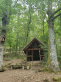
The Hirnelestein on the hills above Steinbach

The Silberthal clearing is a starting point for many family walks.
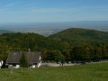
This route runs mainly through woodland, which is very pleasant in warm weather. The highlight is the Hirnlestein, which offers a 180° view of the mountain ranges surrounding southern Alsace.

The walk described here was undertaken with two young children (aged 5 years and 7 months, the latter carried in a baby sling).

Details

3327852
Creation:
Last update:
Last review:
  • Walking
    Activity: Walking
  • ↔
    Distance: 1.67 mi
  • ◔
    Average duration: 1h 05 
  • ▲
    Difficulty: Easy

  • ⚐
    Back to start: Yes
  • ↗
    Ascent: + 328 ft
  • ↘
    Descent: - 331 ft

  • ▲
    Highest point: 1,650 ft
  • ▼
    Lowest point: 1,270 ft

Description of the walk

Park in the car park at the western end of the road that runs through Steinbach.

(S/E) Walk up through the car park until you reach a small footbridge crossing the Erzenbach, then cross the track.

(1) Walk on for about 20 metres, then take the steps on the left. Climb all the way to the top. You will arrive at the Silberthal clearing.
The clearing is a great spot for a picnic break.
Cross the clearing and walk past the Saint-Nicolas Mining Museum.
Opposite the mine entrance, take the path leading uphill, situated immediately on the right (there is usually a box at the start of this path containing the latest finds by former miners).
Follow the path as it continues to climb until you reach the crossroads at the summit.

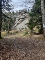
(2) Continue for about a hundred metres. To reach the Hirnlestein, steps and a fence have been installed, allowing younger visitors to enjoy the view. Be careful, however, as the steps are quite steep. On a clear day, there is a magnificent 180° view of the Black Forest, the Alsace plain, the Swiss Alps and the Swiss Jura.

Once you’ve come down from the rock, take the steps on the left. Be careful, as they can be slippery even in dry weather. Continue downwards, staying on the main path.

At the foot of the rock, you’ll often see people practising rock climbing – another fun way to reach the summit. There’s also a designated picnic area here.
Return to the main path and continue downhill.
Turn left to join the track.

(3) Turn left and carry on straight ahead until you reach the car park (S/E).

Waypoints

  1. S/E : mi 0 - alt. 1,322 ft - Car park, picnic area. Towards the footbridge at the - Erzenbach (cours d'eau) - Affluent de la Thur
  2. 1 : mi 0.04 - alt. 1,335 ft - Stairs
  3. 2 : mi 0.41 - alt. 1,624 ft - Crossroads at the summit - Hirnlestein
  4. 3 : mi 1.35 - alt. 1,270 ft - Vehicle access route
  5. S/E : mi 1.67 - alt. 1,322 ft - Car park and picnic area

Notes

Please use the large car park at the bottom of the clearing. There is a smaller one further up, but it may be full, and it is best to reserve access to it for people with reduced mobility.

Worth a visit

Silberthal Clearing: this area has also been developed by a local association and regularly hosts events in summer (refreshments, light meals during mountain bike races, concerts, etc.).

Mining Museum: traces the history of the miners who worked there for several centuries to extract silver-bearing galena. Do pop into the little mining museum and have a chat with the enthusiasts who still regularly go there to look for galena and may be able to show you round the mine. More info: http://www.kalitroc.com/index.html

Reviews and comments

3.9 / 5
Based on 4 reviews

Reliability of the description
3.8 / 5
Ease of following the route
3.8 / 5
Route interest
4.3 / 5
User 29651741

Overall rating : 4 / 5

Date of your route : Aug 13, 2026
Reliability of the description : ★★★★☆ Good
Ease of following the route : ★★★★☆ Good
Route interest : ★★★★☆ Good
Very busy route : Yes

a pleasant climb up to the rock – a lovely panoramic view of the plain from the top of the rock – all without too much effort

Machine-translated

majax
majax

Overall rating : 4.7 / 5

Date of your route : Jun 03, 2025
Reliability of the description : ★★★★★ Very good
Ease of following the route : ★★★★★ Very good
Route interest : ★★★★☆ Good
Very busy route : No

I recommend this tour, no difficulties

Machine-translated

Hélène R
Hélène R ★

Hello,
and thank you for your feedback.
I'll be checking the signposting as soon as possible to update the route.
Thanks in advance for your patience

Machine-translated

berni68
berni68

Overall rating : 3.3 / 5

Date of your route : May 01, 2023
Reliability of the description : ★★★☆☆ Average
Ease of following the route : ★★★☆☆ Average
Route interest : ★★★★☆ Good
Very busy route : No

nice walk, shame the signposting is not very clear, for example at the entrance to the mine it's not opposite but next door and there are stairs going up, fortunately there was the association of the Saint-Nicolas mine for a very nice day's work who redirected us (and for those interested you can visit the mine by booking at the Thann/Cernay tourist office).

Machine-translated

Nicole et François
Nicole et François

Overall rating : 3.7 / 5

Date of your route : Jan 09, 2022
Reliability of the description : ★★★☆☆ Average
Ease of following the route : ★★★☆☆ Average
Route interest : ★★★★★ Very good
Very busy route : Yes

Nice walk, but it took twice as long because of the lack of signposting...

Machine-translated

Other walks in the area

For more walks, use our search engine .

The GPS track and description are the property of this route's author. Please do not copy them without permission.