


 Country:

 City:
City:


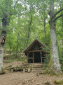
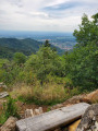
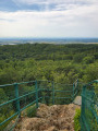
Park in the small hikers’ car park at the end of Chemin de Zuhren in Vieux-Thann. There are only 3–4 parking spaces at most. If there is no space, set off from Route de Cernay and head up Chemin de Zuhren to reach the starting point, at the end of the tarmac road where various paths intersect.
(S/E) At the end of the tarmac road, take the path leading uphill to the left towards Steinbach, marked with a Red Triangle. After about fifty metres, take the path leading uphill to the left. You will come to a fork in the path.
1:: Take the left-hand path, marked with a Yellow Ring; this is the path to the Ifiss Oratory in Steinbach, heading north-east. Further on, pass the path marked with a Red Ring on your right and continue in the same direction until you reach the junction at the Oratory.
(2) Take the path on the left, marked with a Blue Ring. Follow these markings to the summit of the Hirnelestein rock. After the rest area on the right-hand side of the path, at the junction, take the path leading to the right. This descends in a long straight line to reach the junction with the Amselkopfweg.
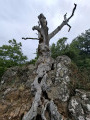
(3) Head right-hand side all the way up, towards the Col de l’Amselkopf. After a few hundred metres, you’ll reach the foot of the Hirnelestein rock.
(4) Go round it on the left to follow the path uphill through the forest. At the top of the rock, continue along the path branching off to the left. After a few metres, when you reach the forest tracks, turn left onto another ascending forest track, marked with a Blue Ring, and follow it to the Amselkopf Pass. There are also Yellow Cross markings all the way to the Rehbrunnel Shelter.
(5) Leave the Yellow Ring markings here. Continue along the ascending forest track marked with Yellow Crosses towards Pastetenplatz. During the climb, there are several junctions with other forest tracks; keep going straight on until you reach a small clearing.
(6) Carry on straight ahead along the path until you reach a junction at a place called Pastetenplatz.
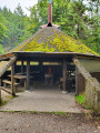
(7) Take the path on the left towards the Rehbrunnel spring – the Yellow Cross path, which is joined by the Blue Ring trail coming from the left – and carry on to the Rehbrunnel shelter.
(8) Continue along the descending forest track. At the Fork in the road, take the path on the left towards the Col du Grumbach (the Blue Ring path branches off to the right). Shortly afterwards, leave the Yellow Cross markings and turn onto the small path descending to the left towards Thann, marked with a Red Disc. Keep heading roughly south until you reach a wide left-hand bend. After about 300 m, the path joins a forest track.
(9) Follow it uphill to the right. At the fork, keep left towards Waldkapelle (Red Disc) and arrive at the junction with the path marked with a Red Rectangle.
(10) Continue in the same direction along this descending track until you reach the junction with the many paths and tracks at Waldkapelle. Follow this new Red Rectangle with a white bar marking until you reach your destination.
(11) Continue left along the path towards Thann via the Jacquot memorial. After a bend to the left and then to the right, take the path on the right leading to the memorial. It winds downwards to the memorial and the junction that follows. Turn right towards the south; the path continues along a forest track and joins a path marked with a Blue Cross.
(12) Continue to the right, heading south, and walk alongside the various ponds before returning to the starting point (S/E).

 Visorando Member
 Easy
Easy 

 Difficult
