Refine your search for walks in Le Gouray
Le Gouray walks
Chemin de la Patouille au départ de Bréhand
Ce petit circuit vous permettra de visualiser les différents aspects caractérisés par le dynamisme de la commune de Bréhand.
Circuit du chemin de la Patouille par le hameau des Fermes à Bréhand
Cette boucle vous immergera dans un sous-bois pour continuer sur des petites routes tranquilles.
Tour of the lake at Jugon-les-Lacs
The route follows the shady banks of the lake, small gravel roads and a few quiet stretches of road.
It will take you through villages with old houses, many of which have been beautifully restored.
To finish your walk, you can explore the streets and alleys of the village along the river, where the wash houses have been restored.
Around Hillion
A protected site, the Bay of Saint-Brieuc can be explored via a coastal path, theGR®34, which offers opportunities to observe a wide variety of birds and discover the Gouessant Valley (very steep-sided) and a large number of beautiful cuts in the loess and silt from the Quaternary period. The route can only be done on foot.
Hiking is not recommended from May to September! See practical information.
The Chaos du Gouët
Historically dedicated to Marc Faucon (a pioneer of hiking in the Côtes d'Armor), this hike will allow nature lovers to explore the foothills of the Gouët and the wooded hills of the surrounding countryside.
The Rance and the Rophemel Pond
In Rophemel, the Rance flows through a valley of great beauty. Built in the 1930s, the hydroelectric dam submerged nine fulling and wheat mills. The dam and valley have been a "listed and protected site" since 1945. In addition to producing electricity, the reservoir also supplies drinking water to the city of Rennes.
The reservoir was drained in early 2018 to carry out work on the dam.
Another drainage operation is underway (2024) to carry out further work on the dam (see my hike: https://www.visorando.com/randonnee-6431... )
Tour of Lake Bosmeleac
A relaxing walk around the dam lake. The path along the banks is beautifully maintained.
The artificial reservoir was created by building a dam at the end of the 19th century to supply the Canal de Nantes à Brest during periods of water shortage. A gauge shows that the water level at the dam can reach 14 metres.
The Néal Valley and the Lampouy alignments in Médréac
Médréac, a small village in Ille-et-Vilaine, on the border with Côtes d'Armor. The route is particularly attractive: the picturesque Néal valley with the cave of Gabillard, a local Chouan resistance fighter, the megalithic alignments of Lampouy, the railway station, its museum and its rail bike with two routes.
This hike follows theGR® 37 and part of thePR® "Circuit des mégalithes" (Megalith Circuit). The southern part of thisPR® has not been included as it is uninteresting and the paths are poorly maintained.
Sables d'Or les Pins to Cap d'Erquy from Erquy
This beautiful route starts from the beach at Erquy, first taking in the narrow streets of the village and then the quiet lanes, before leading back to the sea at the end of the Anse des Sables d'Or. After that, it runs along the coast, from beach to beach, taking us back to the port, crossing the moor and skirting the rocks. From the top of the cliffs or at wave level, this trail offers breathtaking and varied views of this magnificent coastline.
Boucle de la chapelle Notre-Dame de Kernéant
Au départ d’une chapelle, partez pour une boucle en pleine nature. Forêt paisible, ruisseau chantant et campagne sereine vous accompagnent tout au long de cette balade accessible et ressourçante. Une vraie parenthèse bucolique à savourer.
The tip of Saint-Jacut-de-la-Mer via the coastal path
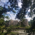
Hike along the coastal path and inland at Saint-Jacut-de-la-Mer with magnificent landscapes. If the tide is low, discover the Pointe du Chevet with its islets.
From Tournemine to Pointe de Bréhin
This circular route straddles the municipalities of Plérin and Pordic. The route follows the coastal path between Tournemine Beach and Pointe de Bréhin, offering beautiful views of Rosaires Beach and the port of Binic. The return journey is inland, mainly through valley bottoms.
Tour de l'Arguenon maritime
Discover a magical estuary and hike in the valley from the mouth of the river to the coast.
Its name, "ar" "gwen" "on" (or the white river), comes from the fact that at high tide, its bed fills with a mysterious natural foam caused by the mixing of fresh and salt water at its mouth: nature in all its diversity.
The Pointe d'Erquy
Stroll between the beaches and moorland of the Pointe d'Erquy.
Added moderator on 07/07/2021 : Attention, itinerary modification in (4). See description and reviews.
Baie de la Fresnaye and Moulin de la Mer
This short hike allows you to discover the southern part of Fresnaye Bay with its colours and lighting changing with the tides, the Moulin de la Mer site, the village of Saint-Germain de la Mer, and views of Fort La Latte.
Château de Bienassis from Les Sables d'Or
Return trip by bike to Château de Bienassis from Les Sables d'Or, on beautiful cycle paths, a few quiet roads and a short stretch of dirt track.Don't miss: the viaduct, the sea views at Erquy and Caroual, and of course a visit to Château de Bienassis
Sables d'Or les Pins - Ruins of the Moulin de la Hunaudaye
An easy route to discover the ruins of a mill, enhanced by magnificent views of the sea and the cliffs of Cap Fréhel.
From Lehon Abbey to Saint-Pern
A long hike for experienced walkers, from Lehon (Côtes-d'Armor), starting at the old Saint-Magloire Abbey (founded in the 9th century) to Saint-Pern (Ille-et-Vilaine), the mother house of the Little Sisters of the Poor. A page of history and religious life waiting to be discovered.
La Pointe du Chevet in Saint-Jacut-de-la-Mer
The Pointe du Chevet tour is easy to do and offers two types of coastline. On the west side: a wild coastline opening onto the Baie de l'Arguenon and the Hébihens archipelago that extends beyond it. On the east side: the Bay of Lancieux: the polders and small ports of La Houlle Causseul and Le Châtelet. The coastline of Saint-Jacut-de-le-Mer is bordered by 11 beaches, which you can discover by straying from the suggested route, which follows theGR® 34 to (8).
Estuary Left bank of the Rance - Loop starting from Dinan
Loop around Dinan between Rance and Pays du Poudouvre via the Écluse du Châtelier to La Moinerie in the commune of Plouër-sur-Rance.
The Rance and the historic heart of Dinan
Wind your way along the banks of the Rance, stopping off at the Abbaye Sainte-Magloire-de-Léhon to visit the fortified heights and historic heart of Dinan.
The Château Serein and Fort La Latte
The Bay of La Fresnaye is one of the most beautiful sites on the Emerald Coast. Sheltered from the prevailing winds, a balcony path winds its way through sparse groves of ash, pine and flowering gorse on the slopes of the small cliffs on the western shore of the bay.
The hike starts at the small hidden beach of Château Serein, follows this balcony trail offering beautiful views of the bay, passes through the tiny port of Saint-Géran and ends at the tip of Fort La Latte.
Cap Fréhel and Fort La Latte from Plévenon
After a few kilometres through the Plévenon countryside, you will come to the sea with Saint-Brieuc Bay on your left and Cap Fréhel on your right. Once you have passed Cap Fréhel and Fort la Latte, you will discover Saint Malo Bay and Fresnaye Bay. Gorse, heather and oak trees of various species line the coastal part of the path.
Stop for a moment at Cap Fréhel to discover the colonies of birds nesting on the rocks.
The marshes and polders of Beaussais-sur-Mer
In a bucolic setting, follow the course of the Ru Le Floubalay, which flows into the polders of the Bay of Beaussais-sur-Mer. In Ville-ès-Prêtres, see the sculpture at the foot of the Ferme du Maris: "À l'abri dans le Marais"(Sheltered in the Marsh). It symbolises the work undertaken to regulate the devastating effects of the tides on this submersible area.
The Pointe de Saint-Cast-le-Guildo
Hike to the Pointe de Saint-Cast-le-Guildo, its harbour and the seaside town.
Brocéliande day 2/2
Departure from Tréhorenteuc towards Paimont (digiding don don).Return journey via the north.Pass by the wonders of the forest.
Brocéliande: a legendary forest
For the potential believer, this is the forest where a magician (Merlin the Enchanter) and a fairy (Viviane the Fairy) met. For the same walker, it's also where Arthur's Knights met at the Round Table. Finally, will the walker see the fairies who took to the water? before meeting the fairy Morgane, who locks up all knights unfaithful to their oath of love in an impenetrable prison of air (the Val sans Retour). A vast program.
From Tréhorenteuc to Trécesson via the Val sans Retour
From Tréhorenteuc to Trécesson, this route explores the southern part of the Forest of Paimpont and, first and foremost, the Val sans Retour. These are places steeped in Arthurian legend and provide a magnificent setting for a walk that is largely through forest.
Please note that during the hunting season, certain parts of the route may be closed to walkers.
The banks of the Frémur from Saint-Briac-sur-Mer
The Frémur estuary has two different aspects: the right bank is lined with mudflats and polders, which provide refuge for many species of birds during migration. The path is lined with hedges and undergrowth, providing a cool environment for walking.
The left bank is sandy, ideal for beach games in summer. It is also where boats moor. There is a beautiful view of the Roche-Good tide mill, nestled at the end of the estuary.
Chambre au Loup circuit
The first part of this hike takes you into deep woods. Then you will discover the archaeological site of the medieval castle of Boutavent. Continue this hike through open areas with beautiful panoramic views and steep ascents and descents to reach the Étang de la Chambre au Loup.The return journey takes you back up a steep, open and rocky climb with breathtaking views.
:!: 9.07.2025: The signposting has been changed from blue to yellow.
Discover Fréhel cape
Short discovery hike around Fréhel cape and across its moorland.
Le littoral à Saint-Briac
Ce circuit du littoral emprunte le GR® 34. Il permet la découverte des anciens chemins des douaniers et offre un point de vue exceptionnel, de l’embouchure de la Rivière du Frémur jusqu’au Cap Fréhel.
Brocéliande day 1/2
Departure from Paimpont to reach the famous Val Sans Retour.
Journey south to the land of legends.
Explore the undergrowth of Brocéliande.
Brocéliande circular 2 days
For a weekend of discovery, this route takes you from valleys to ridges through the Paimpont forest.The legendary BROCELIANDE!
Along the Oust, from the Château de Josselin to the Chapelle Saint-Gobrien
Dominated by the tall silhouette of the Château de Josselin, the River Oust is one of the sections of the Nantes-Brest Canal. This walk follows the shaded course of the river and leads to the charming Chapelle Saint-Gobrien.
The mills of Rance - Les Grèves
La Rance saw its first tidal mill built in 1181 (Moulin du Lupin near Rothéneuf). Were built between the sixteenth and seventeenth century. Today there are not many of these renewable energy suppliers. This tour allows you to see the ruins of two mills (Fosse Mort and La Herviais) and to walk around this estuary ideal for the construction of mills.
Pointe de Cancaval and La Malouinière du Montmarin
Jutting out into the Rance estuary, Pointe de Cancaval offers beautiful views of the right bank: from Saint-Servan to Saint-Malo, the dam and the moorings dotted along the coast.
During the walk, you will notice La Malouinière de Montmarin and its remarkable garden, which is one of the most beautiful private residences, and two tidal mill sites that bear witness to the industrial past linked to the tidal range.
The mills of the Rance - Le Poudouvre
The Rance once had many tide mills on its banks. Today, with the passage of time, erosion and lack of maintenance, little remains. This circuit allows you to discover the coastline, countryside, coastal path, remains of the Montmarin mills, the new mill and the dam that uses the movements of the tides for its tidal power plant.
Dinard between land and sea
You will start by winding your way through the Dinard countryside to reach the sea. Take the customs officers' path, the Clair de Lune promenade, and discover the many islets of the Bay of Saint-Malo. You can also explore the Goule aux Fées cave, where the Lumière brothers took their first photographs in 1877.
The Rance estuary on the Dinard side, then Saint-Malo
Walking along the Chemin de Ronde between the dam and the pier, you will enjoy various panoramic views of Saint-Servan-sur-Mer and then Saint-Malo. A short boat trip will take you to an outer basin of the port of Saint-Malo. Continue on to the Cité d'Aleth, the Solidor Tower and the Rosais to complete this tour by crossing the dam.
A balcony overlooking the Bay of Saint-Malo - La Cité d'Alet
The Cité d'Alet is a family-friendly walk, with an exceptional promontory, offering 270° panorama of the Cité Corsaire, the fortified rocks of La Conchée, Petit Bé, Île Harbour, Grand Bé (Chateaubriand's burial place), the Rance estuary and its dam, and Dinard and its beaches.
It's also Saint-Malo birthplace, with the remains of the first human settlements.
Saint-Malo intramural city and Solidor Tower
Discover the pirate town and the personalities who played a part in its history.
The cliffs of Plouha
This hike can be split into two parts: a 9 km loop to the north-west, which includes Bonaparte Beach, and a second 6.5 km loop to the south, which offers views of Pointe de Plouha.
Both loops follow theGR®34coastal path and include some ascents and descents that may be difficult for inexperienced hikers.