Exploring the paths of Beaupréau Park

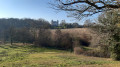
Explore Beaupréau Park on a walk that takes you along all its paths.
This 32-hectare park is the green lung of our little town.

Details

n°2525417
Creation:
Last update:
Last review:
  • Walking
    Activity: Walking
  • ↔
    Distance: 3.83 mi
  • ◔
    Average duration: 2h 00 
  • ▲
    Difficulty: Easy

  • ⚐
    Back to start: Yes
  • ↗
    Ascent: + 289 ft
  • ↘
    Descent: - 289 ft

  • ▲
    Highest point: 331 ft
  • ▼
    Lowest point: 161 ft
  • ⚐ Country: France
  • ⚐ City: Beaupréau (49600)
  • ⚑
    Start/End: N 47.202506° / W 0.986464°
  • ❏
    IGN map(s): Ref. 1423SB
  • Hour-by-hour weather

Photos

Description of the walk

Park in the car park on Rue du Grain d’Or.

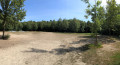
(S/E) Enter the park, cross the play area, and take the path on the right. Continue straight on, turn left, then 50 metres further on, turn left again.

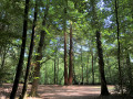
(1) Cross the central square, take the path opposite, to the left of the twinning sign. Carry on straight ahead and, when you reach the bottom, turn right towards the Grand Sequoia roundabout.

(2) At this point, take thesecond path on the right, which leads back to the central square.

(1) Turn left into thethird lane and carry on, then take thefirst lane on the left, which leads back to the Sequoia roundabout.

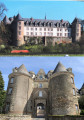
(2) Take the path on the right and follow this long path on the right, which leads to the castle.

(3) At the château, turn left and walk down alongside the River Èvre.

(4) Ignore the start of the Yucca Trail on your left – you’ll follow that later – and carry on straight ahead.

(5) Turn right and carry on along the river through the meadow, then take the wide path on the left which joins the start of the Yucca Trail.

(4) Turn right onto this path, which climbs up the hillside (newly created), and, at the top, joins a main path. Take this path on the right, follow the path to the right of the fitness trail’s climbing frames, and carry on straight ahead until you reach the valley floor.

Then turn right onto the path that descends along the valley floor on your left. At the bottom, take the path on the left and then left again to climb back up to the highest point of the park behind the care home.

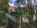
(6) Turn right onto the path that skirts the woods to return to the bridge. Then continue along the path opposite, which runs alongside the boundary wall to the central square.

(1) Turn right onto the first path, which leads back to the starting point (S/E).

Waypoints

  1. S/E : mi 0 - alt. 331 ft - Car park on Rue du Grain d’Or
  2. 1 : mi 0.32 - alt. 315 ft - Central square
  3. 2 : mi 0.56 - alt. 279 ft - Séquoia roundabout
  4. 3 : mi 1.47 - alt. 233 ft - Entrance to the - Château de Beaupréau
  5. 4 : mi 1.57 - alt. 194 ft - Start of the Yucca Trail
  6. 5 : mi 1.68 - alt. 174 ft - Turn-off towards the - barrage sur l'èvre pour moulin à eau
  7. 6 : mi 2.94 - alt. 266 ft - Highest point in the park
  8. S/E : mi 3.83 - alt. 331 ft - Car park on Rue du Grain d’Or

Notes

At the park entrance: toilet facilities and drinking fountain.
Covered cycle parking.
Play area.

Dogs and bicycles are not permitted in this area.
Opening hours: winter 8am–5pm; summer 8am–7pm.

Worth a visit

At point (3), you can walk round the castle and return along the River Èvre.
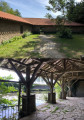
Whilst you’re there, do visit the restored wash house.

Reviews and comments

4 / 5
Based on 1 review

Reliability of the description
4 / 5
Ease of following the route
4 / 5
Route interest
4 / 5
User 6553460

Overall rating : 4 / 5

Date of your route : Sep 28, 2026
Reliability of the description : ★★★★☆ Good
Ease of following the route : ★★★★☆ Good
Route interest : ★★★★☆ Good
Very busy route : Yes

We had a lovely walk in the park this Sunday morning with the members of my walking club; we came across lots of people, from joggers to people out for a stroll.
We enjoyed seeing the cyclamen in bloom, even though they’ve suffered from the drought.
A lovely walk to repeat in another season to see the differences.

Machine-translated

Other walks in the area

For more walks, use our search engine .

The GPS track and description are the property of this route's author. Please do not copy them without permission.