Country:
 City:
City:


(S) Take Rue des Arts et Métiers, which is situated before you cross the River Èvre, and walk along the grassy bank of the river before heading back uphill. Turn left at the fork, continue straight ahead at the roundabout, then keep left to leave the town.
(1) At the next junction, take the road on the right and leave the road via a dirt track until you reach its end.
(2) Turn right onto the wide gravel track to join the road and follow it for about 700 metres. Pass La Gueltière on your left, then turn left towards La Polissière. When you reach the buildings, take the dirt track on the right and follow it until you reach the road.
(3) Turn left onto the road and cross the Èvre to reach the junction with the D146.
(4) Cross it by turning right then left, and continue straight ahead along the dirt track which joins the road.
(5) Pass Grand Combault and head towards Les Chevalleries along a new dirt track. Take the road on the left for about 300 metres before turning right onto a path leading down towards the Èvre.
(6) Then head back up the road to the left to reach Fief-Sauvin.
(7) At the wayside cross, take the street on the right and, at the end, cross the main road, taking the one opposite, slightly to the right. Pass through the housing estate and leave Le Fief-Sauvin, following the signs for the Grotte de la Gabardière along the road leading down towards the River Èvre on the right.
(8) Follow the banks of the Èvre for a while before taking the first path leading uphill to the left. You can make a detour (1.1 km round trip) to see the Bréau menhir (Neolithic) at the top of the climb. Otherwise , take the road to the left then the one to the right until you reach the T-junction.
(9) Then stay on the road to the right towards La Tournerie. The Croix des Martyrs is visible just before La Tournerie. Keep left towards Guicholet and take the path on the left.
(10) Cross the Abriard stream and continue to Le Pointreau.
(11) Continue along the road and take the first path on the right; leave the hamlet and head for La Roussière, keeping straight ahead.
(12) After a short stretch through the centre of the farm, take the path on the right once you’ve passed the last building and head towards Montrevault along the banks of the Èvre. At the junction, turn right, then keep straight ahead, then turn right. Carry on straight ahead twice until you reach La Chambre Neuve. Turn left and continue until you reach a sports ground. Go round it on the right along a path leading to the Moulin de Gibraltar (Raz Gué open-air café, open from April to September).
(13) Cross the Èvre and, at the car park, take the street on the left; a little further on, go up the steps on the left. Turn right to reach the church. Walk past it, taking the street opposite, then turn right onto the Côte du Vieux Port. Continue to the Bohardy bridge and its mill (E).
 Visorando Member
 Easy
Easy 
 Tourist office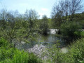
 Moderate