Country:
 City:
City:


Car park on Chemin du Cras Rougeot, opposite the greenhouses, at the start of the “Les sentiers de Chaudane et de Rosemont” walks. You can also start from the car park on Chemin Sous les Vignes in Rognon. Marked with a yellow line.
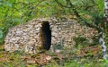
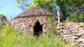
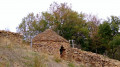
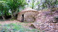
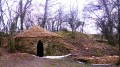
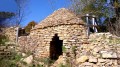
(S/E) Take the path to the left of the signpost, which climbs up the hillside. You will soon reach the pretty little Combe des Œillets with its pond and the first renovated caborde on the right.
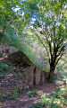
(1) Continue along the path to the right of the caborde, which climbs between piles of stone gathered from fields to reach the second one, situated a little higher up. There’s a bench here for a short break, offering views of the upper Doubs valley. Return to the signpost and the pond via the path that runs above the roof of the first caborde and cross the small clearing at Combe des Œillets (towards Fort de Rosemont), heading for the gate in the dry-stone wall, with views to the right over Chaudanne and Montfaucon. At the staircase with a handrail attached to metal posts, ignore the small path leading down to the right and continue climbing the steps. You’ll reach a stony track; take this to the left until you reach the first nearby hairpin bend.
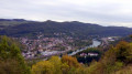
(2) Take the stony path to the left, heading towards La Malcombe, quickly leaving behind a track that climbs to the right towards the cliffs. At the fork in the paths, about fifty metres before reaching the viewpoint over Planoise (do not go there; you’ll come across it later), climb to the right, despite the Yellow Cross. You’ll pass through boxwood trees that are recovering after a moth infestation. Once you’ve left the boxwood behind, carefully follow the beautiful ledge to the bench for a short rest after this steep climb and to enjoy a 180° view of the Besançon hills and the Jura mountains.
(3) Facing the bench, take the path on your left, passing the signpost, towards Velotte. The path widens. Ignore a path leading down to the left and continue to a new signpost marking a crossroads. Head down to the left and stay on this wide, stony path. You’ll come to the hairpin bend again.
(2) Continue down to the viewpoint overlooking the new town of Planoise.
(4) Continue downwards, soon passing a path on your left (at signpost 46). A little further down, at signpost 46b, take the path that veers sharply to the left and leads to the car park on the Chemin Sous les Vignes de Rognon (towards Saint-Ferjeux). At the tarmac car park (fire hydrant), continue to the left. At the nearby fork, head down to the right, staying on this track with patches of tarmac. At the ‘Passage du Coyotte’ sign, with the Véloroute in sight, stay on this track to exit the woods and follow the poplar hedge.
(5) You’ll come out onto the Chemin de Chamuse, which you’ll take to the left to return to the car park. (S/E).

 Visorando Member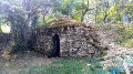

 Moderate