Country:
 City:
City:


Car park on Chemin du Cras Rougeot, opposite the greenhouses, at the start of the ‘Les sentiers de Chaudane et de Rosemont’ walks. Yellow-blue signposting.
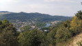
(S/E) Return to the tarmac road and follow it to the right as far as the first house. At signpost no. 47, climb the hillside via the path on the right, towards Rosemont (the second path starts between the signpost and the electricity pole). After a few log steps, you’ll reach a wider stony track; take this to the right to discover, fifty metres further on, the viewpoint overlooking the new town of Planoise and the Doubs valley to the south.
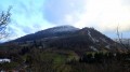
(1) Leave the stony track and take the path leading off to the left (facing the view) into the woods. At the fork, thirty paces further on, climb steeply to the left. You’ll pass through boxwood trees that are recovering after an attack by the box tree moth. As you emerge from the boxwood, you’ll reach the dry grasslands; turn round to enjoy a beautiful view of Planoise and, to the left, the Doubs Valley. Carefully follow the beautiful ledge, taking the path on the right to the bench, where you can rest a little after this steep climb and take in a 180° view of the Besançon hills and the Jura mountains.
(2) Take a look at the remains of Fort du Rosemont by taking the path that climbs between the trail marker and the bench for a round trip. Then return to the bench.
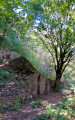
(2) Carefully descend to the left (facing the viewpoint) and continue, still taking care, to the right beneath the overhangs for a return trip to a small cave, passing two paths on your left (NB). At the cave, turn back, leave the first path and descend very, very carefully to the right along the second, stony path. Caution! This short section is quite technical and requires sure-footedness. Thirty metres further down, the track veers to the left and joins a more clearly marked path, which you follow to the left.
You’ll come to a stony path at a hairpin bend. Head down to the right for about a hundred metres and, at the signpost, take the log staircase leading down to the right towards the Combe de l’Œillet (towards Velotte). At the foot of the steps, continue down to the right at the fork. Cross the pasture to the pond. Head left for about twenty paces.
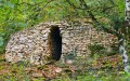
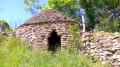
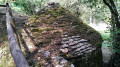
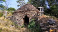
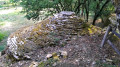
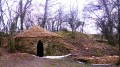
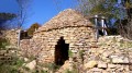
(3) At the signpost, look out for the first ‘caborde’ in the open area on your right. Return to the signpost and head up to the right towards the Roche d’Or. Pass in front of another restored ‘caborde’ (there’s a small staircase to visit it), then the remains of a third.
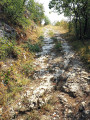
About a hundred metres further down, at the fork in the paths (signposted ‘Collines de Besançon’), carefully descend to the left over scree. Watch out for stones that may roll under your feet! The path is difficult and stony, but follows a picturesque ridge with lovely views. The descent, which has been fitted with steps, must be tackled with care.
When the path veers slightly to the left and you are facing the buildings at La Roche d’Or, look out for a cairn on your right-hand side marking a small track that branches off to the right. Remember to add a small stone to the cairn.
(4) Take the path on the right, soon passing the remains of piles of stone gathered from fields (murgers) and rejoining a well-defined path which you follow down to the left until you reach the junction of two murgers.
(5) Turn sharp right at the fork. You’ll join a wider track (signpost no. 33d); then head down to the left towards La Malcombe to return to the starting point (S/E).
 Visorando Member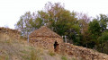

 Moderate