Starting from La Guisane

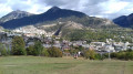
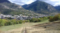
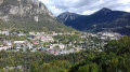
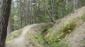
A short walk in the shade for three-quarters of the route. This walk is only possible when there is no snow, as the ski run is off-limits to walkers
30/10/2023: the start of the walk has been changed to avoid private property.

Details

1524701
Creation:
Last update:
Last review:
  • Walking
    Activity: Walking
  • ↔
    Distance: 3.37 mi
  • ◔
    Average duration: 2h 20 
  • ▲
    Difficulty: Easy

  • ⚐
    Back to start: Yes
  • ↗
    Ascent: + 938 ft
  • ↘
    Descent: - 938 ft

  • ▲
    Highest point: 4,806 ft
  • ▼
    Lowest point: 3,950 ft

Photos

Description of the walk

Park in the Bricorama car park in Briançon.

(S/E) On leaving the car park, turn right and you’ll very quickly come to a pedestrian crossing.

(1) Follow the path on the right for 20 metres, then turn left, pass under the RN and follow the Guisane river.

(2) Take the steps on your left to go up to the bridge crossing the Guisane. Cross this bridge, then, 30 metres further on, you’ll come to another set of steps on the left.

(3) Take these steps, which lead you to the foot of the Prorel, then cross the RN via another bridge that takes you onto a path. Follow this path as it heads left and runs alongside the RN until you reach a junction with another path.

(4) Turn right and you’ll reach the foot of the Vauban ski run.

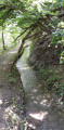
(5) There, you’ll come to a snow-making system container with a green lid. Turn right and follow the path running alongside the Canal des Queyrelles for about 700 metres.

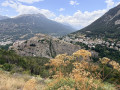
(6) At Le Chabas, turn left, passing by the viewpoint. A 30 per cent gradient awaits you for just over 150 metres. Once at the top, head right and follow the Canal Neuf until you reach the concrete structure.

(7) There, turn left and follow the path that climbs alongside the fence to join the track at the end.

(8) Turn left, heading south.

(9) Continue along the stony path to reach the ski run; head down it to return to the foot of the Vauban run.

(5) Take the same route back to the point at (S/E).

Waypoints

  1. S/E : mi 0 - alt. 3,986 ft - Bricorama car park
  2. 1 : mi 0.03 - alt. 3,980 ft - Pedestrian crossing
  3. 2 : mi 0.23 - alt. 3,950 ft - Stairs leading to the bridge
  4. 3 : mi 0.25 - alt. 3,950 ft - Stairs to Le Prorel
  5. 4 : mi 0.37 - alt. 4,022 ft - Path junction
  6. 5 : mi 0.57 - alt. 4,219 ft - Snow cannon system container
  7. 6 : mi 1.02 - alt. 4,232 ft - Viewpoint
  8. 7 : mi 1.5 - alt. 4,442 ft - Concrete structure
  9. 8 : mi 1.76 - alt. 4,806 ft - Path junction, turn left
  10. 9 : mi 2.48 - alt. 4,518 ft - Stony path
  11. S/E : mi 3.37 - alt. 3,983 ft - Car park at the Guisane block of flats

Reviews and comments

4.3 / 5
Based on 2 reviews

Reliability of the description
4.5 / 5
Ease of following the route
4 / 5
Route interest
4.5 / 5
domsail
domsail

Overall rating : 4 / 5

Date of your route : Jun 27, 2024
Reliability of the description : ★★★★☆ Good
Ease of following the route : ★★★★☆ Good
Route interest : ★★★★☆ Good
Very busy route : No

A bit of a rough start, at the foot of the Prorel
Then a pleasant route between the Old Canal and the New Canal

Machine-translated

Helene102
Helene102
• Edited:

Overall rating : 4.7 / 5

Date of your route : Apr 15, 2024
Reliability of the description : ★★★★★ Very good
Ease of following the route : ★★★★☆ Good
Route interest : ★★★★★ Very good
Very busy route : No

We had a bit of trouble finding the entrance to the footbridge over the RN, but otherwise the directions are very clear.
An easy walk overlooking Briançon. Suitable from mid-April.
To return to the start, after point 5, make sure you follow the marked route carefully. We tried taking a shortcut along the path on the left, which led us onto private property!

Machine-translated

Other walks in the area

For more walks, use our search engine .

The GPS track and description are the property of this route's author. Please do not copy them without permission.