Fort de Pugey Circular Route

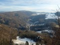
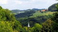
A lovely family walk along the ridge overlooking the village of Pugey, passing by the Fort de Pugey. The route runs partly through woodland and across meadows, offering beautiful views of the lower Jura plateaus and the Franco-Swiss mountain range on a clear day. Nature lovers will be able to spot numerous plant species typical of the limestone hills around Besançon.

Details

5198597
Creation:
Last update:
Last review:
  • Walking
    Activity: Walking
  • ↔
    Distance: 2.29 mi
  • ◔
    Average duration: 1h 20 
  • ▲
    Difficulty: Easy

  • ⚐
    Back to start: Yes
  • ↗
    Ascent: + 361 ft
  • ↘
    Descent: - 367 ft

  • ▲
    Highest point: 1,598 ft
  • ▼
    Lowest point: 1,220 ft
  • ⚐ Country: France
  • ⚐ City: Pugey (25720)
  • ⚑
    Start/End: N 47.184401° / E 5.990979°
  • ❏
    IGN map(s): Ref. 3323ET
  • Hour-by-hour weather

Photos

Description of the walk

Park in front of the town hall in the village of Pugey, where there are several parking spaces available; alternatively, you can park in the market hall car park at the entrance to the village and walk to the town hall.

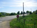
(S/E) Turn right onto Rue de la Maltournée (D142) and head up to the edge of the village. Continue through a stretch of
 through the woodland, you’ll come to a bend.

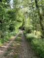
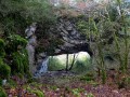
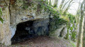
(1) Take thefirst path on the left, heading towards the fort. Continue along this path through the woodland to the end to reach Fort de Pugey, which is unique in that it is buried.

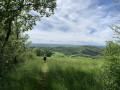
(2) Then walk to the right of the fort, where you’ll see the front moat, heading towards a large rectangular stone lying across the path. You’ll emerge into a field where, on a clear day, you’ll have a view of the first plateaus of the Jura and the Franco-Swiss mountain range.
Then turn left and follow the edge of the field until you reach a small forest track branching off to the left. Once you’ve passed through the woodland, continue along the track that runs along the ridge. Head back down, keeping to the edge of the field. You’ll reach the junction with the Route de Levier.

(3) Here you’ll find a gap in the fence made from pallets. Turn left to reach the village of Pugey. After passing the first few houses, you’ll see the village’s old wash house on your left.
Cross the bridge and pass thefirst junction on the left, then turn left at thesecond junction to head back up to the village centre.
Carry on straight ahead to the town hall, or turn right to return to the market hall car park (S/E).

Waypoints

  1. S/E : mi 0 - alt. 1,266 ft - Pugey Town Hall
  2. 1 : mi 0.61 - alt. 1,457 ft - Chemin du Fort
  3. 2 : mi 1.13 - alt. 1,591 ft - Viewpoint over the Haut Doubs plateaus
  4. 3 : mi 1.85 - alt. 1,220 ft - Junction with the Levier road
  5. S/E : mi 2.29 - alt. 1,263 ft - Pugey Town Hall

Notes

Part of the walk takes you along the edge of meadows, with a few barbed-wire crossings that are more or less well-maintained and therefore pose no difficulty. The farmers allow access provided you respect their crops, meadows and livestock. Please do stick to the path along the edge of the fields and close any gates behind you where there are any, and there won’t be any problems!

Worth a visit

Pugey Fort is open to visitors during Heritage Days and on Saturdays; otherwise, you can take a virtual tour on the local council’s website.

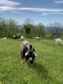
Between (2) and (3), take a short break near the statue of the Virgin Mary to admire the view; plant enthusiasts will be able to spot several species typical of limestone grasslands. Others will no doubt see the Montbéliarde cattle grazing peacefully in the meadow – they’re very friendly.
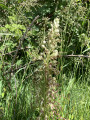
For plant enthusiasts, consult the regional inventory; you’ll be able to spot many species typical of the Besançon hills, and if you look closely, you’ll see a clump of Goat’s-beard Orchid. Above all, don’t tread on it or pick it – as its name suggests, this flower has the distinctive feature of smelling of a goat.

Reviews and comments

4.8 / 5
Based on 2 reviews

Reliability of the description
5 / 5
Ease of following the route
5 / 5
Route interest
4.5 / 5
antoine0104
antoine0104

Overall rating : 4.7 / 5

Date of your route : Sep 01, 2021
Reliability of the description : ★★★★★ Very good
Ease of following the route : ★★★★★ Very good
Route interest : ★★★★☆ Good
Very busy route : No

A very well-signposted route, a pleasant walk offering beautiful and varied scenery.
I was lucky enough to come across a goat farm near Fort de Pugey.
However, the field that follows looks to me as though it’s private, as it’s surrounded by barbed wire. That doesn’t stop you from crossing it, but it’s worth bearing in mind.

Machine-translated

46497477
46497477

Overall rating : 5 / 5

Date of your route : Aug 23, 2021
Reliability of the description : ★★★★★ Very good
Ease of following the route : ★★★★★ Very good
Route interest : ★★★★★ Very good
Very busy route : No

Hello,
this route is both very pleasant and great fun,
After a short climb from Arguel, this well-marked and shaded path is very accessible to everyone.
I wish everyone planning to do this walk a lovely time – I highly recommend it, particularly the section at the fort, which is very well explained.
Pierre

Machine-translated

Other walks in the area

For more walks, use our search engine .

The GPS track and description are the property of this route's author. Please do not copy them without permission.