The Fort de la Grande Maye with descent via Pied Sec and Le Mélezin

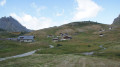
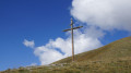
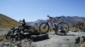
A fantastic route above Briançon with remarkable views from the Fort de la Croix de Bretagne and the Fort de la Grande Maye. Rolling climbs alternate with technical descents, notably the ‘Pied Sec’ descent, which features a very difficult section. The Mélezin descent is one of the most beautiful in the Briançon area, with its magnificent winding trail.

Details

n°17171740
Creation:
Last update:
Last review:
  • Mountain biking
    Activity: Mountain biking
  • ↔
    Distance: 19.16 mi
  • ◔
    Duration according to the author: 5 hrs 
  • ▲
    Difficulty: Difficult

  • ⚐
    Back to start: Yes
  • ↗
    Ascent: + 5,089 ft
  • ↘
    Descent: - 5,072 ft

  • ▲
    Highest point: 7,887 ft
  • ▼
    Lowest point: 3,881 ft
  • ⚐ Country: France
  • ⚐
  • ⚐ City: Briançon (05100)
  • ⚑
    Start/End: N 44.880743° / E 6.621936°
  • ❏
    IGN map(s): Ref. 3536OT, 3536OTR

  • ◶
    Type of surface:
  •  
     
     
    ■ 33% Road ■ 34% Byway ■ 33% Path
  • ⇧
    Bike carrying: No
  • ▲
    Difficulty: Difficult
  • Hour-by-hour weather

Photos

Description of the route

From the exit of Briançon (lower town), at the traffic lights, follow signs for Gap. 1.8 km further on, turn left (signposted ‘ZA sud’ and ‘Villard-Saint-Pancrace’), cross the bridge over the Durance and park near the roundabout.

(S/E) With your back to the Durance, at the roundabout, turn immediately right towards Villard-Saint-Pancrace. In the centre of the village, take the steeply ascending street in front of the church (dating from 1542: a listed historic monument). You’ll reach the Route des Espagnols.

(1) Follow it to the left for 400 m, then turn right onto Rue du Mélezin (signposted ‘Centre Montagne’). Ignore a turn-off to the left and continue to the next junction. Turn right onto Rue de la Croix (another ‘Centre Montagne’ sign). At the top of this street, turn left (signposted ‘Maison d’enfants la Guisane’). Follow this tarmac road to the end (you’ll be looking down on Briançon) and you’ll reach the children’s home car park at the end.

(2) Ahead of you, the road turns into a forest track; follow it for 450 m.

(3) At the junction, take the track on the right at an acute angle (an old sign reads ‘military road – no entry’). Follow this very stony track for 6.2 km to the Fort de la Croix de Bretagne.

(4) After visiting the fort (you can walk right up to the top), continue along the track for about 700 m and look out for the start of a track on the right.

(5) Continue left, uphill along the road, until you reach a fork almost at the summit.

(6) Turn left and you’ll reach the other fort.

(7) Fort de la Grande Maye is the highest point of the walk. From there, after taking in the view, head back down to the previous junction.

(6) Turn right to head back down (the road continuing left for 1.7 km is a dead end) and reach the junction marked after Fort de la Croix de Bretagne.

(5) Take the hairpin bend, follow the narrow track and head for ‘Pied Sec’ (summer sheepfolds).

(8) From the sheepfolds, follow the single track down towards the Torrent des Ayes. It is at times very steep, with tricky hairpin bends, rocky steps and a ravine that can be quite daunting. Caution! Part of this descent is rated ‘very difficult’ and the drop-off is very exposed; it’s best for non-experts to walk this section (especially on an e-MTB, which is very handy on the climb but quite heavy and much clumsier on the descent). Once you reach the bottom of the Pied Sec ravine,

(9) Cross the wooden bridge and follow the path back up to the tarmac road to Les Ayes.

(10) Take the tarmac road to the left and head up to the hamlet of Les Ayes (fountain).

(11) Continue for 400 m from the village exit along the tarmac road,

(12) Take thefirst forest track on the right and, after 3.2 km, you’ll reach the hamlet of ‘Mélezin’.

(13) Once you reach the hamlet (at the fountain), follow the path to the right which descends towards the houses at the bottom. This becomes a single track that winds its way down through the forest; at the start, just past the houses, it is very narrow and steep with steps, but once you’ve passed this section, it’s pure joy – a real treat. After 1.3 km, cross a track and reach a road.

(14) Cross it and continue to a forest track. Turn right for 70 m and reach the hamlet known as ‘Le Lauzin’.

(15) Then carry on along the single track which descends for 400 metres to a fork.

(16) Turn left and join the Les Ayes forest track. You can also carry on straight ahead; the single track is a little easier and shorter than the left-hand fork. Slow down properly! There is a rainwater drainage channel at the junction of the single track and the forest track, which can be treacherous if you’re going too fast.

(17) Ride down the road, which becomes tarmac, to Villard-Saint-Pancrace.

(18) At the end of the road, turn left (it’s a slight climb) onto Rue de l’Olivier, then take thefirst right (it goes downhill and is still Rue de l’Olivier) and reach the next junction a few metres further on.

(19) Turn left; this is a steep descent (tarmac) along Rue des Pierres Rouges, and rejoin the route you took on the way there at the bottom of the street.

(1) Cross Route des Espagnols to go down Rue de l’Église, then Rue de la Maisonnette, and arrive at the ZA Sud industrial estate in Briançon and the roundabout (S/E).

Waypoints

  1. S/E : mi 0 - alt. 3,881 ft - Roundabout at the industrial estate - La Durance
  2. 1 : mi 0.7 - alt. 4,078 ft - Route des Espagnols
  3. 2 : mi 1.77 - alt. 4,334 ft - Children’s home car park and start of the trail
  4. 3 : mi 2 - alt. 4,449 ft - Junction towards the Croix de Bretagne
  5. 4 : mi 5.68 - alt. 6,447 ft - Entrance to the Fort de la Croix de Bretagne
  6. 5 : mi 6.19 - alt. 6,486 ft - Junction: Pied Sec – Fort de la Grande Maye
  7. 6 : mi 8.83 - alt. 7,844 ft - Turn-off towards Fort de la Grande Maye
  8. 7 : mi 9.09 - alt. 7,887 ft - Fort de la Grande Maye
  9. 8 : mi 12.21 - alt. 6,476 ft - Summer sheepfolds
  10. 9 : mi 13.23 - alt. 5,377 ft - At the bottom of Pied Sec (bridge)
  11. 10 : mi 13.28 - alt. 5,374 ft - Junction: Villard – Les Ayes
  12. 11 : mi 14.08 - alt. 5,659 ft - Les Ayes (fountain)
  13. 12 : mi 14.4 - alt. 5,794 ft - Start of the path towards Le Mélezin
  14. 13 : mi 16.42 - alt. 6,168 ft - Le Mélezin: start of the downhill single track
  15. 14 : mi 17.31 - alt. 5,105 ft - Crossing the tarmac road
  16. 15 : mi 17.49 - alt. 4,885 ft - Le Lauzin: start of the downhill single track
  17. 16 : mi 17.7 - alt. 4,629 ft - Junction
  18. 17 : mi 17.8 - alt. 4,485 ft - The tarmac road at Les Ayes
  19. 18 : mi 18.22 - alt. 4,222 ft - Junction, Rue de l’Olivier
  20. 19 : mi 18.29 - alt. 4,199 ft - Rue des Pierres Rouges
  21. S/E : mi 19.16 - alt. 3,881 ft - Roundabout at the industrial estate - La Durance

Notes

Alternative route:
(10) You can return directly to Villard-Saint-Pancrace by taking the road on the right that leads downhill.

Best time of year for this ride: once the snow has cleared, generally from June to September, and sometimes in May, October or November. It all depends on the snow.

On an electric mountain bike: feasible with a 500 W battery.

Fountains at Les Ayes and Le Mélezin.

In spring, the road leading up to Le Mélezin from Les Ayes is often dry, except for one spot where an avalanche occurs every winter; over a 50-metre stretch, the road is covered by a snowdrift that you’ll often have to walk past.

Take care on the ‘Pied Sec’ descent; part of it may be classified as ‘Very difficult’, and even the slightest fall is particularly exposed, so if you have the slightest doubt about your ability, it’s best to dismount and walk for 5 minutes alongside your bike.

In the height of summer, there are very often walkers on the singletrack; please be careful and friendly. Pulling over to the side of the track to let walkers pass doesn’t cost us much, and it’s often a chance to have a chat with them.

Worth a visit

During the ride: magnificent views from the two forts.
And a visit to the forts, of course.

Reviews and comments

4.7 / 5
Based on 1 review

Reliability of the description
5 / 5
Ease of following the route
5 / 5
Route interest
4 / 5
Chris3084
Chris3084

Overall rating : 4.7 / 5

Date of your route : Jun 11, 2022
Reliability of the description : ★★★★★ Very good
Ease of following the route : ★★★★★ Very good
Route interest : ★★★★☆ Good
Very busy route : No

Hello,
I have a few comments about this walk (which I’d already done on foot about five years ago).
The path is indeed very stony and can be rather unpleasant at times, as you have to concentrate so hard on where you’re going, particularly on the descent.
Otherwise, the route is peaceful; I only came across two hikers on the whole route! (Admittedly, it was a Friday during the week).
I’d like to point out that the descent via Pied Sec is strongly discouraged, especially on an e-MTB: there’s a high risk of falling and being swept away by the slope (along with your bike!). For my part, I did the round trip via the same route.
At the summit, it’s worth continuing along the ridge path to the southern end, where a viewing point built by the military offers a superb 360° view (at an altitude of around 2,550 metres). Once again, it is not possible to reach this viewing point entirely by bike, so you’ll need to continue on foot, taking great care not to slip on the scree. I chose to head to the fort after reaching the viewing point, as the access track is situated higher up along this ridge path.

Machine-translated

Other walks in the area

For more walks, use our search engine .

The GPS track and description are the property of this route's author. Please do not copy them without permission.