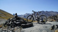
Lake Néal

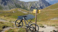
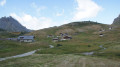
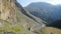
A lovely ride, taking in the Clapeyto chalets, mountain lakes and superb views of the surrounding peaks.

Details

16594657
Creation:
Last update:
Last review:
  • Mountain biking
    Activity: Mountain biking
  • ↔
    Distance: 9.00 mi
  • ◔
    Duration according to the author: 2 hrs 
  • ▲
    Difficulty: Moderate

  • ⚐
    Back to start: Yes
  • ↗
    Ascent: + 2,556 ft
  • ↘
    Descent: - 2,536 ft

  • ▲
    Highest point: 8,337 ft
  • ▼
    Lowest point: 5,919 ft
  • ⚐ Country: France
  • ⚐
  • ⚐ City: Arvieux (05350)
  • ⚑
    Start/End: N 44.794767° / E 6.724895°
  • ❏
    IGN map(s): Ref. 3536OT, 3536OTR, 3537ET, 3537ETR

  • ◶
    Type of surface:
  •  
     
     
     33% Road  34% Byway  33% Path
  • ⇧
    Bike carrying: No
  • ▲
    Difficulty: Difficult
  • Hour-by-hour weather

Photos

Description of the route

To reach the start point, at the entrance to the village of Brunissart as you head up towards the Col de l’Izoard, take the road on the left, Route des Ayes. Follow this road alongside the stream, then fords it and head to the Jamberoute car park.

(S/E) From the car park (Le Jamberoute restaurant), continue along the road towards the Chalets de Clapeyto. This becomes a track.

(1) At the point where the track enters the scree, look out for the start ofthe GR®® on the left. However, continue along the track as far as the Chalets de Clapeyto.

(2) At the end of the track, by the last chalets, follow the path that continues on. Pass the Lacs du Cogour and the Lacs Marion.

(3) Ignore the path branching off to the right towards Lac de Néal; continue straight ahead, pass the Col de Néal and reach a fork in the path.

(4) Take the path on the left. The first 60 metres or so are very steep and on a slope. It is advisable to walk this section. Afterwards, the track is narrow but easily passable. Descend to the Chalets du Collet.

(5) Leave them on your left and take the path on the right. Join the track you took on the way up and follow it to the right until you reach the start ofthe GR®® marked on the ascent.

(1) Take this on the right and head towards a car park. Continue to follow theGR®® which starts to the right of the track, then rejoin the track. A little further down, take another path on the right (GR®®) and arrive at the Jamberoute car park (S/E).

Waypoints

  1. S/E : mi 0 - alt. 5,925 ft - Jamberoute car park
  2. 1 : mi 1.57 - alt. 6,654 ft - Start of the return trail
  3. 2 : mi 2.95 - alt. 7,316 ft - Clapeyto Chalets
  4. 3 : mi 2.98 - alt. 7,352 ft - Clapeyto Chalets
  5. 4 : mi 4.71 - alt. 8,251 ft - Junction - Lac de Néal
  6. 5 : mi 5.08 - alt. 8,333 ft - Junction
  7. 6 : mi 5.76 - alt. 7,707 ft - Junction
  8. 7 : mi 6.68 - alt. 7,231 ft - Chalets du Small Pass
  9. 8 : mi 6.79 - alt. 7,156 ft - Junction
  10. 9 : mi 7.45 - alt. 6,709 ft - Follow the Pisre on the right
  11. 10 : mi 7.55 - alt. 6,647 ft - junction
  12. S/E : mi 9 - alt. 5,925 ft - Jamberoute car park

Notes

E-MTB route.

The duration refers to the time spent riding.
From (2) to the Gogour Lakes, there are a few sections where you’ll have to push your bike, but nothing insurmountable.
For conventional mountain bikes, expect long stretches of pushing.

Always be cautious and plan ahead when you're outdoors. Visorando and the author of this route cannot be held responsible for any accidents occurring on this route.

The GR® and PR® markings are the intellectual property of the Fédération Française de Randonnée Pédestre.

Reviews and comments

5 / 5
Based on 1 review

Reliability of the description
5 / 5
Ease of following the route
5 / 5
Route interest
5 / 5
User 30311270

I went to the Clapeyto chalets, not to Lake Neal

Machine-translated

Boule2023
Boule2023

Overall rating : 5 / 5

Date of your route : Sep 08, 2025
Reliability of the description : ★★★★★ Very good
Ease of following the route : ★★★★★ Very good
Route interest : ★★★★★ Very good
Very busy route : Yes

A beautiful and enjoyable hike.
We climbed up the white path and returned via Selle Vieille (the return via Bois Bernard was marked red due to a landslide). At Neal Pass, there was a beautiful view of Neal Lake with a huge herd of sheep and Patous (some hikers will remember this due to marks on their calves). We continued on to the Lauzon Pass and even to the Col de Givre (a narrow, sloping path).

Machine-translated

Other walks in the area

For more walks, use our search engine .

The GPS track and description are the property of this route's author. Please do not copy them without permission.