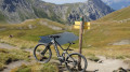
Pic de Château Renard – Col du Longet

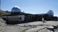
A high-mountain ride taking in Saint-Véran, the highest inhabited village in Europe. A beautiful climb up to the Pic de Château Renard observatory, with magnificent views. To finish, a lovely technical descent from the Col du Longet.

Details

11904463
Creation:
Last update:
Last review:
  • Mountain biking
    Activity: Mountain biking
  • ↔
    Distance: 15.46 mi
  • ◔
    Duration according to the author: 2.5 hrs 
  • ▲
    Difficulty: Difficult

  • ⚐
    Back to start: Yes
  • ↗
    Ascent: + 3,573 ft
  • ↘
    Descent: - 3,570 ft

  • ▲
    Highest point: 9,646 ft
  • ▼
    Lowest point: 6,342 ft
  • ⚐ Country: France
  • ⚐
  • ⚐ City: Molines-en-Queyras (05350)
  • ⚑
    Start/End: N 44.718861° / E 6.903557°
  • ❏
    IGN map(s): Ref. 3637OT, 3637OTR

  • ◶
    Type of surface:
  •  
     
     
     33% Road  34% Byway  33% Path
  • ⇧
    Bike carrying: No
  • ▲
    Difficulty: Difficult
  • Hour-by-hour weather

Photos

Description of the route

Access: From Ville Vieille, follow the D5 towards Moilines-en-Queyras, then turn left onto the D205 towards the Col Agnel. Pass through Pierre Grosse and then Fongillarde, and park on the right at the Pont de Larianne car park.

(S/E) From the car park, cross the bridge and take the track on the right. Continue straight on until you reach a road.

(1) Follow this road to the left, pass the Chalet des Amoureux, and you’ll arrive at the entrance to the village of Saint-Véran.

(2) Take the upper street, which passes a wayside shrine a few metres further on, and carry on straight ahead until you reach a car park on the outskirts of the village at the Rif de Sainte-Luce.

(3) Follow the track which climbs to the left and, ignoring the side paths on either side, head towards another small car park.

(4) Just before this, take the track on the left which leads to the Pic de Château Renard Observatory. When you reach the left-hand bend, almost at the foot of a gravel pit, look out for a path on the right heading towards the Col du Longet.

(5) Continue left along the track until you reach the observatory.

(6) At the observatory, retrace your steps back to the path you spotted on the way up.

(5) Take the path on the left and head for the Col du Longet.

(7) Cross over to the other side of the valley and follow the path down to the Pont de l’Ariane (S/E).

Waypoints

  1. S/E : mi 0 - alt. 6,640 ft - Pont de Lariane car park - Aigue Agelle (rivière) - Affluent du Guil
  2. 1 : mi 2.29 - alt. 6,362 ft - Route
  3. 2 : mi 3.6 - alt. 6,637 ft - Saint-Véran
  4. 3 : mi 4.51 - alt. 6,588 ft - Car park
  5. 4 : mi 4.54 - alt. 6,608 ft - junction. Track
  6. 5 : mi 6.31 - alt. 7,326 ft - Small car park - Aigue blanche
  7. 6 : mi 9.06 - alt. 8,678 ft - A/R junction
  8. 7 : mi 10.99 - alt. 9,646 ft - Pic de Château Renard Lookout Point - Pic de Château Renard
  9. 8 : mi 12.82 - alt. 8,684 ft - Junction
  10. 9 : mi 13.18 - alt. 8,845 ft - Col de Longet (2701m)
  11. 10 : mi 13.19 - alt. 8,845 ft - Col du Longet
  12. S/E : mi 15.46 - alt. 6,640 ft - Pont de Lariane

Notes

Route completed on an e-MTB.

The duration is the riding time.

Other walks in the area

For more walks, use our search engine .

The GPS track and description are the property of this route's author. Please do not copy them without permission.