Country:

 City:
City:


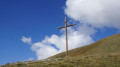
To reach the start, on leaving Arvieux towards Brunissard, look out for a wooden sign on the left marked ‘Parking des Randonneurs’. Follow this narrow road, Route de Furfande, which leads to the car park (campervan area).
(S/E) Follow the track, ignore a turn-off to the right, cross the bridge over the stream and, at the next junction, turn left. The track climbs through the woodland and reaches another junction.
(1) Turn right and head for the Col de Furfande, following the track.
(2) Cross over to the other side of the valley and walk about a hundred metres to the next junction.
(3) Turn right onto theGR®®541, heading towards Les Granges de Furfande.
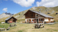
(4) At the Granges de Furfande chalets, take a sharp left onto the path. Follow it along the mountainside to reach the Refuge de Furfande.
(5) Carry on straight ahead, still along the mountainside, until you reach the Col de la Lauze.
(6) Take the path on the left, descend for about 600 metres and arrive at a junction.
(7) Continue along the path on the left, heading towards Le Queyron.
(8) At the Chalets du Queyron, carry on along the track (car park on your right). Walk for about 400 m until you find the start of a path on the left at the edge of a meadow.
(9) Follow this path (mountain bike marker no. 27) and carry on straight ahead until you rejoin the track you left earlier.
(10) Turn left (mountain bike marker no. 27). Continue along the mountainside, ignoring any side paths, until you come to the start of a path on the right 300 m after passing thesecond gully.
(11) Take this path to the right (mountain bike marker no. 27). Join the track you took at the start and walk a few metres to the right until you reach the hikers’ car park (start/finish).
 Visorando Member
 Very difficult
 Moderate