


 Country:

 City:


The start of the route is at the car park on the right, just after the bridge, on the road to Puy-Saint-Vincent.
(S) Follow the small path that leads to the campsite along the river.
(1) At the reception, carry on straight ahead, cross the campsite and continue along a dirt track for approximately 2.5 km.
(2) At the bridge, carry on straight ahead. The track climbs until you reach a fork. Ignore the track on the left and carry on straight ahead for 2.5 km.
(3) At the fork in the road just before the riding centre, follow the track on the right and the mountain bike signposts. Cross a road and follow the track for 500 metres until you reach a fork at the edge of the stream.
(4) Turn left and join the D504 road.
(5) Cross the Pont de Gérendoine on the right and follow the road for 300 metres.
(6) Turn right and follow the small road (marked ‘no entry’ with mountain bike signs) to the village of Vallouise.
(7) Turn right and head towards the bridge over the Gyr.
(8) Just after the bridge, turn left and follow the stream for 2.5 km.
(9) Continue to the left, cross the bridge and turn immediately right to reach the Pelvoux ski resort. Ride through the whole resort until you reach a junction just before a bridge on the right.
(10) Turn left and follow the small road leading to the Pelvoux campsite. Continue straight on for 500 metres.
(11) At the end of the road, turn left and follow a track that climbs, heading south-south-west. Do not cross the stream. Continue along the same path, which climbs steadily and crosses several ski runs. Continue for 4.5 km.
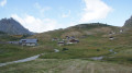
Towards the end, the track becomes very steep and finally opens out onto a grassy plateau. Follow the track for 2 km and, at the fork just before the ridge, turn left. The path descends and soon reaches the pretty little mountain village of Puy Aillaud.
(12) At the fork in the road at the entrance to the village, turn left to go round the village and follow the tarmac road for 1 km.
(13) After a sharp bend to the left, leave the road and follow a small path on the left for 600 metres to the Chapelle Saint-Jean.
(14) Follow the tarmac road to the left, which descends for 5 km to the hamlet of Le Villard.
(15) Turn right and follow the road for 2.5 km to a campsite.
(16) Leave the road and cross the stream via a wooden bridge.
(17) Turn left immediately and follow the Onde for 3 km until you reach a bridge.
(18) Cross the stream, then turn right and continue for 1.5 km until you reach the D504 road.
Return to the starting point by following the same route in reverse as on the way there.


 Visorando Member
 Difficult


 Very difficult

