Le Falgoux – Le Claux

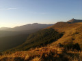
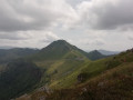
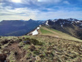
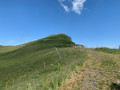
A very beautiful (and fairly short) stage, partly along the ridge with views of Puy Mary. A magnificent basalt plateau from Le Luchard onwards.
The route leads to the Puy Mary lodge, about 1.5 km beyond the village.

This walk is part of a multi-day hike: Tour du volcan Cantalien par le GR®400 dans le sens horaire

Details

1937046
Creation:
Last update:
Last review:
  • Walking
    Activity: Walking
  • ↔
    Distance: 8.28 mi
  • ◔
    Average duration: 5h 50 
  • ▲
    Difficulty: Moderate

  • ⚐
    Back to start: No
  • ↗
    Ascent: + 2,333 ft
  • ↘
    Descent: - 1,729 ft

  • ▲
    Highest point: 5,082 ft
  • ▼
    Lowest point: 3,009 ft

Photos

Description of the walk

(S) From the centre of Le Falgoux, follow the main road towards Puy Mary. Continue to the Le Cher Soubro neighbourhood.

(1) Leave the road and turn left onto theGR®, heading towards the Ferme du Coin. Continue up a steep, zigzagging climb. Pass aPR® route on your right, then on your left. Continue due north, then head east to join a wider track. Zigzag until you reach the Luchard plateau.

(2) Follow theGR® trail to the right, passing a farm on the left, walk past a spring and go round the Rocher de l’Aygue on a gentle climb. Reach the Pas Rouge.

(3) Here you have two options:
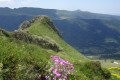
- you can climb up the ridge to the left via well-marked paths to reach the Knoll Gros, which offers magnificent views. Take the southern ridge to reach the junction where the two branches ofthe GR® meet at the fork towards Les Claux.
- Stay on theGR® to reach this same junction.

(4) Take the left-hand branch. First, head down the hillside; then, a right-hand bend allows you to continue the descent towards the ruins of Ricou la Mouche. Turn 90° to the left and continue downhill, entering the woodland below. Cross a stream, take a track to the left, then another to the right and again to the right, continuing downhill. Follow this track, ignoring the offshoots to the right and left (generally speaking, head straight on until you reach the cross-country ski car park and a tarmac road at Les Chaumilloux.

(5) Continue along this road. Pass the houses at Lascourt and arrive at the Y-junction, marked by a cross.

(6) Turn right and walk round the Étang de Lascourt. You’ll reach aGR® signpost on the other side of the pond. Begin the descent through the woods, turning right and then left to enter the village. Take the road (D62) on the left and head towards the centre of the village of Les Claux, where you’ll find a bar.

(7) Turn right onto the road that crosses the small valley, then head uphill on the opposite side. Ignore the roads to the right and left as you climb, and make your way to today’s stopover lodge in the hamlet of Lavialle (E).

Waypoints

  1. S : mi 0 - alt. 3,009 ft - Le Falgoux
  2. 1 : mi 0.53 - alt. 3,077 ft - The Cher Soubro
  3. 2 : mi 2.22 - alt. 4,764 ft - Luchard Plateau
  4. 3 : mi 3.81 - alt. 5,069 ft - Le Pas Rouge
  5. 4 : mi 4.35 - alt. 4,957 ft - Junction towards Les Claux
  6. 5 : mi 5.86 - alt. 3,983 ft - Cross-country skiing car park
  7. 6 : mi 6.62 - alt. 3,842 ft - Junction towards Étang de Lascourt
  8. 7 : mi 7.55 - alt. 3,402 ft - Le Claux. Valley of the - Petite Rhue (rivière)
  9. E : mi 8.28 - alt. 3,642 ft - Gîte du Puy Mary

Notes

Please note: the route shown on the map in this description does not correspond to what is found on the ground: theGR® goes round Étang de Lascourt, then follows a path that is not the one shown on the 1:25,000 map.
On the FFRP website, the route corresponds to the description above and the signposts on the ground, but is shown on a map background that is therefore incorrect in its representation of the route.

Worth a visit

Always be cautious and plan ahead when you're outdoors. Visorando and the author of this route cannot be held responsible for any accidents occurring on this route.

The GR® and PR® markings are the intellectual property of the Fédération Française de Randonnée Pédestre.

Reviews and comments

4.6 / 5
Based on 3 reviews

Reliability of the description
4.3 / 5
Ease of following the route
4.3 / 5
Route interest
5 / 5
celined77
celined77

Overall rating : 5 / 5

Date of your route : Aug 29, 2022
Reliability of the description : ★★★★★ Very good
Ease of following the route : ★★★★★ Very good
Route interest : ★★★★★ Very good
Very busy route : No

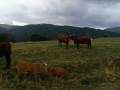
We set off from Caux towards Falgoux – the GR trail was well signposted in our view, with lovely pastures and a magnificent view over the ridges; it’s possible to make a quick detour (less than 2 hours) to Puy Mary and then return to head back down towards Falgoux (or Caux, depending on your starting point) (which is what we did) – the only downside was the descent over the stony path. We did the route in the opposite direction on the way back.

Machine-translated

danielrollet
danielrollet

Overall rating : 4.3 / 5

Date of your route : Jun 19, 2021
Reliability of the description : ★★★★☆ Good
Ease of following the route : ★★★★☆ Good
Route interest : ★★★★★ Very good
Very busy route : No

The stunning Luchard Plateau
A fairly short stage, but somewhat marred by signposting that was at times inadequate or poorly installed. Stopped for 1½ hours at the Café du Claux whilst waiting for the lodge to open (4.00 pm)
Fine weather
A few unclear sections, particularly at Cher Soubro, at the 1168 mark after Le Coin, at the entrance to the Luchard Plateau, and at the 1510 mark when descending to the other side.
But the biggest problem was on the alternative route via the Étang du Claux: scarce signposting and an impassable path, which forced us to take a detour across the meadow to reach the D62.
I would advise staying on the NNE road instead, until you find a path that descends SSE towards the Claux.

Machine-translated

bernardgemenos
bernardgemenos

Overall rating : 4.3 / 5

Date of your route : Jun 10, 2021
Reliability of the description : ★★★★☆ Good
Ease of following the route : ★★★★☆ Good
Route interest : ★★★★★ Very good
Very busy route : No

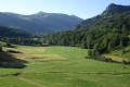
Taken in the opposite direction to the description, this fairly short and easy stage offers a very pleasant ridge walk and a lovely traverse across the pastures. The GR trail after Le Claux is sometimes difficult to find in the woods and meadows; the GPS was a great help to us.

Machine-translated

Other walks in the area

For more walks, use our search engine .

The GPS track and description are the property of this route's author. Please do not copy them without permission.