Country:

 City:


Car park at the bottom of the village.
(S/E) Walk up to the top of the village along the tarmac road. Turn right onto thefirst street on the right. Then turn right again onto the fairly steep path that climbs towards the forest, following the yellow markings.
(1) At the signpost for Pré Mottet, turn left towards Peyre Grosse along the narrow path which climbs gently with lovely little hairpin bends.
(2) At the junction with the forest track, carry on straight ahead along the path until it widens slightly, then continue on to Côtes Abrans.
(3) Ignore the forest track branching off to the right and left and carry on straight ahead through the forest.
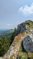
(4) At the signpost for Peyre Grosse, turn right to reach the Montagne de Dindaret. The slope rises steeply (over a fairly short stretch) to a cairn marking the summit.
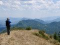
(5) Enjoy the view of Mont Ventoux. Turn back and return to the previous junction.
(4) Head south-east towards the Col des Praux along the ridges, following the yellow markings at all times (you’ll need to use your hands at one point to climb onto a rock, but it’s neither difficult nor dangerous).
(6) At the Col des Praux, take the track (GR®94) on the left towards Valdrôme (north).
(7) At the Praux junction, leave theGR®91track and follow theGR®94, which heads off opposite into the forest. The path climbs gently through pine trees and scree to the Col d’Arnin.
(8) Take the forest track straight ahead, heading north-east then north towards Combe Oursière.
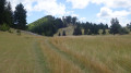
(9) At the signpost for Combe Oursière, leave the track and turn left towards Le Duffre along the narrow path that climbs through the woods, marked with yellow signs. The slope is quite steep at first but levels out afterwards until you reach the Pas de la Lauze. You’ll arrive at an open plateau.
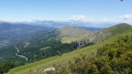
(10) Enjoy a beautiful view of the surrounding area and the ski lifts at the Valdrôme resort. Turn left towards La Pyramide (it’s a bit of a climb).
(11) At the summit of La Pyramide, marked by a cairn, head back down into the valley and then climb up towards Mont du Duffre (a fairly short descent and ascent).
(12) At the summit of the Duffre, the highest point of the walk, enjoy the exceptional 360° view (in clear weather, of course). Head west, then north-west, following the ridge and passing a magnificent little cross.
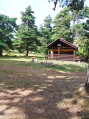
(13) When you reach the end of the ridge, follow a bend to the right to re-enter the forest, descending the nature trail to the Pré Pourri hut.
(14) At the Pré Pourri signpost, head down the nature trail, taking a sharp left-hand bend.
(15) At the junction with the forest track, carry on straight ahead along the path, then onto a wide track which narrows further on, until you reach a tarmac road (a fairly steep descent towards the end).
(16) At the junction with the road, turn right towards the village and make your way to the car park (S/E) via the narrow streets.

 Visorando Member
 Moderate