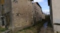
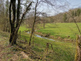
The north-eastern foot of Sion Hill, starting from Tantonville

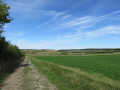
A circular walk through the lowlands and woods, below Sion Hill, passing through the villages of Tantonville, Forcelles Saint-Gorgon, Vroncourt and Praye. Throughout the walk, there are views of the bell tower of the Basilica of Sion.

Details

n°3326143
Creation:
Last update:
Last review:
  • Walking
    Activity: Walking
  • ↔
    Distance: 11.46 mi
  • ◔
    Average duration: 5h 35 
  • ▲
    Difficulty: Moderate

  • ⚐
    Back to start: Yes
  • ↗
    Ascent: + 322 ft
  • ↘
    Descent: - 331 ft

  • ▲
    Highest point: 1,115 ft
  • ▼
    Lowest point: 974 ft
  • ⚐ Country: France
  • ⚐ City: Tantonville (54116)
  • ⚑
    Start/End: N 48.470739° / E 6.140988°
  • Accessible from the train station Gare de Praye-sous-Vaudémont.
  • ❏
    IGN map(s): Ref. 3416O
  • Hour-by-hour weather

Photos

Description of the walk

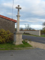
Park in Tantonville at the junction by the wayside cross where Rue de Nancy, Rue de la Gare, Rue Gambetta and Chemin du Moulin meet; parking is available in the car spaces.

(S/E) Head towards the village centre along Rue de Nancy and Rue de Tourtelles Frères (D913), passing the Town Hall, then the church square, heading towards Mirecourt.

(1) At a left-hand bend, take the small road on the right, Chemin de Forcelles, which turns into a track.

(2) Turn into thefirst track on the right. At the end of the track, turn left, then take a 90° bend.
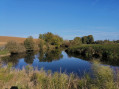
At the next junction, turn left onto the D904. Cross it carefully and carry on straight ahead, take the S-bend, then pass a small pond, follow the railway line and join a road.

(3) Turn right onto this road towards the village, cross the level crossing and continue along Rue de la Gare, passing the wayside cross and the church.

(4) At the end of this street, turn left onto the Grande Rue. Turn 90° and then right, continuing along the Route de Vroncourt. Carry on along this small road until you reach the village of Vroncourt.
At the end of Rue de Forcelles, turn left onto Grande Rue, pass the museum and reach a T-junction.

(5) Turn left onto Rue Saint-Joseph towards Chaouilley and take the first street on the left, before the wayside cross, Rue de Vignes, and carry on straight ahead.
At the end of the track, at the edge of the woods, turn left, then right, and enter the woods.

(6) Take thefirst path on the left, join a track, pass through a barrier to keep cars out and emerge onto a small road. Turn left onto it and continue along the road. Enter the woods again; these are the Han woods.

(7) Turn onto the path on the right, go through the vehicle barrier and carry on straight ahead, following the railway line, then continue along the track to reach Praye cemetery.
At the road, after the cemetery, turn left, cross the railway line and enter the village of Praye via Rue de Chaouilley. Head towards the church.

(8) Take thefirst street on the left, Rue du Docteur Breton, walk past the Town Hall and take the first street on the left towards Vèzelise; when you reach the junction with a wayside cross, continue to the right onto the Route de Vèzelise. Then take thefirst track on the right and continue straight on. At a Y-junction, carry on straight ahead, take a 90° bend and you’ll arrive at the orchard.

(9) Turn left, join a track, follow it to the right and cross the Ruisseau de Forêt. You’ll come out onto a small road; cross it and carry on until you reach the D904. Cross it carefully and you’ll soon reach the junction you passed on the way there.

(2) Follow the route back in the opposite direction to return to the Calvaire car park on Rue de Nancy (S/E).

Waypoints

  1. S/E : mi 0 - alt. 1,001 ft - Calvaire car park, Rue de Nancy - Gare de Tantonville Ligneville
  2. 1 : mi 0.38 - alt. 997 ft - Junction on a small road
  3. 2 : mi 0.7 - alt. 1,020 ft - Crossroads marking the end of the circular loop
  4. 3 : mi 2.19 - alt. 1,060 ft - Rue de la Gare
  5. 4 : mi 2.62 - alt. 1,056 ft - Grande Rue
  6. 5 : mi 3.96 - alt. 978 ft - Rue Saint-Joseph
  7. 6 : mi 5.15 - alt. 1,102 ft - Entering the woods
  8. 7 : mi 6.34 - alt. 1,086 ft - The Bois du Han
  9. 8 : mi 7.89 - alt. 1,004 ft - Rue de Vezelise
  10. 9 : mi 9.32 - alt. 1,056 ft - Orchard in Savoy
  11. S/E : mi 11.46 - alt. 1,001 ft - Calvaire car park, Rue de Nancy - Gare de Tantonville Ligneville

Worth a visit

Walk through the village of Tantonville, taking in the town hall, the church and the two castles
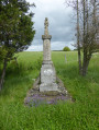
A visit to the village of Forcelles Saint Gorgon with its calvary and church
The village of Vroncourt and its museum
Walk beneath Sion Hill with a view of the Basilica’s bell tower
Walk along paths through the plains and woods
Walk past the mirabelle plum orchards

Reviews and comments

4.7 / 5
Based on 1 review

Reliability of the description
4 / 5
Ease of following the route
5 / 5
Route interest
5 / 5
sylvainchretien
sylvainchretien

Overall rating : 4.7 / 5

Date of your route : Jan 10, 2021
Reliability of the description : ★★★★☆ Good
Ease of following the route : ★★★★★ Very good
Route interest : ★★★★★ Very good
Very busy route : No

A lovely walk, quite well-marked from the start, but in the HAN woods I must have missed the first path, as the one I took led us a bit astray. We ended up reaching Praye via the road and were then able to get back on the right track. But it was a very pleasant stroll across the plains.
A bit of information I picked up from a local: the agricultural museum in Vroncourt is likely to close in 2021 as there’s no one to take it over. What a shame!

Machine-translated

Other walks in the area

For more walks, use our search engine .

The GPS track and description are the property of this route's author. Please do not copy them without permission.