Country:
 City:


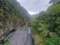
From Saint-Louis: Head towards Saint-Pierre via the N1. After crossing the Rivière Saint-Étienne, take the next exit onto the D26 towards l’Entre-Deux. At the roundabout, take the third exit, then the opposite exit at the next two roundabouts. After the third roundabout, take the first departmental road on the left. Continue to the end of the road, marked by a ‘Stop’ sign, then turn left towards Entre-Deux. Stay on the same road until you reach a sign on the left reading: ‘Confortement des berges de la Ravine du Bras Long’. Take the path that starts to the left of the sign. Park one vehicle here.
To reach the starting point, continue uphill along the same road until you reach the sign on the left indicating the access to the Coteau Sec and the Sentier Bayonne. Then follow the track to the start of the Sentier de Bayonne, which is signposted on the right just before the end of the track.
From Saint-Pierre: Head towards Saint-Louis via the N1. After crossing the Ravine des Cabris, take the next exit onto the D26. At the roundabout, take the first exit, then the second at the next one. Then take the first departmental road on the left. Continue to the end of the road, marked by a ‘Stop’ sign, then turn left towards L’Entre-Deux. Stay on the same road until you reach a sign on the left reading: ‘Confortement des berges de la Ravine du Bras Long’. Take the path that starts to the left of the sign. Park the first vehicle here.
To reach the starting point, continue uphill along the same road until you reach the sign on the left indicating the access to the Coteau Sec. Then follow the track to the start of the Sentier de Bayonne, which is signposted on the right just before the end of the track.
(S) Turn right (Nod) onto the Sentier de Bayonne. Turn left, then, about 150 metres further on, turn right. Continue northwards uphill.
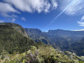
(1) You can turn back at any time! For us, this will be at the final hairpin bend before the path heads straight towards the Plateau Raisin – that is, after about 40 minutes’ walk one way. This gives you a first taste of the Sentier de Bayonne. On this section of the path, the gradient is already steep and makes itself felt right from the start! And to think that this is just a taster compared to the rest of the trail! If you’re already exhausted by the gradient and the difficulty of this section of the Bayonne Trail, don’t go any further, as it gets worse the further you go! However, the views along this section of the Bayonne Trail are stunning, which makes the effort well worth it. Make the most of the few gentle stretches and take care on the descent. The Bayonne Trail is one of the most challenging on the island! It’s strongly advised not to tackle it during or after a rainy day!
So retrace your steps back to the starting point.
(S) Follow Rue Corre to the right.
(2) Take the Sentier du Coteau Sec, which starts just off the road and then turns right. The slope soon becomes apparent, but the climb is entirely shaded and short. The steps (sometimes very high), stones and roots add an extra challenge and can be hard on the knees. Here and there, gaps in the vegetation offer panoramic views of the Entre-Deux and the Dimitile. The slope levels off before reaching the end of the climb. You can then spot a clump of bamboo ahead, a sign that the end of the climb is near.
(3) After a 15- to 20-minute climb and an elevation gain of around 100 metres, we’ve finally reached the end of the second climb of the walk. The path levels out, widens and runs straight on until it reaches the concrete road.
(4) Turn right onto the concrete path. The gradient then steepens abruptly. From here, there’s a superb view over the southern part of the island. The path descends almost in a straight line, but the gradient remains steep all the way down! Stay on the concrete path until you reach the next reservoir. There’s a viewpoint with an information board at this point.
(5) Take the path that starts opposite the reservoir and to the left of the road. Make the most of the final panoramic views offered by the first few hairpin bends! The path then plunges into a forest of lowland vegetation. It is also dotted with information boards located here and there along the descent. At the next junction, turn left to go round the tennis court. The path leads to a road, which you should follow to its end.
(6) Then turn right to join Rue Grand Fond Extérieur.

 Visorando Member
 Difficult
 Easy