The Chemin du Maupas

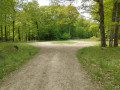
This circular loop in the Senonches State Forest, starting from the Grand Rond – a magnificent star-shaped junction of forest tracks – first follows long forest tracks leading to the Rond des Quatre Barrières and then to the Rond des Hussards. A path then winds its way between the state-owned forest and private woodland. After passing through the Rond de la Rachée, the route passes at the foot of the Chêne d’Hérissé, the sole survivor of the 1999 storm in this area. Shortly before the finish, the Hêtre du Haut Cornet stands a few metres from the path.

Details

21587823
Creation:
Last update:
Last review:
  • Walking
    Activity: Walking
  • ↔
    Distance: 4.25 mi
  • ◔
    Average duration: 2h 00 
  • ▲
    Difficulty: Easy

  • ⚐
    Back to start: Yes
  • ↗
    Ascent: + 36 ft
  • ↘
    Descent: - 36 ft

  • ▲
    Highest point: 912 ft
  • ▼
    Lowest point: 869 ft

Photos

Description of the walk

Access via the forest road from the D941 or the D20. Car park around the Grand Rond.

No signposting

(S/E) From the Grand Rond, head right past the forest ranger’s house along the Ligne du Haut Cornet to the Rond des Quatre Barrières.

(1) At the Rond, turn left and follow the track to the Rond des Hussards.

Yellow signposting

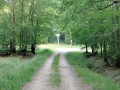
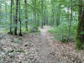
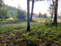
(2) Take the second lane on the left at a 90° angle, the Route de la Rachée. After about a hundred metres, leave this road and turn right onto a bridle path running along the boundary between the state-owned forest and private woodland. Stay close to the embankment and the ditch marking the forest boundary; do not cross them.

(3) Further on, the path turns eastwards and remains within the state-owned forest.

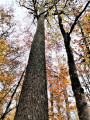
(4) You’ll come out onto a tarmac forest road; follow it to the left. Immediately cross the Rond de la Rachée and continue along the tarmac. Pass the Chêne d’Hérissé, a remarkable oak tree that towers above the others, and carry on for another hundred metres.

(5) Then turn right onto the track between plots no. 143 and no. 144.

(6) At the end, turn left and follow a stream (not shown on the map). Ignore a path on the left (plots nos. 143 and 142) and head for the Ligne du Haut Cornet.

(7) Turn left and you will soon reach the Grand Rond (S/E).

Waypoints

  1. S/E : mi 0 - alt. 876 ft - Grand Rond (Forêt de Senonches)
  2. 1 : mi 0.93 - alt. 873 ft - Rond des Quatre Barrières
  3. 2 : mi 1.7 - alt. 912 ft - Rond des Hussards
  4. 3 : mi 2.6 - alt. 879 ft - Change in the route
  5. 4 : mi 2.89 - alt. 892 ft - Tarmac forest road
  6. 5 : mi 3.26 - alt. 889 ft - Path between plots no. 143 and no. 144
  7. 6 : mi 3.53 - alt. 883 ft - T-junction
  8. 7 : mi 4.03 - alt. 869 ft - Haut Cornet Route - Blaise (rivière) - Affluent de l'Eure
  9. S/E : mi 4.25 - alt. 876 ft - Grand Rond (Forêt de Senonches)

Notes

This route is best enjoyed in summer.
The paths can be very wet, so wear suitable footwear.
During the hunting season, check with the Perche Forest Office for hunting days in the national forest (no hunting on Sundays). The Chemin du Maupas runs alongside private woods. If you happen to be passing during a hunt, it is best to stay on the Route de la Rachée from the Rond des Hussards.

Worth a visit

The Grand Rond: one of the most beautiful forest crossroads in the Senonches State Forest, and the oldest to have been laid out, it appears on a map dating from 1781. Situated at an altitude of 268 m, almost at the highest point of the forest, the Rond des Hussards is only 10 m higher. It was refurbished a few years ago to restore it to its former appearance. During the First Empire, it was named ‘Rond Napoléon le Grand’. Even today, it remains the meeting point for the teams taking part in hunts on horseback. Two foresters’ cottages provide accommodation for them.

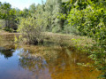
Source de la Blaise: the ‘gouttier’ (stream), recognised by geographers as the upper course of the Blaise, is said to originate about a hundred metres from the Grand Rond, on the edge of the Route des Trois Pierres, before flowing into the Tardais pond and giving rise to the Blaise. The locals disagree and believe that another stream, which starts near the Louvetiers Forest House on the D 941 and then runs parallel to this road as far as the Tardais pond, is the true Blaise. Be that as it may, these streams only flow during short, particularly wet periods.

The Rond des Quatre Barrières and the Rond des Hussards are situated on the boundary between the state-owned forest and private woodland. At the Rond des Quatre Barrières, the original central post has been preserved, though it shows worrying signs of instability. At the Rond des Hussards, however, only a circular clearing marks the centre of the crossroads.

The Chêne d’Hériché andthe Hêtre du Haut Cornet are ranked amongst the forest’s finest and most remarkable trees.

Senonches, 6 km away: shops – accommodation – Huttopia holiday village – castle museum.

La Ferté-Vidame, 6 km away: shops – accommodation – campsite – Maison Saint Simon – park and castle ruins.

Reviews and comments

4.7 / 5
Based on 1 review

Reliability of the description
5 / 5
Ease of following the route
5 / 5
Route interest
4 / 5
FARGAS Jean-Claude
FARGAS Jean-Claude

Surprised... and delighted that the trail is already so popular!!! I thought this path would remain hidden deep in the woods, where I could enjoy the peace and solitude. But if lots of people are using it, so much the better. Just be careful not to overdo it, though! I'd feel terrible if I was responsible for making it too popular!

Machine-translated

Anher
Anher

Overall rating : 4.7 / 5

Date of your route : Aug 18, 2025
Reliability of the description : ★★★★★ Very good
Ease of following the route : ★★★★★ Very good
Route interest : ★★★★☆ Good
Very busy route : Yes

easy hike (well marked) in the forest.

Machine-translated

Other walks in the area

For more walks, use our search engine .

The GPS track and description are the property of this route's author. Please do not copy them without permission.