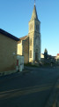
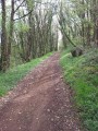
In the Saint-Sauvant State Forest

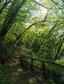
Explore the Saint-Sauvant Forest on this easy walk.

Details

2057886
Creation:
Last update:
Last review:
  • Walking
    Activity: Walking
  • ↔
    Distance: 4.56 mi
  • ◔
    Average duration: 2h 10 
  • ▲
    Difficulty: Easy

  • ⚐
    Back to start: Yes
  • ↗
    Ascent: + 56 ft
  • ↘
    Descent: - 56 ft

  • ▲
    Highest point: 522 ft
  • ▼
    Lowest point: 456 ft

Description of the walk

To reach the start, take the D29 and, once in the forest, turn towards the Route Forestière de la Méridienne (southern leisure area). Park in the car park just before a barrier.

(S/E) Go through the barrier and turn immediately left (west-south-west) onto the Route forestière du Bois Perrault. At the Châtaignier Besson junction, carry on straight ahead.

(1) As you come out of the woods, turn right. At the next junction, turn right again and follow the edge of the woods.

(2) Cross the D29 and then the D96 (take care). Continue north, ignoring all side tracks (muddy patches possible).

(3) Cross a track; you’ll immediately come out onto a road – follow it to the right for a few metres. Quickly leave the road and take a grassy track on the right.

(4) After about 1 km, turn right. At the end of the track, turn left onto the Route Forestière du Fort à l’Anglais.

(5) After about 150 metres, at the junction, turn right towards the Maison Forestière des Châteliers. Leave the forest and continue straight on.

(6) Follow the D96 to the right. Cut left whilst keeping to the right-hand side of the road.

(7) Just past the estate (Domaine le Domanial), turn left onto a small tarmac road (Route forestière des Carmes). Continue straight on towards the south-east, ignoring all turn-offs on the left.

(8) At the junction, take the road opposite, which leads quickly to the car park at the start of the route (S/E).

Waypoints

  1. S/E : mi 0 - alt. 512 ft - Car park at the forest gate
  2. 1 : mi 0.7 - alt. 476 ft - Junction
  3. 2 : mi 1.24 - alt. 466 ft - D29
  4. 3 : mi 2.23 - alt. 472 ft - Crossroads
  5. 4 : mi 2.84 - alt. 505 ft - Junction
  6. 5 : mi 3.15 - alt. 515 ft - Crossroads
  7. 6 : mi 3.61 - alt. 512 ft - D96
  8. 7 : mi 3.8 - alt. 509 ft - Route forestière des Carmes
  9. 8 : mi 4.37 - alt. 502 ft - Méridienne junction
  10. S/E : mi 4.56 - alt. 512 ft - Car park at the forest gate

Reviews and comments

3.9 / 5
Based on 3 reviews

Reliability of the description
4 / 5
Ease of following the route
4.7 / 5
Route interest
3 / 5
Ildiko 7616
Ildiko 7616

Overall rating : 4 / 5

Date of your route : Sep 03, 2021
Reliability of the description : ★★★★☆ Good
Ease of following the route : ★★★★★ Very good
Route interest : ★★★☆☆ Average
Very busy route : No

A short walk along wide, flat, straight paths with no difficulty whatsoever. Not particularly interesting.

Machine-translated

jeremymanser
jeremymanser

Overall rating : 4 / 5

Date of your route : Mar 14, 2021
Reliability of the description : ★★★★☆ Good
Ease of following the route : ★★★★★ Very good
Route interest : ★★★☆☆ Average
Very busy route : No

An easy, flat and pleasant walk. A bit one-dimensional.

Machine-translated

JeanPierredeCaen
JeanPierredeCaen

Overall rating : 3.7 / 5

Date of your route : Aug 18, 2020
Reliability of the description : ★★★★☆ Good
Ease of following the route : ★★★★☆ Good
Route interest : ★★★☆☆ Average
Very busy route : No

A very easy and very pleasant walk, alternating between woodland and fields.
One of its particular advantages is that it can be easily shortened or extended thanks to the numerous paths that criss-cross this woodland.

Machine-translated

Other walks in the area

For more walks, use our search engine .

The GPS track and description are the property of this route's author. Please do not copy them without permission.