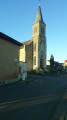
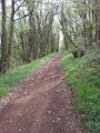
Circular loop around Saint-Sauvant

A very easy route with no elevation gain.
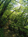
The entire route follows paths through the Saint-Sauvant State Forest or, for short stretches, along minor roads with very little traffic.

Details

n°3931503
Creation:
Last update:
Last review:
  • Walking
    Activity: Walking
  • ↔
    Distance: 7.48 mi
  • ◔
    Average duration: 3h 30 
  • ▲
    Difficulty: Moderate

  • ⚐
    Back to start: Yes
  • ↗
    Ascent: + 52 ft
  • ↘
    Descent: - 52 ft

  • ▲
    Highest point: 522 ft
  • ▼
    Lowest point: 459 ft

Description of the walk

Park in the car park at the southern leisure area of the Saint-Sauvant Forest.

(S/E) Head due south along the Route Forestière de la Méridienne until you reach the wooden barrier blocking access to cars.

(1) Take the path on the right which runs alongside the forest and the fields.

(2) Keep to the right to stay along the edge of the woodland and join the D29.

(3) Cross the road, taking the usual precautions, then do the same for the D96 just after. Continue along the path opposite, ignoring the turnings on either side, until you reach a small road which you should follow to the right for about 200 metres to reach a junction.

(4) Turn right onto the path that leads into the forest and fields, and follow it straight on until you reach the Route Forestière des Grandes Croisées.

(5) Follow this track to the right for 200 metres, then take the path branching off to the right. Pass by the farm on the right where members of the Resistance were killed in 1944 (La Branlerie), and continue until you reach the wide avenue known as Laie des Chateliers.

(6) Follow this avenue until you reach the Route Forestière du Fort à l’Anglais.

(7) Take the first major lane on the right, then turn off onto the first major lane on the left. Pass the forester’s cottage on your right and continue until you reach the D96 at the entrance to the hamlet of Le Parc.

(8) Turn right onto this road, take the left-hand bend after 100 m and carry on to the next junction.

(9) Turn left onto the Route Forestière des Carmes and join the D29 at the Méridienne crossroads.

(10) Cross carefully and follow the forest road opposite, which leads to the start car park (S/E).

Waypoints

  1. S/E : mi 0 - alt. 512 ft - Saint-Sauvant South Forest car park
  2. 1 : mi 0.79 - alt. 499 ft - Wooden barrier
  3. 2 : mi 1.86 - alt. 476 ft - Crossroads at the edge of the woods
  4. 3 : mi 2.31 - alt. 466 ft - Crossing the D29
  5. 4 : mi 3.5 - alt. 486 ft - Junction
  6. 5 : mi 4.66 - alt. 495 ft - Route Forestière des Grandes Croisées
  7. 6 : mi 5.64 - alt. 499 ft - Laie des Chateliers
  8. 7 : mi 5.91 - alt. 509 ft - Route Forestière du Fort à l’Anglais
  9. 8 : mi 6.53 - alt. 512 ft - D96 road
  10. 9 : mi 6.72 - alt. 509 ft - Route Forestière des Carmes
  11. 10 : mi 7.28 - alt. 502 ft - La Méridienne crossroads
  12. S/E : mi 7.48 - alt. 512 ft - Saint-Sauvant South Forest car park

Notes

IGN map 1728 SB.

Worth a visit

Reviews and comments

5 / 5
Based on 1 review

Reliability of the description
5 / 5
Ease of following the route
5 / 5
Route interest
5 / 5
bilouriri
bilouriri
• Edited:

Overall rating : 5 / 5

Date of your route : Sep 15, 2023
Reliability of the description : ★★★★★ Very good
Ease of following the route : ★★★★★ Very good
Route interest : ★★★★★ Very good
Very busy route : No

My wife and I found ourselves on this magnificent route on 15 September 2023, during our 15-day stay in the Vienne region. The Visorando guide is perfect, and we were lucky enough to meet some lovely people, notably an ONF technician – an encounter that also led to a very fruitful exchange of views. Thank you for posting this walk on your website; we really enjoyed it!
For your information, I often look up walks which, unfortunately, given our ages, we don’t actually go on – far from it, in fact!
You remain a leading reference, for us and no doubt for many other lovers of hiking and the great outdoors across France!
Please keep sharing all those hiking ideas and everything else!
We’re not the only ones who love you, and we hope it stays that way for a long time to come!
A big thank you!

Machine-translated

Other walks in the area

For more walks, use our search engine .

The GPS track and description are the property of this route's author. Please do not copy them without permission.