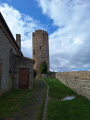
The Chemin des Maquis

This route takes you to the highest point in the commune of Lérigneux, in the Hautes Chaumes, where you’ll follow in the footsteps of the local maquis. You’ll be able to enjoy an exceptional panoramic view of the Alps and Mont Blanc.

PR®19trail.

Details

22150974
Creation:
Last update:
Last review:
  • Walking
    Activity: Walking
  • ↔
    Distance: 5.15 mi
  • ◔
    Average duration: 3h 00 
  • ▲
    Difficulty: Moderate

  • ⚐
    Back to start: Yes
  • ↗
    Ascent: + 764 ft
  • ↘
    Descent: - 764 ft

  • ▲
    Highest point: 4,409 ft
  • ▼
    Lowest point: 3,645 ft

Description of the walk

To get to the starting point at Dovézy, take the D113 towards the Col de Baracuchet, and head for thesecond hairpin bend on the road. Park in the LPO car park.

SignpostedPR®19, blue on a yellow background

(S/E) Cross the D113 and take the small road towards Grand Champ and Genêtoux
At thefirst junction, continue straight ahead along the tarmac road.

(1) At the end of the tarmac road, take the path on the right, cross the stream and continue straight on, ignoring the path on the right which leads to Grand Champ.
At the hamlet of Genêtoux, turn left. Take in the panoramic view of the Alps and Mont Blanc.
Continue along the dirt track, veering slightly to the right twice in succession, and ignore the grassy paths on the left. Carry on straight ahead, passing a private track on your left.

(2) Walk past the Pivadan shepherd's hut, where a commemorative plaque marks the battles fought by the Maquis.
Walk past the farm and continue along the tarmac road for 150 m, then leave the road and take the path on the left. Cross the pine forest, continuing along the dirt track, then turn left and follow this path to the crossroads where a tarmac road begins.

(3) Take the dirt track on the left, continue to the water catchment area marked by a green gate, and follow the track on the left which leads into the woods. At the next junction, continue along the track on the left.

(4) At the Les Combes junction, marked by a large stone marker (1,309 m), turn left and continue along a fairly wide dirt track. Pass the shepherd's hut on your right and carry on for a good hundred metres.

(5) Ignore the wide dirt track on the right and take theGR®3straight on at Les Combes Basses. Carry on until you reach the tree trunk carved into a bench (GR®3).

(6). At the bench, take the path on the left towards Champbey. Follow this path downhill, keeping straight on the whole time. Pass a log cabin at Champbey on your left and carry on straight ahead along a dirt track. You’ll reach the tarmac road where you started.

(1) Return to the car park via the same route you took on the way out (S/E).

Waypoints

  1. S/E : mi 0 - alt. 3,645 ft - LPO car park
  2. 1 : mi 0.33 - alt. 3,829 ft - Towards the hamlet of ‘Genêtoux’
  3. 2 : mi 1.23 - alt. 4,124 ft - Shepherd's hut of the Maquis – Pivadan
  4. 3 : mi 2.04 - alt. 4,239 ft - Junction with a tarmac road.
  5. 4 : mi 2.83 - alt. 4,367 ft - Large stone marker – Les Combes
  6. 5 : mi 3.2 - alt. 4,278 ft - GR°°®°°3
  7. 6 : mi 3.79 - alt. 4,249 ft - "Bench" on the GR°°®°°3
  8. S/E : mi 5.15 - alt. 3,645 ft - LPO car park

Notes

3 km from the start, in Lérigneux, on Place des Écureuils, you’ll find a noticeboard listing all the walks in the municipality. Public toilets and drinking water are available.

Always be cautious and plan ahead when you're outdoors. Visorando and the author of this route cannot be held responsible for any accidents occurring on this route.

The GR® and PR® markings are the intellectual property of the Fédération Française de Randonnée Pédestre.

Reviews and comments

4.2 / 5
Based on 3 reviews

Reliability of the description
4.3 / 5
Ease of following the route
4.3 / 5
Route interest
4 / 5
mhi_lyon
mhi_lyon

Overall rating : 3.7 / 5

Date of your route : Aug 09, 2025
Reliability of the description : ★★★★☆ Good
Ease of following the route : ★★★★☆ Good
Route interest : ★★★☆☆ Average
Very busy route : No

The passage between point 6 and the GR3 is now blocked by a string and there is no indication of the change in direction! But the route does indeed pass through there.

Machine-translated

Felixine
Felixine

Overall rating : 4.3 / 5

Date of your route : Feb 17, 2025
Reliability of the description : ★★★★☆ Good
Ease of following the route : ★★★★☆ Good
Route interest : ★★★★★ Very good
Very busy route : Yes

A magnificent hike, very well signposted on the PR19.
Stunning views of the entire Alpine range and Mont Blanc.

Machine-translated

Commune de Lérigneux

Thank you for your feedback and well done on your performance.
The time we give is an estimate for a family walk with children, which explains our ‘cautious’ estimate.

Machine-translated

rorociz
rorociz
• Edited:

Overall rating : 4.7 / 5

Date of your route : Jan 06, 2025
Reliability of the description : ★★★★★ Very good
Ease of following the route : ★★★★★ Very good
Route interest : ★★★★☆ Good
Very busy route : Yes

Good signposting, but the estimated walking time is on the low side. 2 adults, 2-hour walk, 70% on snow-covered ground. I think 2 hours would be a more accurate estimate than the 2½ hours given. A pleasant walk; apart from the tarmac section at the start, the gradient is gentle.

Machine-translated

Other walks in the area

For more walks, use our search engine .

The GPS track and description are the property of this route's author. Please do not copy them without permission.