The Way of the Cross between Autoreille and Gy

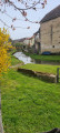
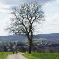
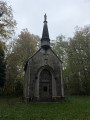
A short walk along a path marked by Templar crosses between Autoreille and Gy. Passes by the small Calvary Chapel. You can also take a round trip to see Gy Castle.

Details

n°111317780
Creation:
Last update:
Last review:
–
  • Walking
    Activity: Walking
  • ↔
    Distance: 4.92 mi
  • ◔
    Average duration: 2h 45 
  • ▲
    Difficulty: Easy

  • ⚐
    Back to start: Yes
  • ↗
    Ascent: + 561 ft
  • ↘
    Descent: - 577 ft

  • ▲
    Highest point: 1,263 ft
  • ▼
    Lowest point: 892 ft
  • ⚐ Country: France
  • ⚐ City: Autoreille (70700)
  • ⚑
    Start/End: N 47.369373° / E 5.809774°
  • ❏
    IGN map(s): Ref. 3322O
  • Hour-by-hour weather

Photos

Description of the walk

Park in the car park at Autoreille Town Hall.

(S/E) Head due north along the path marked by Templar crosses and continue between houses and fields. Then follow the edge of a woodland until, at the end of the clearing, you reach a crossroads with a signpost.

(1) Turn left, then immediately right uphill. Then head downhill to reach the Calvaire Chapel.

(2) Here you have two options:
- veer right to quickly reach the junction with the return path,
- continue straight ahead to quickly reach a four-way junction (route marked).

(3) Here, too, there are two options:
- turn right in almost a 180° turn to also reach the junction with the return path,
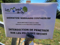
- go left then immediately right onto the small downhill path. Via a right-hand hairpin bend, reach the Friche de Brûle-Cul path (marked route).

(4) Take this path to the right, continuing to follow the Templar crosses, until you reach the junction with the return path.

(5) Carry on straight ahead uphill, keeping a close eye on the crosses, until you reach the highest point.

(6) Carry on along a flat section, then begin an easy descent and return to the junction with the sign you passed on the way out.

(1) Head straight ahead in the opposite direction, retracing your steps from the outward journey, to return to the car park at Autoreille Town Hall (S/E).

Waypoints

  1. S/E : mi 0 - alt. 928 ft - Autoreille Town Hall car park
  2. 1 : mi 1.24 - alt. 1,135 ft - Crossroads marking the end of the circular loop
  3. 2 : mi 2.12 - alt. 1,191 ft - Chapelle du calvaire (Gy)
  4. 3 : mi 2.31 - alt. 1,076 ft - Four-way junction
  5. 4 : mi 2.64 - alt. 1,020 ft - Brûle-Cul wasteland
  6. 5 : mi 2.85 - alt. 1,093 ft - Return junction
  7. 6 : mi 3.3 - alt. 1,214 ft - High point
  8. S/E : mi 4.92 - alt. 902 ft - Autoreille Town Hall car park

Notes

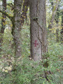
Caution: two fallen trees on the path.

Worth a visit

(3) Gy Calvary Chapel.
(3) You can take the path on the left to make a return trip to Gy Castle.

Other walks in the area

For more walks, use our search engine .

The GPS track and description are the property of this route's author. Please do not copy them without permission.