The Châtelard Battery

Starting from Clot du Dou, this walk—suitable for all—will take you to the Châtelard Battery. Please note that the site is private; to ensure the owners continue to allow walkers access, please treat the area with the utmost respect.

Details

139706
Creation:
Last update:
Last review:
  • Walking
    Activity: Walking
  • ↔
    Distance: 1.25 mi
  • ◔
    Average duration: 0h 50 
  • ▲
    Difficulty: Easy

  • ⚐
    Back to start: Yes
  • ↗
    Ascent: + 269 ft
  • ↘
    Descent: - 262 ft

  • ▲
    Highest point: 4,865 ft
  • ▼
    Lowest point: 4,616 ft

Photos

Description of the walk

YellowPR® markings

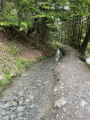
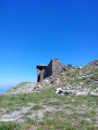
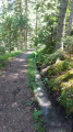
(S/E) At Clot du Dou (1,420 m), take the path that branches off to the left of the small wooden hut and winds its way up through the forest. After 500 to 600 m (horizontal distance), the path widens and descends gently down the other side of the promontory (pay close attention to the markings) until you reach the Châtelard Battery (1,450 m).

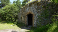
(1) Take the wide path branching off to the right; the military fortifications are about a hundred metres away.
The descent begins by retracing your steps.

(1) Do not take the path on the left that you took on the way up, but stay on the path that descends through the fir trees, heading west then south.

(2) Turn left at the gate to reach the Clot du Dou (S/E).

Waypoints

  1. S/E : mi 0 - alt. 4,616 ft - Park at Clot du Dou
  2. 1 : mi 0.58 - alt. 4,770 ft - Batterie du Châtelard
  3. 2 : mi 1.11 - alt. 4,642 ft - At the gate, turn left
  4. S/E : mi 1.25 - alt. 4,616 ft - Car park at the start

Notes

Please note: both the map route and the GPS track may be inaccurate; walkers should take care to follow the route as it appears on the ground, whether it be a marked path or track, signposts or cairns. In any case, a good sense of direction and experience are your best assets.
Please ensure the route is adapted to the least able members of the group.

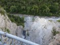
Please note: the battery site is bordered by cliffs.

Worth a visit

This battery was built during the reorganisation of the border defence system between 1883 and 1885 to complement the Saint-Vincent-les-Fort fortifications (the Chaudon Redoubt at Le Village and the Col Bas battery at the Sommet de Dormillouse). A simple shoulder-type battery, its position allows it to overlook the Ubaye valley.

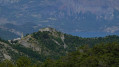
If you continue to the very tip of the promontory, you’ll be rewarded with a magnificent view of the valley and, directly opposite, the Morgon. The golden eagle nests in these cliffs; with a good pair of binoculars, a bit of perseverance and a touch of luck, you might just manage to spot its nest.

Situated on a rock face, usually sheltered by an overhang that protects it from rain and sun, the nest consists of a tangle of interwoven branches. It is usually built at an altitude of between 1,500 and 2,200 metres, and in any case at a lower altitude than its hunting grounds, as the bird of prey cannot take flight with prey weighing several kilos.

The young eagles’ first flight usually takes place towards the end of July; by then they are 80 days old and have a wingspan of nearly 1.90 metres. Juveniles can be recognised by their white patches under the wings and on the underside of the tail. These patches will gradually disappear as they reach sexual maturity at the age of five. At this age, once they are fully-grown adults, they settle in a territory which they will never leave for the rest of their lives, and seek a mate to form a lifelong, monogamous pair.

Always be cautious and plan ahead when you're outdoors. Visorando and the author of this route cannot be held responsible for any accidents occurring on this route.

The GR® and PR® markings are the intellectual property of the Fédération Française de Randonnée Pédestre.

Reviews and comments

4.7 / 5
Based on 2 reviews

Reliability of the description
5 / 5
Ease of following the route
5 / 5
Route interest
4 / 5
glaciers
glaciers

Overall rating : 4.7 / 5

Date of your route : Jun 01, 2021
Reliability of the description : ★★★★★ Very good
Ease of following the route : ★★★★★ Very good
Route interest : ★★★★☆ Good
Very busy route : No

It is worth noting that to reach the Dou car park, you need to take an unpaved track suitable for vehicles.
The GPS track to get there is useful.
At the car park, there is a clearing with a picnic area. It’s a lovely spot.
The walk is easy, and the climb through the forest is straightforward.
We counted three batteries, of different sizes.
Don’t miss the viewpoint at the far end of the battery emplacements (proceed with caution...).
A lovely family walk.
Thanks to the author for sharing this.

Machine-translated

jojolejoyeux
jojolejoyeux

Overall rating : 4.7 / 5

Date of your route : Apr 22, 2017
Reliability of the description : ★★★★★ Very good
Ease of following the route : ★★★★★ Very good
Route interest : ★★★★☆ Good

A short walk for the whole family

Machine-translated

Other walks in the area

For more walks, use our search engine .

The GPS track and description are the property of this route's author. Please do not copy them without permission.