


Refine your search for walks in Le Château-d'Oléron
Le Château-d'Oléron walks


 Between marshes, forest and vineyards at the start of Château-d'Oléron
 Visorando Member
 6.10 mi
 +13 ft
 -13 ft
 2h 50
2h 50
 Easy
Easy
 Departure from Le Château-d'Oléron (Charente-Maritime)
An easy hike between the marshes of Château, La Chevalerie, Grésillon, Le Fief de la Gombaudière, Le Riveau and La Renisière. Please note that this hike is not possible in winter, as some paths are impassable when wet. From April to October, no problem.
Around Ors and its oyster channel at Château-d'Oléron
 4.67 mi
+13 ft
-10 ft
2h 10
Easy
Departure from Le Château-d'Oléron (Charente-Maritime)
4.67 mi
+13 ft
-10 ft
2h 10
Easy
Departure from Le Château-d'Oléron (Charente-Maritime)
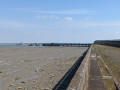
Walk around the village of Ors, its oyster channel and Grésillon.
Ors was the arrival and departure point for tourists during the heyday of the ferry (1945–1966) until the viaduct was built (1966). Traffic jams are guaranteed in the narrow, winding streets!
Stunning views of the Oléron viaduct and the old Ors jetty, which linked the mainland to the port of Chapus in Bourcefranc.
Saint-Trojan-les-Bains on the Île d'Oléron
 10.33 mi
+52 ft
-52 ft
4h 50
10.33 mi
+52 ft
-52 ft
4h 50
 Moderate
Departure from Saint-Trojan-les-Bains (Charente-Maritime)
Moderate
Departure from Saint-Trojan-les-Bains (Charente-Maritime)
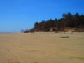
The commune of Saint-Trojan-les-Bains is located at the south-western tip of the Île d'Oléron, bathed by the Pertuis de Maumusson and the Coureau d'Oléron.
Its large sandy beaches, pine forest, mimosa trees and mild climate make Saint-Trojan-les-Bains a very popular seaside resort.
The southern tip of the Île d'Oléron, starting from Saint-Trojan
 10.15 mi
+79 ft
-79 ft
4h 45
Moderate
Departure from Saint-Trojan-les-Bains (Charente-Maritime)
10.15 mi
+79 ft
-79 ft
4h 45
Moderate
Departure from Saint-Trojan-les-Bains (Charente-Maritime)
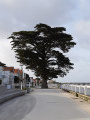
A circular walk that takes you from the village of Saint-Trojan to explore the national forest, the wild Atlantic coast with the impressive Maumusson channel, and Gatseau Bay. A complete panorama to discover this southern tip of the Île d’Oléron, far from the cars and crowds on the beaches.Please note: To walk easily on the hard sand between (4) and (5), you must check the tide times (see the Practical Information section)
Vert Bois beach and Grande Plage on the Île d'Oléron
6.88 mi
+20 ft
-23 ft
3h 10
Moderate
Departure from Le Grand-Village-Plage (Charente-Maritime)
Circular coastal loop on the west coast of Île d'Oléron. The first part is in the Saint-Trojan National Forest, followed by a long walk on the beach, before a final stretch in the forest. Visorando app recommended.
The tour of Pointe de Gatseau and Pertuis de Maumusson
 3.11 mi
+10 ft
-10 ft
1h 25
Easy
Departure from Saint-Trojan-les-Bains (Charente-Maritime)
3.11 mi
+10 ft
-10 ft
1h 25
Easy
Departure from Saint-Trojan-les-Bains (Charente-Maritime)
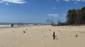
This short 5 km circular takes you around Pointe de Gatseau, the southernmost point of the Île d'Oléron, and allows you to discover the wild Pertuis de Maumusson (passage between the island and the mainland), which is only accessible on foot or by mini train during the season
Boyardville – Le Douhet circular loop
 14.18 mi
+26 ft
-26 ft
6h 35
14.18 mi
+26 ft
-26 ft
6h 35
 Difficult
Departure from Saint-Georges-d'Oléron (Charente-Maritime)
Difficult
Departure from Saint-Georges-d'Oléron (Charente-Maritime)
A circular walk covering a section of the north-eastern coast of Île d’Oléron and passing through the Saumonards State Forest. From Boyardville, you pass the Pointe des Saumonards whilst looking out over Fort Boyard, then the mussel beds in the Anse de la Maleconche, before arriving at the small marina at Douhet. After passing through the salt marshes and the village of Foulerot, you reach the forest of maritime pines and holm oaks typical of the Atlantic dune coastline. This route takes you along a mix of small roads, forest tracks, sandy beaches and seaside paths.
Promenade des Carrelets in Port-les-Barques
4.63 mi
+26 ft
-23 ft
2h 10
Easy
Departure from Port-des-Barques (Charente-Maritime)
A round trip walk from the carrelets of Port-les-Barques to those of Île Madame. Please note: only possible at low tide.
The grand tour of Marennes, between fresh water and salt water
9.08 mi
+39 ft
-49 ft
4h 15
Moderate
Departure from Marennes (Charente-Maritime)
A walk between land and sea, following in the footsteps of the ghost trains of an old railway line.
 Oyster beds of Saint-Pierre-d'Oléron
7.11 mi
+20 ft
-20 ft
1.5 hrs
Easy
Departure from Saint-Pierre-d'Oléron (Charente-Maritime)
Circular loop to discover the oyster beds around Saint-Pierre-d'Oléron, which can be added to the Île d'Oléron cycle tour.
Around l'îIe Madame
 4.16 mi
+36 ft
-36 ft
1h 55
Easy
Departure from Port-des-Barques (Charente-Maritime)
4.16 mi
+36 ft
-36 ft
1h 55
Easy
Departure from Port-des-Barques (Charente-Maritime)
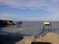
A pleasant walk passing by the Passe aux boeufs causeway, then around an island steeped in history. Numerous and varied views of the surrounding islands and coastline.
Vasselot Coastal Dune Circular Loop
5.37 mi
+36 ft
-36 ft
2h 30
Easy
Departure from La Tremblade (Charente-Maritime)
The first part of the hike is on the beach, along the edge of a shifting dune, sometimes on old sections of the Coubre coastal forest, returning via a path through the undergrowth.The Visorando app is highly recommended (to locate (2) in particular).
From Fouras to Fort La Pointe
 5.38 mi
+43 ft
-33 ft
2h 30
Easy
Departure from Fouras (Charente-Maritime)
5.38 mi
+43 ft
-33 ft
2h 30
Easy
Departure from Fouras (Charente-Maritime)
This hike allows you to discover two links in the chain of defences that protected Rochefort in the 17th and 18th centuries. The route, which largely follows the coast, is easy and does not present any navigation difficulties.
Charente Estuary, Saint-Laurent Marshes and Pointe de la Fumée
 15.37 mi
+39 ft
-66 ft
2.5 hrs
Moderate
Departure from Fouras (Charente-Maritime)
15.37 mi
+39 ft
-66 ft
2.5 hrs
Moderate
Departure from Fouras (Charente-Maritime)
A lovely circular route between land and sea, with superb views of the islands and the offshore forts. The route starts between the Charente and the grazed marshes of Saint-Laurent-de-la-Prée and ends with a return trip to the Pointe de la Fumée and its magnificent panoramic views. A few forts on land and several seaside houses add a lovely touch of heritage. In summer, this mountain bike route can be combined with a refreshing swim in the sea.
More walks in Le Château-d'Oléron
Select a point of interest below: