Boyardville – Le Douhet circular loop

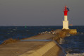
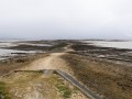
A circular walk covering a section of the north-eastern coast of Île d’Oléron and passing through the Saumonards State Forest. From Boyardville, you pass the Pointe des Saumonards whilst looking out over Fort Boyard, then the mussel beds in the Anse de la Maleconche, before arriving at the small marina at Douhet. After passing through the salt marshes and the village of Foulerot, you reach the forest of maritime pines and holm oaks typical of the Atlantic dune coastline. This route takes you along a mix of small roads, forest tracks, sandy beaches and seaside paths.

Details

44466858
Creation:
Last update:
Last review:
  • Walking
    Activity: Walking
  • ↔
    Distance: 14.18 mi
  • ◔
    Average duration: 6h 35 
  • ▲
    Difficulty: Difficult

  • ⚐
    Back to start: Yes
  • ↗
    Ascent: + 26 ft
  • ↘
    Descent: - 26 ft

  • ▲
    Highest point: 36 ft
  • ▼
    Lowest point: -7 ft

Photos

Description of the walk

There are several parking options in Boyardville: the market square (except in the mornings – depending on the route chosen), or behind the square; a large car park on Avenue de l’Océan (or Avenue Pierre Loti); or near the tennis courts and along the adjacent road.

(S/E) Head north-east along Avenue de l’Océan towards the beach.

(1) At the junction by the tennis court, turn left onto the path that runs behind the houses and follow it for about 150 m.

(2) Turn onto a forest track and take the one furthest to the right. This fairly wide path veers to the left after a fallen tree trunk lying across it. It narrows and leads to a cycle path running alongside the Route des Saumonards. Continue left along the cycle path, turn right at the roundabout and go past the barrier.

(3) Just after the barrier, take the forest path on the left: marked with a yellow line or white dot. The path runs parallel to the Route des Saumonards, then veers away from it at the campsite before finally heading towards the beach.

(4) Turn right to stay as close as possible to the sea and follow the coast to Plage des Saumonards after passing the fort.

(5) Cross the car park and, heading south, follow a wide forest track for a short distance before turning west (to the right) onto a straight forest path that leads to the sea.

:6:: Continue to the left, staying on the path which begins to wind before reaching Plage de la Gautrelle.

(7) Carry on along the beach to Plaisance Beach.

(8) Go straight on to Port du Douhet.

(9) To reach the harbour from the beach, climb over a few rocks: it’s not difficult. Follow the road alongside the harbour basin.

(10) Before the channel, turn left onto a track that runs between the basins and joins the cycle path at the next junction.

(11) Follow it south-east (to the left). At the junction at the end of the straight stretch, continue along the edge of the marsh, keeping to the left.

(12) At the next junction, turn right towards the south-west, crossing the area of gardens and houses. Join the local road and turn left. At the next junction, turn left again to reach the entrance to Saint-Georges-d’Oléron.

(13) With your back to the village, turn left onto Rue de l’Océan in Foulerot. Then turn right onto Rue du Caillochis: this allows you to admire the many gardens and typical Oléron-style houses in Foulerot. Continue straight on along Rue du Foulerot until you reach the end.

(14) Turn left onto Rue de la Marotte and, after about 300 metres, turn right towards the forest. Cross an open space and head down a wide forest track.

(15) Leave this very soon after, at a place called Bretagne, and take a path veering off to the left; follow it until you reach a wide track. Take this track eastwards to cross straight through the Forêt des Saumonards. The terrain follows that of the dunes, with a succession of ascents and descents.

(16) After a ride of around 3.5 km, turn off onto a path on the right, heading south-east towards the Cabanes Martin. This well-marked path winds its way to the cycle path.

(17) Turn right onto it towards the Boyardville salt marshes and join the D126, which marks the end of the cycle path. Turn left onto the departmental road and follow it to Rue des Hirondelles.

(18) Turn left again to follow this street, then take Rue des Albatros on the right and Avenue de l’Océan on the left to reach the market square (S/E).

Waypoints

  1. S/E : mi 0 - alt. 10 ft - Boyardville, market square
  2. 1 : mi 0.11 - alt. 10 ft - Path on the left
  3. 2 : mi 0.19 - alt. 10 ft - Path on the right
  4. 3 : mi 0.53 - alt. 23 ft - Barrier, path on the left
  5. 4 : mi 1.08 - alt. 13 ft - Turn right
  6. 5 : mi 2.3 - alt. 26 ft - Saumonards Beach
  7. 6 : mi 3.37 - alt. 13 ft - Turn left
  8. 7 : mi 4.34 - alt. 20 ft - La Gautrelle Beach
  9. 8 : mi 5.83 - alt. 23 ft - Plaisance Beach
  10. 9 : mi 6.3 - alt. 13 ft - Port du Douhet
  11. 10 : mi 6.49 - alt. 10 ft - Path on the left between the ponds
  12. 11 : mi 7.14 - alt. 13 ft - Cycle path
  13. 12 : mi 7.99 - alt. 7 ft - Crossroads
  14. 13 : mi 8.73 - alt. 13 ft - Saint-Georges-d’Oléron, Rue de l’Océan
  15. 14 : mi 9.59 - alt. 16 ft - Rue de la Marotte
  16. 15 : mi 9.87 - alt. 13 ft - A place called Bretagne
  17. 16 : mi 12.37 - alt. 16 ft - Path to the Cabanes Martin
  18. 17 : mi 13.3 - alt. 10 ft - Cycle path
  19. 18 : mi 13.94 - alt. 13 ft - Rue des Hirondelles
  20. S/E : mi 14.18 - alt. 10 ft - Boyardville, market square

Notes

This walk can be undertaken in any season. However, July and August can be very hot; January and February, by contrast, can be very cold. There is no shelter apart from in the villages. Water points are available on the beaches and at Port de Douhet during the summer months.

The entire route from Boyardville Beach to Plaisance Beach, via Saumonards and La Gautrelle beaches, can be walked along the beach. This depends on the tide times and tidal coefficients.

If you collect debris washed up by the ocean (plastic, ropes, bottles, shoes, etc.), there are ‘tide bins’ where this waste is collected at Boyardville, Plaisance and La Gautrelle beaches.

This route passes through a protected area, which may be subject to special regulations:

Worth a visit

In the village of Saint-Georges-d’Oléron: market halls and a Romanesque church.

Reviews and comments

5 / 5
Based on 2 reviews

Reliability of the description
5 / 5
Ease of following the route
5 / 5
Route interest
5 / 5
Nawacks
Nawacks

Overall rating : 5 / 5

Date of your route : Dec 29, 2025
Reliability of the description : ★★★★★ Very good
Ease of following the route : ★★★★★ Very good
Route interest : ★★★★★ Very good
Very busy route : No

Took this route at the end of December. Great balance between beach and forest. Classified as difficult, probably because of the length (we did it in 6.5 hours, taking our time). Just one slightly less pleasant stretch on the road halfway through, just after the marshes (you could skip it by staying on the beach side). Otherwise, very, very nice.

Machine-translated

User 26323103

Overall rating : 5 / 5

Date of your route : Oct 20, 2025
Reliability of the description : ★★★★★ Very good
Ease of following the route : ★★★★★ Very good
Route interest : ★★★★★ Very good
Very busy route : No

Walk through the woods, along the seashore and canal. A very beautiful hike with a view of Fort Boyard at the start. Very nice! If you are in the area, don't hesitate to go on this hike.

Machine-translated

Other walks in the area

For more walks, use our search engine .

The GPS track and description are the property of this route's author. Please do not copy them without permission.