Country:
 City:
City:


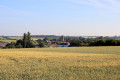


The start is at the town hall car park. Follow the yellow signposts for the “Le camp des Américains (1917–1919)” route.
(S/E) Take the D16 towards Les Bordes and Issoudun, heading south-southeast, and leave Paudy.
(1) At the entrance to the hamlet of Montbougrand, turn right (signposted) onto a tarmac lane which then becomes a wide, grassy farm track.
At the next junction, turn left onto a stony track, then take a grassy path on the right. Then turn left onto a track.
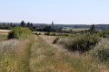
(2) Follow a gravel track to the right, which takes you past the foot of a wind turbine and into the Bois de Volvault. At the junction of paths, continue straight on along a grassy track at the edge of the woods.
(3) At the junction, turn left and carefully cross the D 960 to continue straight ahead along a grassy track. Then turn right.
(4) Follow the small road to the right leading to the village of Vœu. Walk through the village, keeping the various streets to your right and left, and cross the D 960 again. At the Fork in the road, turn left, cross the D 27 carefully and continue along the Route des Vouets towards Giroux.
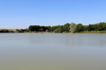
(5) 700 m further on, take the track on the right, which then turns into a grassy path as you approach the village pond. A short path followed by a footbridge takes you to the edge of the pond, which you walk round to the left.
(6) When you reach the entrance to the site, follow the D 27 to the left for 700 m, then turn left onto a grassy track which runs alongside another private pond and then crosses the fields. At the end of the track, turn right.
(7) Carry on straight ahead until you pass a farmhouse in the hamlet of Villetroche. Continue along the grassy track to the cemetery.
(8) At the entrance to the cemetery, take the D16 to the right, cross the Herbon stream via the bridge and continue straight on at the first junction, then turn left at the second. Leave the main road and the yellow signposting on your right to continue straight on along Rue de la Basse Cour.
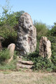
(9) Turn left to admire the keep 100 metres ahead. Retrace your steps.
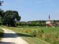
(9) Turn left to reach the church; walk alongside it on the left until you reach a gravel path. At the pétanque court, turn right, walking alongside the school wall to return to the town hall car park (S/E).
 Visorando Member
 Easy
Easy