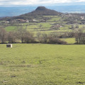
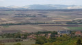
Puy d’Ysson and the surrounding area

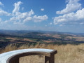
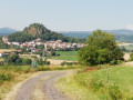
A walk of just under 8 km, passing the orientation table on the Puy d’Ysson (856 m), which offers a 360° view of the Chaîne des Puys and the Forez.

Details

1370274
Creation:
Last update:
Last review:
  • Walking
    Activity: Walking
  • ↔
    Distance: 4.85 mi
  • ◔
    Average duration: 2h 50 
  • ▲
    Difficulty: Easy

  • ⚐
    Back to start: Yes
  • ↗
    Ascent: + 682 ft
  • ↘
    Descent: - 712 ft

  • ▲
    Highest point: 2,802 ft
  • ▼
    Lowest point: 2,156 ft

Photos

Description of the walk

At the top of Solignat, follow the signs for Le Puy d’Ysson.
Park on the grassy area near the wooden playground at the junction.

(S/E) Take the road up to the summit of Le Puy, heading south-west.

(1) At the first junction, continue left along the road, heading due south, towards the Puy d’Ysson (856m).

(2) Enjoy the 360° panoramic view at the summit of the Chaîne des Puys, then head back down.

(1) At the junction, head down the path on the left.

(3) After descending a stony path, continue to the right.
At the next crossroads (250m), turn left.
Head down to the D32

(4) Follow it to the right for 75m, then take the path on the right.

(5) At the crossroads, turn right. After 300m, ignore the path branching off to the right and continue northwards.

(6) After 400m, continue to the right at the three-way junction (elevation 692).
Pass close to the Florat farm, cross the road and go straight on (elevation 676).

(7) At the next junction, take the path on the right towards Solignat.

(8) When you reach the area near the stadium, follow the road for 30 metres and turn right towards Le Puy to return to the starting point (S/E).

Waypoints

  1. S/E : mi 0 - alt. 2,323 ft - Grassy area at the crossroads
  2. 1 : mi 0.62 - alt. 2,654 ft - Junction
  3. 2 : mi 0.85 - alt. 2,802 ft - 360° panorama
  4. 3 : mi 1.72 - alt. 2,346 ft - To the right
  5. 4 : mi 2.16 - alt. 2,221 ft - D32 on the right
  6. 5 : mi 2.49 - alt. 2,208 ft - To the right
  7. 6 : mi 3 - alt. 2,274 ft - Turn right at the three-way junction
  8. 7 : mi 3.99 - alt. 2,156 ft - Path on the right
  9. 8 : mi 4.45 - alt. 2,270 ft - Turn right onto the road
  10. S/E : mi 4.85 - alt. 2,323 ft - Grassy area at the crossroads

Notes

The climb up to Le Puy is partly through woodland.
The descent to Vodable takes you through fields of sunflowers and maize (depending on the season).
After that, the walk continues through woodland almost all the way to the finish.

Worth a visit

See the 360° orientation table at the summit of Puy d’Ysson.

Reviews and comments

5 / 5
Based on 2 reviews

Reliability of the description
5 / 5
Ease of following the route
5 / 5
Route interest
5 / 5
jloup63
jloup63

Overall rating : 5 / 5

Date of your route : Jan 13, 2025
Reliability of the description : ★★★★★ Very good
Ease of following the route : ★★★★★ Very good
Route interest : ★★★★★ Very good
Very busy route : No

Stunning, very pleasant, 360-degree panoramic view

Machine-translated

m@rieca
m@rieca
• Edited:

Overall rating : 5 / 5

Date of your route : Sep 03, 2018
Reliability of the description : ★★★★★ Very good
Ease of following the route : ★★★★★ Very good
Route interest : ★★★★★ Very good

A lovely walk… stunning views…
For ‘geocaching’ enthusiasts, there are two caches along the way
Have a lovely day, everyone
Marie

Date of the walk: 29 August 2018

Machine-translated

Other walks in the area

For more walks, use our search engine .

The GPS track and description are the property of this route's author. Please do not copy them without permission.