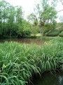
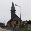
The Bois de Pîtres in La Neuville-Chant-d'Oisel

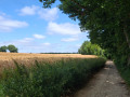
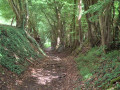
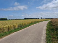
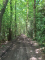
A mixed route through the village of La Neuville-Chant-d’Oisel and the Bois de Pîtres, passing through part of the Forêt de Longboël. Suitable for walking, running or mountain biking.

Details

71051183
Creation:
Last update:
Last review:
  • Walking
    Activity: Walking
  • ↔
    Distance: 6.43 mi
  • ◔
    Average duration: 3h 15 
  • ▲
    Difficulty: Moderate

  • ⚐
    Back to start: Yes
  • ↗
    Ascent: + 338 ft
  • ↘
    Descent: - 338 ft

  • ▲
    Highest point: 525 ft
  • ▼
    Lowest point: 167 ft

Photos

Description of the walk

Park on Allée de la Maupassière in La Neuville-Chant-d’Oisel.

(S/E) Take Rue des Andelys towards Boos.

(1) At 1558 Rue des Andelys, admire the neo-Gothic-style oak doors. They were carved around 1930 by the cabinetmaker Charles ROMON to showcase his craftsmanship.

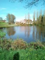
(2) Head towards Mare Verboc, situated on the other side of the road, then turn left onto Rue de l’Église and walk past it.

(3) Turn left to follow Rue des Houssayes. This street is very long; you’ll reach the entrance to the Bois de Pîtres in 2.6 km. Pass the Côte du Montier, then the Mare à Crasse. You’ll see horses after the farm on your left.

(4) Leave the tarmac road at Les Houssayes and continue along the path that leads into the Bois de Pîtres.

(5) Turn left at the ‘No Entry’ signs. Follow this path as it winds through the woods; take care (there are stones and roots hidden beneath the fallen leaves).

(6) Carry on until you reach a crossroads.

(7) Turn left, temporarily leaving the undergrowth, and head towards a three-way junction on the edge of the Longboël Forest.

(8) Keep to the right towards Le Chouquet; the slope is steep, so take your time. Cross a section of the Longboël Forest, taking care to stay on the same course, and you’ll reach the edge.

(9) Continue along a wooded strip on your right, pass some beehives and join a path crossing the Chouquet.

(10) Turn right onto this path, which very quickly becomes tarmac. Go straight on until you reach the junction with Rue des Jardins. Carry on straight ahead, then follow the Mare Joncquemare before emerging onto Rue des Andelys (D138). The Prim’Oisel Farm is directly in front of you; do not try to enter to see the animals: they do not sell to the public and it is dangerous whilst agricultural machinery is in operation.

(11) Turn left onto Rue des Andelys towards Boos and pass the town hall. Carry on to reach the car park (S/E).


Waypoints

  1. S/E : mi 0 - alt. 505 ft - Allée de la Maupassière
  2. 1 : mi 0.34 - alt. 522 ft - 1558 Rue des Andelys
  3. 2 : mi 0.55 - alt. 509 ft - Rue de l’Église
  4. 3 : mi 0.78 - alt. 509 ft - Rue des Houssayes
  5. 4 : mi 2.3 - alt. 459 ft - Les Houssayes
  6. 5 : mi 2.58 - alt. 443 ft - Turn left at the three-way junction
  7. 6 : mi 3.53 - alt. 312 ft - Grande Vallée
  8. 7 : mi 3.71 - alt. 236 ft - Junction, turn left
  9. 8 : mi 3.97 - alt. 171 ft - Edge of the woods, three-way junction, turn right
  10. 9 : mi 4.87 - alt. 453 ft - Leaving the forest
  11. 10 : mi 5.36 - alt. 443 ft - Le Chouquet, on the right
  12. 11 : mi 6.19 - alt. 502 ft - Rue des Andelys
  13. S/E : mi 6.43 - alt. 505 ft - Allée de la Maupassière

Notes

(S) Forgotten to bring a cold drink? There’s a Panier Sympa mini-market at the start of this walk.

(S) Allée de la Maupassière: a local market takes place every Saturday morning.

(2) 98, Rue de l’Église: try the delicious cream puffs from the Choko’Pain bakery.

(11) 2301, Rue des Andelys: Les Serres Neuvillaises is not just a nursery! You’ll also find a selection of local produce there.

(E) Before setting off again, you can also relax and enjoy the peace and quiet of Longboël Park.

Worth a visit

Notre Dame de Fontaine-Guérard Abbey (7 km)
CD 714, 27380 Radepont

The former Levavasseur spinning mill (8 km)
27360 Pont-Saint-Pierre

The Poses Lock (10 km)
4 Rue des Ecluses, 27380 Amfreville-sous-les-Monts

Panorama des Deux Amants (11 km)
Route des Deux Amants, 27380 Amfreville-sous-les-Monts

Angélique’s Gardens (8 km)
2692 Rte de Lyons, 76520 Montmain.

The Côte Sainte Catherine Viewpoint (12 km)
Route de la Corniche, 76240 Bonsecours

Le Jardin Plume (12 km)
790 Rue de la Plaine, 76116 Auzouville-sur-Ry

Martainville Castle (14 km)
Route du Château, 76116 Martainville-Épreville

Reviews and comments

4.5 / 5
Based on 2 reviews

Reliability of the description
4.5 / 5
Ease of following the route
4.5 / 5
Route interest
4.5 / 5
Julien76520
Julien76520

Hello,

I have updated the description of Point No. 3 by adding the length of Rue des Houssayes.

Thank you for your contribution.

All the best.

Machine-translated

RTTteauber
RTTteauber

Overall rating : 4.3 / 5

Date of your route : May 08, 2025
Reliability of the description : ★★★★☆ Good
Ease of following the route : ★★★★☆ Good
Route interest : ★★★★★ Very good
Very busy route : No

A lovely walk by RTT276. A lovely stretch through the woods. The description is accurate. However, it should be made clear that Rue des Houssayes is very long before you reach the woods.
Best regards.

Machine-translated

Dionisi Yves
Dionisi Yves

Overall rating : 4.7 / 5

Date of your route : Apr 16, 2025
Reliability of the description : ★★★★★ Very good
Ease of following the route : ★★★★★ Very good
Route interest : ★★★★☆ Good
Very busy route : No

A pleasant walk, despite a slightly long start on a tarmac road. A very pleasant path through the woods.
Note: 500 metres after setting off, you’ll pass a house (on the left) with two magnificent carved doors.

Machine-translated

Other walks in the area

For more walks, use our search engine .

The GPS track and description are the property of this route's author. Please do not copy them without permission.