


 Country:

 City:


Park your car at the side of the N94 road a few hundred metres south of L’Argentière-la-Bessée (opposite the Pont Chancel).
Follow the yellow-marked trail signposted ‘Route du Bois de France’ throughout the route.
(S/E) Head steeply up the path, which joins a forest track in 20 minutes.
(1) Turn left and follow the track for about 1,800 metres under a power line (the yellow markings are irregular due to roadworks on the forest track).
(2) At a pylon, leave the track and take the path (marked by a large cairn) which heads off to the right and climbs steeply, crossing the track several times (the yellow markings are clearly visible again).
Follow the path for approximately 2,500 metres until you reach a fork.
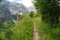
(3) Leave the path that climbs to the right and continue straight on, heading north. The yellow-marked path climbs steadily and crosses tracks again, sometimes following them for a few metres.
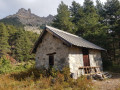
After about 2,000 metres, the path veers to the right, now heading south, and continues to climb until it reaches a series of small rock shelters (labelled ‘caves’ on the map).
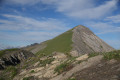
(4) The climb becomes very steep and the terrain more challenging, but you will nevertheless reach the highest point of the route (1,828 m) in a few minutes.
(5) The landscape changes as you reach a section of woodland spared by the fire.
Follow the path which crosses the Ravin des Rouyes and begins to descend steadily. After about 600 metres, you reach a fork in the path.
(6) Follow the path on the right, which continues to descend and re-enters the area devastated by the fire.
Follow the path for 2,500 metres until you reach the fork you encountered on the way up.
(3) Turn left and retrace your steps along the morning’s route to return to the starting point (S/E).

 Visorando Member
 Very difficult

 Difficult

 Easy

