Leguay Roger

 Visorando Member
 Premium user
 - Location: Puy-Saint-Pierre (05100)
- Gender: man
Sign up:
Published route(s)
 Emparis Plateau, Lac Lérié and Lac Noir
 10.44 mi
 +3,271 ft
 -3,297 ft
 7h 40
7h 40
 Moderate
 Departure from La Grave (Hautes-Alpes)
A somewhat long but magnificent hike with the Meije glaciers in the background.
Message from the moderator: You are in a Sensitive Natural Area (Natura 2000) which is subject to specific regulations (see practical information).
The Cerces tour
 10.62 mi
+3,261 ft
-3,235 ft
7h 45
10.62 mi
+3,261 ft
-3,235 ft
7h 45
 Difficult
Departure from Névache (Hautes-Alpes)
Difficult
Departure from Névache (Hautes-Alpes)
A beautiful, challenging hike that takes you around the Cerces Massif, from lake to lake...
There are a few tricky sections for those who are afraid of heights
Tour of the Bois de Saint-Hippolyte
 6.68 mi
+2,365 ft
-2,349 ft
5h 10
Moderate
Departure from Névache (Hautes-Alpes)
6.68 mi
+2,365 ft
-2,349 ft
5h 10
Moderate
Departure from Névache (Hautes-Alpes)
This forest hike does not present any major difficulties. It is suitable for all experienced hikers. It can be done in all seasons, but I prefer autumn because of the colours of the larch trees. After the first snowfall, it is also possible to do this route on snowshoes. However, be careful of the often exposed slopes, which are prone to avalanches.
Le Pied du Col - Lac du Pontet - L'Aiguillon
 7.66 mi
+1,834 ft
-1,824 ft
5h 05
Moderate
Departure from Villar-d'Arêne (Hautes-Alpes)
7.66 mi
+1,834 ft
-1,824 ft
5h 05
Moderate
Departure from Villar-d'Arêne (Hautes-Alpes)
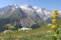
This hike is accessible to all without any particular difficulty and allows you to walk with the magnificent panorama of the Meije glaciers as a backdrop.
What's more, the remarkable exposure of the circuit and its relatively modest altitude mean that this loop can be completed as soon as the snow melts.
Moderator's note added on 26/07/2021: please note that part of this circuit is no longer passable. See reviews for an alternative route
Col de l'Echelle – Aiguille Rouge circular loop
 5.88 mi
+2,651 ft
-2,654 ft
5h 00
Difficult
Departure from Névache (Hautes-Alpes)
5.88 mi
+2,651 ft
-2,654 ft
5h 00
Difficult
Departure from Névache (Hautes-Alpes)
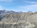
The hike from Col de l’Échelle to Aiguille Rouge is a classic route usually done as a round trip via an easy path.
The uniqueness of the route suggested here lies in the fact that it follows a little-known path for much of the ascent. Please note: as this path passes through areas prone to erosion, it is therefore reserved for experienced hikers.
Cascade de la Pisse - Bois des Rousses - Bois de l'Ours in Saint-Chaffrey
 4.92 mi
+1,798 ft
-1,801 ft
3h 50
Moderate
Departure from Saint-Chaffrey (Hautes-Alpes)
4.92 mi
+1,798 ft
-1,801 ft
3h 50
Moderate
Departure from Saint-Chaffrey (Hautes-Alpes)
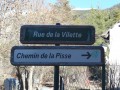
A very pleasant route through a pine forest. Panoramic views of the Serre Chevalier valley, the village of Saint-Chaffrey and the Écrins mountain range.
Tour des Têtes
 7.23 mi
+2,516 ft
-2,507 ft
5h 30
Moderate
Departure from L'Argentière-la-Bessée (Hautes-Alpes)
7.23 mi
+2,516 ft
-2,507 ft
5h 30
Moderate
Departure from L'Argentière-la-Bessée (Hautes-Alpes)
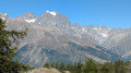
The first part of the hike is sunny. At the top of Les Têtes, you can enjoy a 360° panorama of the Pelvoux massif to the north and west and the Durance Valley to the south.
 Mountain biking in the Vosges, Day 4: Hohwald - Chatenois (Part 1)
7.84 mi
+840 ft
-1,558 ft
2.5 hrs
Moderate
Departure from Le Hohwald (Bas-Rhin)
This route is the first part of thefourth stage of a seven-day tour of the Alsatian side of the Vosges mountains. Most of the route is on forest roads in good condition. The signage is excellent, consisting of signs with an orange or red mountain bike logo and the letters TMV (Traversée du Massif Vosgien).
Vosges Mountain Biking Day 5: Chatenois – Aubure (Part 1)
9.60 mi
+2,021 ft
-436 ft
4 hrs
Difficult
Departure from Châtenois (Bas-Rhin) (Bas-Rhin)
This route forms the first part of the fifth stage of a 7-day tour on the Alsatian side of the Vosges. The route follows mainly forest tracks in good condition. The signposting, which is excellent, consists of signs bearing an orange or red mountain bike logo accompanied by the letters TMV (Traversée du Massif Vosgien).