Country:
 City:


Car park opposite No. 29 Rue Saint-Martin in Antheit, 4520 Wanze.
(S/E) From the car park, turn right and head towards the end of Rue Saint-Martin to go down the Thier de la Messe. At the bottom, turn right, then right again into Rue Reine Astrid for about a hundred metres.
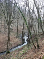
(1) Just before No. 17, turn right onto the path running alongside this property and a bridleway. The path turns 90° to the left and runs alongside a stream. Follow it for 500 metres and pass the two turnstiles.
(2) Shortly after the turnstiles, take the path on the left which climbs diagonally up the hillside of the valley. It then opens out into a field before leading onto Rue E. Vandervelde.
(3) Walk up this street for 100 m and turn right into Rue des Vallées. Walk up this street for 150 m until you reach No. 45.
(4) Turn into the narrow lane leading down towards numbers 44 and 43 on the street. After the houses, the lane continues as a path through the meadows. Continue down to the stream, cross it (double beam) to reach the edge of the woods and a junction.
(5) Turn left onto the path that runs alongside the stream at a distance. After 500 m, the path joins a tarmac road (Rue Doyard). Turn left onto it and head downhill.
(6) Before reaching the bottom of the hill, turn sharply right onto the farm track that runs alongside the stream. Ignore the path that climbs up the valley near a house. Continue along the stream, again ignoring the path on the right that climbs the hillside (white house visible on the other side of the stream).
(7) Shortly afterwards, at the junction, carry on straight ahead, cross the stream and begin the climb up the valley. Once at the top, the path emerges at a bend in a street (Rue des Étangs). Carry on straight ahead along this street, which bends to the right and then reaches a junction.
(8) Turn right onto Rue Cachine. After about a hundred metres, this street changes its name to Rue Theys and enters the woods. Follow it to the bottom (bench).
(9) Turn left towards number 1 and continue along the forest track which enters the woods again. Follow it for 400 metres, then turn sharply right onto the path leading down the valley. At the bottom, this path runs alongside the Bois de Champia and some fields, then climbs slightly to reach the hamlet of Champia.
(10) At the junction, turn left twice to begin the climb up Rue Ferdinand Fontaine. After the large farm, the road continues as a farm track, runs alongside a woodland and joins a tarmac road after a right-hand bend.
(11) Cross the road and head straight on along the farm track that runs alongside the Bois de Gistru and the fields: “at the top of the track, there is a stunning view of the cooling towers at the Tihange power station”. After the woodland, there is a field followed by a meadow. Ignore the path on the right.
(12) Turn onto the farm track on the right at the three-way junction (three-way junction) immediately after a crest in the path. This track is overgrown with grass, runs straight and follows the meadows, descending slightly. As you approach the houses, the slope becomes steeper.
(13) At the bottom, carry on straight ahead along Rue Fernand Lacroix. Then turn left down Rue Victor Martin, which curves to the right. At the end, turn left into Rue Maurice Bawin, until you reach Rue Jules Mulquet.
(14) Turn right onto this street. At the junction, carry on straight ahead, then turn left into Rue Ernest Malvoz. Follow it down for 200 metres.
(15) At number 34, take the narrow lane on the right leading uphill. This continues as a footpath running alongside the gardens and leads out onto Rue Saint-Martin, directly opposite the car park (S/E).

 Visorando Member


 Easy